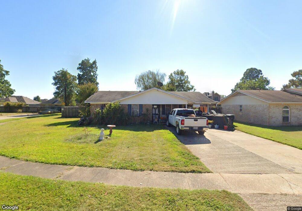
2104 Orbit Dr Bossier City, LA 71112
South Bossier NeighborhoodEstimated Value: $149,000 - $169,000
3
Beds
1
Bath
1,128
Sq Ft
$140/Sq Ft
Est. Value
About This Home
This home is located at 2104 Orbit Dr, Bossier City, LA 71112 and is currently estimated at $158,078, approximately $140 per square foot. 2104 Orbit Dr is a home located in Bossier Parish with nearby schools including Sun City Elementary School, Curtis Elementary School, and Elm Grove Middle School.
Ownership History
Date
Name
Owned For
Owner Type
Purchase Details
Closed on
Jul 19, 2010
Sold by
Griffith Neil Robert and Griffith Tiffany Ann
Bought by
Wiggins Ronnie Merle and Wiggins Genevieve Nora Painter
Current Estimated Value
Home Financials for this Owner
Home Financials are based on the most recent Mortgage that was taken out on this home.
Original Mortgage
$115,940
Outstanding Balance
$77,082
Interest Rate
4.73%
Mortgage Type
Second Mortgage Made To Cover Down Payment
Estimated Equity
$80,996
Purchase Details
Closed on
Feb 23, 2005
Sold by
Blakeley Michael Roy and Rudolph Blakeley Robin Debra
Bought by
Griffith Niel Robert
Home Financials for this Owner
Home Financials are based on the most recent Mortgage that was taken out on this home.
Original Mortgage
$90,900
Interest Rate
5.71%
Mortgage Type
VA
Create a Home Valuation Report for This Property
The Home Valuation Report is an in-depth analysis detailing your home's value as well as a comparison with similar homes in the area
Home Values in the Area
Average Home Value in this Area
Purchase History
| Date | Buyer | Sale Price | Title Company |
|---|---|---|---|
| Wiggins Ronnie Merle | $113,500 | None Available | |
| Griffith Niel Robert | $89,000 | None Available |
Source: Public Records
Mortgage History
| Date | Status | Borrower | Loan Amount |
|---|---|---|---|
| Open | Wiggins Ronnie Merle | $115,940 | |
| Previous Owner | Griffith Niel Robert | $90,900 |
Source: Public Records
Tax History Compared to Growth
Tax History
| Year | Tax Paid | Tax Assessment Tax Assessment Total Assessment is a certain percentage of the fair market value that is determined by local assessors to be the total taxable value of land and additions on the property. | Land | Improvement |
|---|---|---|---|---|
| 2024 | $539 | $10,609 | $2,450 | $8,159 |
| 2023 | $505 | $10,078 | $2,300 | $7,778 |
| 2022 | $228 | $10,078 | $2,300 | $7,778 |
| 2021 | $228 | $10,078 | $2,300 | $7,778 |
| 2020 | $276 | $10,078 | $2,300 | $7,778 |
| 2019 | $278 | $10,060 | $2,000 | $8,060 |
| 2018 | $278 | $10,060 | $2,000 | $8,060 |
| 2017 | $505 | $10,060 | $2,000 | $8,060 |
| 2016 | $505 | $10,060 | $2,000 | $8,060 |
| 2015 | $233 | $10,230 | $2,000 | $8,230 |
| 2014 | $233 | $10,230 | $2,000 | $8,230 |
Source: Public Records
Map
Nearby Homes
- 2023 Pluto Dr
- 238 Avondale Ln
- 1911 General Jackson Place
- 2002 General Jackson Place
- 1701 Avondale Ct
- 466 Jordan Dr
- 4717 General Ewell Dr
- 1957 Rossie Lee Dr
- 5322 Jonquil St
- 1943 Rossie Lee Dr
- 1945 Rossie Lee Dr
- 000 Rossie Lee Dr
- 4210 Mike St
- 2129 Rossie Lee Dr
- 4808 General Scott Place
- 523 Columbia Cir
- 1904 Carol St
- 1931 Alfred Ln
- 1711 Alison Ave
- 1906 Ray Ave