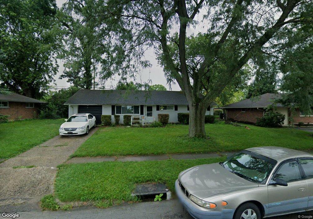
2104 Owendale Dr Dayton, OH 45439
Woodbourne-Hyde Park NeighborhoodEstimated Value: $181,000 - $202,000
3
Beds
1
Bath
1,080
Sq Ft
$175/Sq Ft
Est. Value
About This Home
This home is located at 2104 Owendale Dr, Dayton, OH 45439 and is currently estimated at $189,439, approximately $175 per square foot. 2104 Owendale Dr is a home located in Montgomery County with nearby schools including West Carrollton High School, Miami Valley Academies, and St. Albert the Great Catholic School.
Ownership History
Date
Name
Owned For
Owner Type
Purchase Details
Closed on
Apr 22, 2021
Sold by
Donald C Wright Investments Llc
Bought by
Vb One Llc
Current Estimated Value
Purchase Details
Closed on
Feb 15, 2002
Sold by
Lane Tyrone L and Lane Tammie D
Bought by
Donald C Wright Investments Llc
Purchase Details
Closed on
Mar 23, 1998
Sold by
Holtrup Robert M
Bought by
Lane Tyrone L and Lane Tammie D
Home Financials for this Owner
Home Financials are based on the most recent Mortgage that was taken out on this home.
Original Mortgage
$73,461
Interest Rate
7.15%
Mortgage Type
FHA
Purchase Details
Closed on
Feb 11, 1994
Sold by
Papp Paul Joseph and Papp Debora Lynn
Bought by
Holtrup Robert M
Create a Home Valuation Report for This Property
The Home Valuation Report is an in-depth analysis detailing your home's value as well as a comparison with similar homes in the area
Home Values in the Area
Average Home Value in this Area
Purchase History
| Date | Buyer | Sale Price | Title Company |
|---|---|---|---|
| Vb One Llc | $2,300,000 | Total Title Services Llc | |
| Donald C Wright Investments Llc | $71,000 | -- | |
| Lane Tyrone L | $74,900 | -- | |
| Lane Tyrone L | $74,900 | -- | |
| Holtrup Robert M | -- | Midland Title |
Source: Public Records
Mortgage History
| Date | Status | Borrower | Loan Amount |
|---|---|---|---|
| Previous Owner | Lane Tyrone L | $73,461 |
Source: Public Records
Tax History Compared to Growth
Tax History
| Year | Tax Paid | Tax Assessment Tax Assessment Total Assessment is a certain percentage of the fair market value that is determined by local assessors to be the total taxable value of land and additions on the property. | Land | Improvement |
|---|---|---|---|---|
| 2024 | $3,691 | $50,210 | $7,820 | $42,390 |
| 2023 | $3,691 | $50,210 | $7,820 | $42,390 |
| 2022 | $3,379 | $33,700 | $5,250 | $28,450 |
| 2021 | $2,562 | $28,320 | $5,250 | $23,070 |
| 2020 | $2,442 | $28,320 | $5,250 | $23,070 |
| 2019 | $2,631 | $25,450 | $5,250 | $20,200 |
| 2018 | $2,474 | $25,450 | $5,250 | $20,200 |
| 2017 | $2,460 | $25,450 | $5,250 | $20,200 |
| 2016 | $2,491 | $24,940 | $5,250 | $19,690 |
| 2015 | $2,331 | $24,940 | $5,250 | $19,690 |
| 2014 | $2,331 | $24,940 | $5,250 | $19,690 |
| 2012 | -- | $26,250 | $10,500 | $15,750 |
Source: Public Records
Map
Nearby Homes
- 2090 Mattis Dr
- 1673 W Stroop Rd
- 1692 Hillwood Dr
- 4301 Tait Rd
- 1952 Tait Circle Rd
- 1905 Tait Circle Rd
- 4051 Ellery Ave
- 4207 S Dixie Dr
- 4629 Richwood Dr
- 4661 Richwood Dr
- 2050 William Ln
- 4792 Loxley Dr
- 3720 Ridgeleigh Rd Unit D
- 2571 Cluster Ave
- 2639 Blanchard Ave
- 1955 Kresswood Cir
- 1349 Tamerlane Rd
- 5084 Mays Ave
- 2399 Polo Park Dr
- 4400 Royal Ridge Way
- 2116 Owendale Dr
- 2092 Owendale Dr
- 2119 Lynpark Ave
- 2131 Lynpark Ave
- 2103 Lynpark Ave
- 2128 Owendale Dr
- 2076 Owendale Dr
- 2099 Owendale Dr
- 2113 Owendale Dr
- 2145 Lynpark Ave
- 2095 Lynpark Ave
- 2085 Owendale Dr
- 2125 Owendale Dr
- 2142 Owendale Dr
- 2062 Owendale Dr
- 2139 Owendale Dr
- 2159 Lynpark Ave
- 2069 Owendale Dr
- 2081 Lynpark Ave
- 2114 Mattis Dr