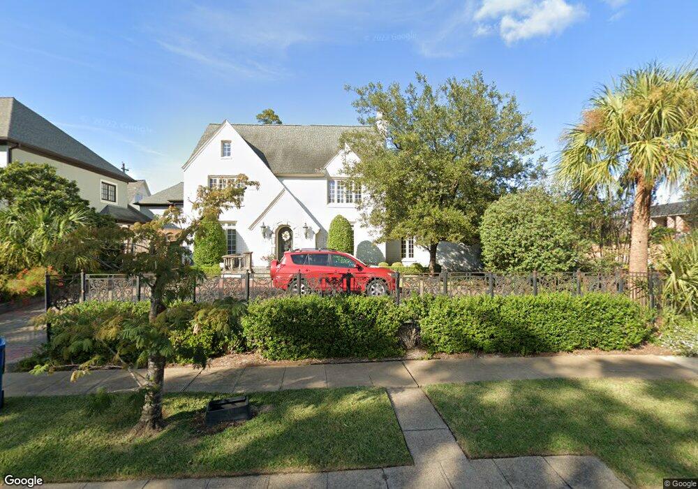
2104 Pelham Dr Houston, TX 77019
River Oaks NeighborhoodEstimated Value: $2,467,000 - $2,637,000
4
Beds
7
Baths
5,212
Sq Ft
$492/Sq Ft
Est. Value
About This Home
This home is located at 2104 Pelham Dr, Houston, TX 77019 and is currently estimated at $2,565,374, approximately $492 per square foot. 2104 Pelham Dr is a home located in Harris County with nearby schools including River Oaks Elementary School, Lanier Middle School, and Lamar High School.
Ownership History
Date
Name
Owned For
Owner Type
Purchase Details
Closed on
Dec 9, 2004
Sold by
Rac Closing Services Llc
Bought by
Harrington Richard J and Harrington Carole Keeney
Current Estimated Value
Purchase Details
Closed on
Sep 13, 2004
Sold by
Fletcher Samuel K and Fletcher Sandra C
Bought by
Rac Closing Services Llc
Purchase Details
Closed on
Mar 31, 1998
Sold by
Gerhart Gregory N and Gerhart Ann I
Bought by
Fletcher Samuel K and Fletcher Sandra C
Home Financials for this Owner
Home Financials are based on the most recent Mortgage that was taken out on this home.
Original Mortgage
$400,000
Interest Rate
7.04%
Purchase Details
Closed on
Jun 20, 1995
Sold by
Gerhart Frances Isabell and Norwin Gerhart E
Bought by
Gerhart Frances Isabell
Create a Home Valuation Report for This Property
The Home Valuation Report is an in-depth analysis detailing your home's value as well as a comparison with similar homes in the area
Home Values in the Area
Average Home Value in this Area
Purchase History
| Date | Buyer | Sale Price | Title Company |
|---|---|---|---|
| Harrington Richard J | -- | First American Title | |
| Rac Closing Services Llc | -- | First American Title | |
| Fletcher Samuel K | -- | Charter Title Company | |
| Gerhart Frances Isabell | -- | -- |
Source: Public Records
Mortgage History
| Date | Status | Borrower | Loan Amount |
|---|---|---|---|
| Previous Owner | Fletcher Samuel K | $400,000 |
Source: Public Records
Tax History Compared to Growth
Tax History
| Year | Tax Paid | Tax Assessment Tax Assessment Total Assessment is a certain percentage of the fair market value that is determined by local assessors to be the total taxable value of land and additions on the property. | Land | Improvement |
|---|---|---|---|---|
| 2025 | $15,540 | $2,373,989 | $1,197,504 | $1,176,485 |
| 2024 | $15,540 | $2,148,515 | $1,124,928 | $1,023,587 |
| 2023 | $15,540 | $1,755,712 | $1,088,640 | $667,072 |
| 2022 | $35,513 | $1,759,085 | $1,052,352 | $706,733 |
| 2021 | $34,173 | $1,466,234 | $979,776 | $486,458 |
| 2020 | $35,370 | $1,460,606 | $979,776 | $480,830 |
| 2019 | $36,875 | $1,457,245 | $979,776 | $477,469 |
| 2018 | $17,478 | $1,517,707 | $1,002,456 | $515,251 |
| 2017 | $36,707 | $1,517,707 | $1,002,456 | $515,251 |
| 2016 | $33,370 | $1,471,283 | $956,032 | $515,251 |
| 2015 | $13,937 | $1,437,139 | $921,888 | $515,251 |
| 2014 | $13,937 | $1,299,691 | $785,312 | $514,379 |
Source: Public Records
Map
Nearby Homes
- 2105 Del Monte Dr
- 1711 Huldy St Unit A
- 1601 S Shepherd Dr Unit 20
- 1601 S Shepherd Dr Unit 29
- 1601 S Shepherd Dr Unit 138
- 1910 Huldy St Unit A
- 2100 Welch St Unit C113
- 2100 Welch St Unit C101
- 2217 Pelham Dr
- 1712 Mcduffie St
- 2026 Welch St
- 1915 Spann St
- 1909 Brun St Unit 17
- 1909 Brun St Unit 16
- 2233 Pelham Dr
- 2111 Welch St Unit A321
- 2111 Welch St Unit A232
- 2111 Welch St Unit A107
- 1509 Mcduffie St
- 1606 Hazard St
- 2110 Pelham Dr
- 2114 Pelham Dr
- 2111 Del Monte Dr
- 2117 Del Monte Dr
- 2105 Pelham Dr
- 2120 Pelham Dr
- 2115 Pelham Dr
- 2123 Del Monte Dr
- 2126 Pelham Dr
- 2121 Pelham Dr
- 1813 Sharp Place
- 1809 Sharp Place
- 2129 Del Monte Dr
- 1805 Sharp Place
- 2104 Del Monte Dr
- 2116 Del Monte Dr
- 1801 Sharp Place
- 1817 Sharp Place
- 2135 Del Monte Dr
- 2122 Del Monte Dr