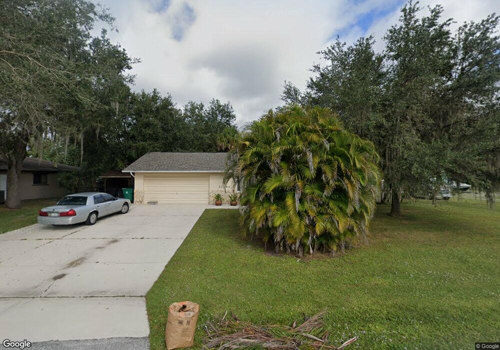
21044 Exmore Ave Port Charlotte, FL 33952
Estimated Value: $258,554 - $320,000
3
Beds
2
Baths
1,754
Sq Ft
$162/Sq Ft
Est. Value
About This Home
This home is located at 21044 Exmore Ave, Port Charlotte, FL 33952 and is currently estimated at $283,889, approximately $161 per square foot. 21044 Exmore Ave is a home located in Charlotte County with nearby schools including Neil Armstrong Elementary School, Murdock Middle School, and Port Charlotte High School.
Ownership History
Date
Name
Owned For
Owner Type
Purchase Details
Closed on
Sep 12, 1997
Sold by
Sparks Ann
Bought by
Phillips David R and Phillips Dale K F
Current Estimated Value
Home Financials for this Owner
Home Financials are based on the most recent Mortgage that was taken out on this home.
Original Mortgage
$63,000
Outstanding Balance
$9,755
Interest Rate
7.46%
Estimated Equity
$274,134
Purchase Details
Closed on
Jul 9, 1996
Sold by
Carroll Ilse N
Bought by
Carroll Ilse N
Create a Home Valuation Report for This Property
The Home Valuation Report is an in-depth analysis detailing your home's value as well as a comparison with similar homes in the area
Home Values in the Area
Average Home Value in this Area
Purchase History
| Date | Buyer | Sale Price | Title Company |
|---|---|---|---|
| Phillips David R | $70,000 | -- | |
| Carroll Ilse N | -- | -- |
Source: Public Records
Mortgage History
| Date | Status | Borrower | Loan Amount |
|---|---|---|---|
| Open | Phillips David R | $63,000 |
Source: Public Records
Tax History Compared to Growth
Tax History
| Year | Tax Paid | Tax Assessment Tax Assessment Total Assessment is a certain percentage of the fair market value that is determined by local assessors to be the total taxable value of land and additions on the property. | Land | Improvement |
|---|---|---|---|---|
| 2023 | $1,368 | $84,280 | $0 | $0 |
| 2022 | $1,292 | $81,825 | $0 | $0 |
| 2021 | $1,350 | $79,442 | $0 | $0 |
| 2020 | $1,306 | $78,345 | $0 | $0 |
| 2019 | $1,224 | $76,584 | $0 | $0 |
| 2018 | $1,110 | $75,156 | $0 | $0 |
| 2017 | $1,104 | $73,610 | $0 | $0 |
| 2016 | $1,104 | $72,096 | $0 | $0 |
| 2015 | $1,091 | $71,595 | $0 | $0 |
| 2014 | $1,071 | $71,027 | $0 | $0 |
Source: Public Records
Map
Nearby Homes
- 21068 Exmore Ave
- 1394 Viscaya Dr
- 1418 Viscaya
- 1402 Viscaya Dr
- 21051 Cascade Ave
- 1409 Yorkshire St
- 21059 Cascade Ave
- 20995 Cornell Ave
- 1490 Yorkshire St
- 21019 Malden Ave
- 1505 Kenmore St
- 1370 Kenmore St
- 1529 Newton St
- 1301 Yates St
- 1525 Hinton St
- 1358 Fargo St
- 1321 Newton St
- 1565 Dorchester St
- 1381 Fargo St
- 1630 Viscaya Dr
- 21036 Exmore Ave
- 21060 Exmore Ave
- 21051 Cornell Ave
- 21035 Cornell Ave
- 21043 Exmore Ave
- 21028 Exmore Ave
- 21059 Cornell Ave
- 21028 Avenue
- 21027 Cornell Ave
- 21059 Exmore Ave
- 21067 Cornell Ave
- 21076 Cornell Ave
- 21067 Exmore Ave
- 21019 Cornell Ave
- 1443 Viscaya Dr
- 21012 Exmore Ave
- 21044 Cornell Ave
- 21052 Kearney Ave
- 21019 Exmore Ave
- 21036 Kearney Ave