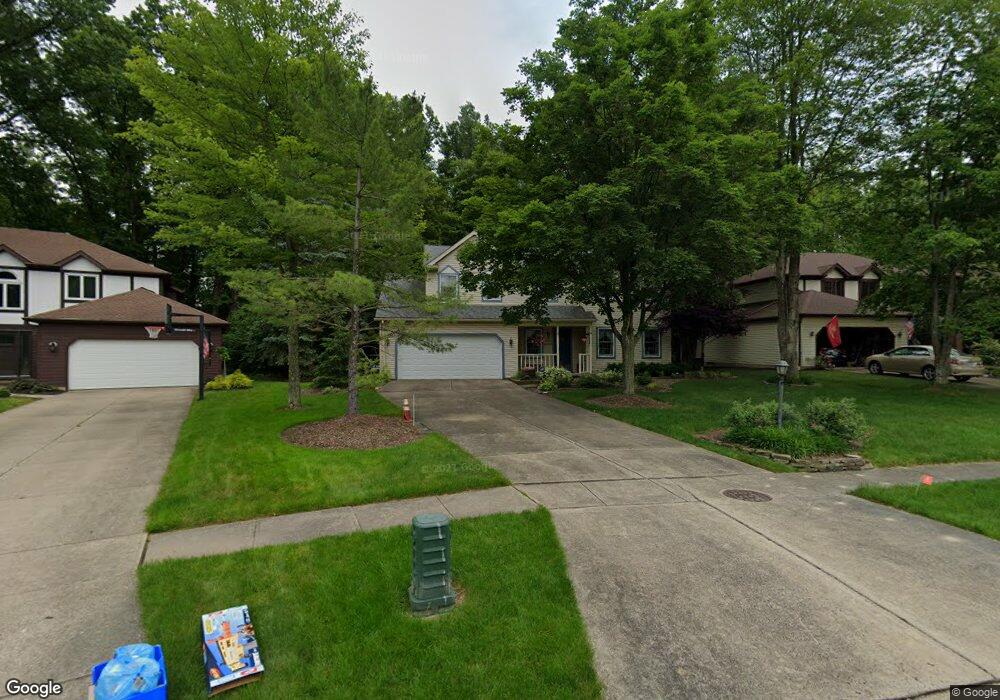
21044 Montclare Blvd Strongsville, OH 44149
Estimated Value: $419,449 - $444,000
4
Beds
3
Baths
2,422
Sq Ft
$178/Sq Ft
Est. Value
About This Home
This home is located at 21044 Montclare Blvd, Strongsville, OH 44149 and is currently estimated at $432,112, approximately $178 per square foot. 21044 Montclare Blvd is a home located in Cuyahoga County with nearby schools including Strongsville High School, St Mary School, and Sts Joseph & John Interparochial School.
Ownership History
Date
Name
Owned For
Owner Type
Purchase Details
Closed on
Feb 1, 2024
Sold by
Palmer Timothy Palmer
Bought by
Palmer Jessica and Re Not
Current Estimated Value
Purchase Details
Closed on
Nov 20, 2019
Sold by
Fallon Mark C and Mark C Fallon Trust
Bought by
Palmer Timothy and Palmer Jessica
Home Financials for this Owner
Home Financials are based on the most recent Mortgage that was taken out on this home.
Original Mortgage
$224,000
Interest Rate
3.5%
Purchase Details
Closed on
May 5, 2006
Sold by
Fallon Mark C and Fallon Nancy A
Bought by
Fallon Mark C and Fallon Nancy A
Purchase Details
Closed on
May 30, 1986
Bought by
Fallon Mark C
Purchase Details
Closed on
Jan 1, 1985
Bought by
Fair Farms Co
Create a Home Valuation Report for This Property
The Home Valuation Report is an in-depth analysis detailing your home's value as well as a comparison with similar homes in the area
Home Values in the Area
Average Home Value in this Area
Purchase History
| Date | Buyer | Sale Price | Title Company |
|---|---|---|---|
| Palmer Jessica | -- | None Listed On Document | |
| Palmer Timothy | $280,000 | Gateway Title Agency | |
| Fallon Mark C | -- | None Available | |
| Fallon Mark C | $26,000 | -- | |
| Fair Farms Co | -- | -- |
Source: Public Records
Mortgage History
| Date | Status | Borrower | Loan Amount |
|---|---|---|---|
| Previous Owner | Palmer Timothy | $224,000 |
Source: Public Records
Tax History Compared to Growth
Tax History
| Year | Tax Paid | Tax Assessment Tax Assessment Total Assessment is a certain percentage of the fair market value that is determined by local assessors to be the total taxable value of land and additions on the property. | Land | Improvement |
|---|---|---|---|---|
| 2024 | $5,809 | $123,725 | $22,260 | $101,465 |
| 2023 | $6,257 | $99,930 | $21,910 | $78,020 |
| 2022 | $6,212 | $99,930 | $21,910 | $78,020 |
| 2021 | $6,163 | $99,930 | $21,910 | $78,020 |
| 2020 | $6,110 | $87,640 | $19,220 | $68,430 |
| 2019 | $5,931 | $250,400 | $54,900 | $195,500 |
| 2018 | $5,271 | $87,640 | $19,220 | $68,430 |
| 2017 | $5,255 | $79,210 | $17,360 | $61,850 |
| 2016 | $5,212 | $79,210 | $17,360 | $61,850 |
| 2015 | $5,132 | $79,210 | $17,360 | $61,850 |
| 2014 | $5,132 | $76,900 | $16,870 | $60,030 |
Source: Public Records
Map
Nearby Homes
- 8627 Courtland Dr
- 8902 Lincolnshire Blvd
- 84 Sprague Rd
- 8036 Fair Rd
- 9829 Plum Brook Ln
- 9401 Pheasant Run Place
- 10353 Oak Branch Trail
- 104 Whitehall Dr
- 740 Fair St
- 9598 Pebble Brook Ln
- 0 Priem Rd
- 22300 Rock Creek Cir
- 21355 Hickory Branch Trail
- 21176 Hickory Branch Trail
- 8746 Barton Dr
- 243 Jananna Dr
- 148 Meadow Cir
- 10839 Prospect Rd
- 20424 Scotch Pine Way
- 20684 Albion Rd
- 20996 Montclare Blvd
- 21092 Montclare Blvd
- 20948 Montclare Blvd
- 21140 Montclare Blvd
- 21059 Montclare Blvd
- 20987 Montclare Blvd
- 21188 Montclare Blvd
- 20935 Montclare Blvd
- 21242 Jonathan Dr
- 21190 Jonathan Dr
- 21292 Jonathan Dr
- 21236 Montclare Blvd
- 21138 Jonathan Dr
- 20913 Montclare Blvd
- 21086 Jonathan Dr
- 21481 Montclare Blvd
- 21398 Jonathan Dr
- 21284 Montclare Blvd
- 21034 Jonathan Dr
- 21529 Montclare Blvd