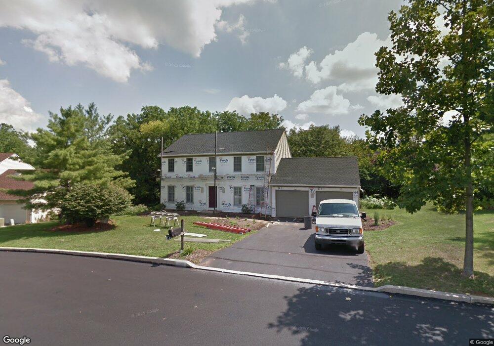
2105 Brook Cir Macungie, PA 18062
Lower Macungie Township East NeighborhoodEstimated Value: $509,156 - $567,000
4
Beds
3
Baths
2,240
Sq Ft
$242/Sq Ft
Est. Value
About This Home
This home is located at 2105 Brook Cir, Macungie, PA 18062 and is currently estimated at $541,539, approximately $241 per square foot. 2105 Brook Cir is a home located in Lehigh County with nearby schools including Willow Lane Elementary School, Eyer Middle School, and Emmaus High School.
Ownership History
Date
Name
Owned For
Owner Type
Purchase Details
Closed on
Nov 2, 2009
Sold by
Jacobs George H
Bought by
Gradin Joseph C
Current Estimated Value
Home Financials for this Owner
Home Financials are based on the most recent Mortgage that was taken out on this home.
Original Mortgage
$179,000
Outstanding Balance
$116,940
Interest Rate
5.01%
Mortgage Type
New Conventional
Estimated Equity
$424,599
Purchase Details
Closed on
Sep 25, 1987
Sold by
Ferguson & Flynn Enterprises Inc
Bought by
Jacobs George H and Alexa Ginsburg
Purchase Details
Closed on
Jul 2, 1986
Sold by
Oxford Financial Corporation
Bought by
Ferguson & Flynn Enterprises Inc
Purchase Details
Closed on
Mar 9, 1984
Bought by
Oxford Financial Corporation
Create a Home Valuation Report for This Property
The Home Valuation Report is an in-depth analysis detailing your home's value as well as a comparison with similar homes in the area
Home Values in the Area
Average Home Value in this Area
Purchase History
| Date | Buyer | Sale Price | Title Company |
|---|---|---|---|
| Gradin Joseph C | $297,500 | -- | |
| Jacobs George H | $156,400 | -- | |
| Ferguson & Flynn Enterprises Inc | $1,105,000 | -- | |
| Oxford Financial Corporation | $200,000 | -- |
Source: Public Records
Mortgage History
| Date | Status | Borrower | Loan Amount |
|---|---|---|---|
| Open | Gradin Joseph C | $179,000 |
Source: Public Records
Tax History Compared to Growth
Tax History
| Year | Tax Paid | Tax Assessment Tax Assessment Total Assessment is a certain percentage of the fair market value that is determined by local assessors to be the total taxable value of land and additions on the property. | Land | Improvement |
|---|---|---|---|---|
| 2025 | $6,469 | $253,400 | $42,500 | $210,900 |
| 2024 | $6,259 | $253,400 | $42,500 | $210,900 |
| 2023 | $6,134 | $253,400 | $42,500 | $210,900 |
| 2022 | $5,989 | $253,400 | $210,900 | $42,500 |
| 2021 | $5,861 | $253,400 | $42,500 | $210,900 |
| 2020 | $5,806 | $253,400 | $42,500 | $210,900 |
| 2019 | $5,707 | $253,400 | $42,500 | $210,900 |
| 2018 | $5,632 | $253,400 | $42,500 | $210,900 |
| 2017 | $5,534 | $253,400 | $42,500 | $210,900 |
| 2016 | -- | $253,400 | $42,500 | $210,900 |
| 2015 | -- | $253,400 | $42,500 | $210,900 |
| 2014 | -- | $253,400 | $42,500 | $210,900 |
Source: Public Records
Map
Nearby Homes
- 2173 Brookside Rd
- 1991 Autumn Ridge Rd
- 2056 Autumn Ridge Rd
- 5175 Meadowview Dr
- 6022 Eli Cir
- 1675 Hamlet Dr
- 5280 Townsquare Dr
- 5706 Whitemarsh Dr
- 6007 Timberknoll Dr
- 2691 Terrwood Dr W Unit 176
- 5133 Meadow Ln
- 4762 Steeplechase Dr Unit 13C
- 2878 Whitemarsh Place
- 2969 Aronimink Place
- 2992 Aronimink Place
- 2756 Springhaven Place
- 2796 Springhaven Place
- 2777 Springhaven Place
- 1385 Brookside Rd
- 2560 Gracie Lone
- 5537 Princeton Rd
- 2085 Brook Cir
- 5549 Princeton Rd
- 5531 Princeton Rd
- 5554 Princeton Rd
- 2073 Brook Cir
- 5544 Princeton Rd
- 2076 Brook Cir
- 5536 Princeton Rd
- 5569 Princeton Rd
- 2111 Stonewall Dr
- 5523 Princeton Rd
- 2055 Brook Cir
- 2131 Stonewall Dr
- 5530 Princeton Rd
- 2050 Brook Cir
- 5583 Princeton Rd
- 2039 Brook Cir
- 5517 Princeton Rd
- 5574 Princeton Rd