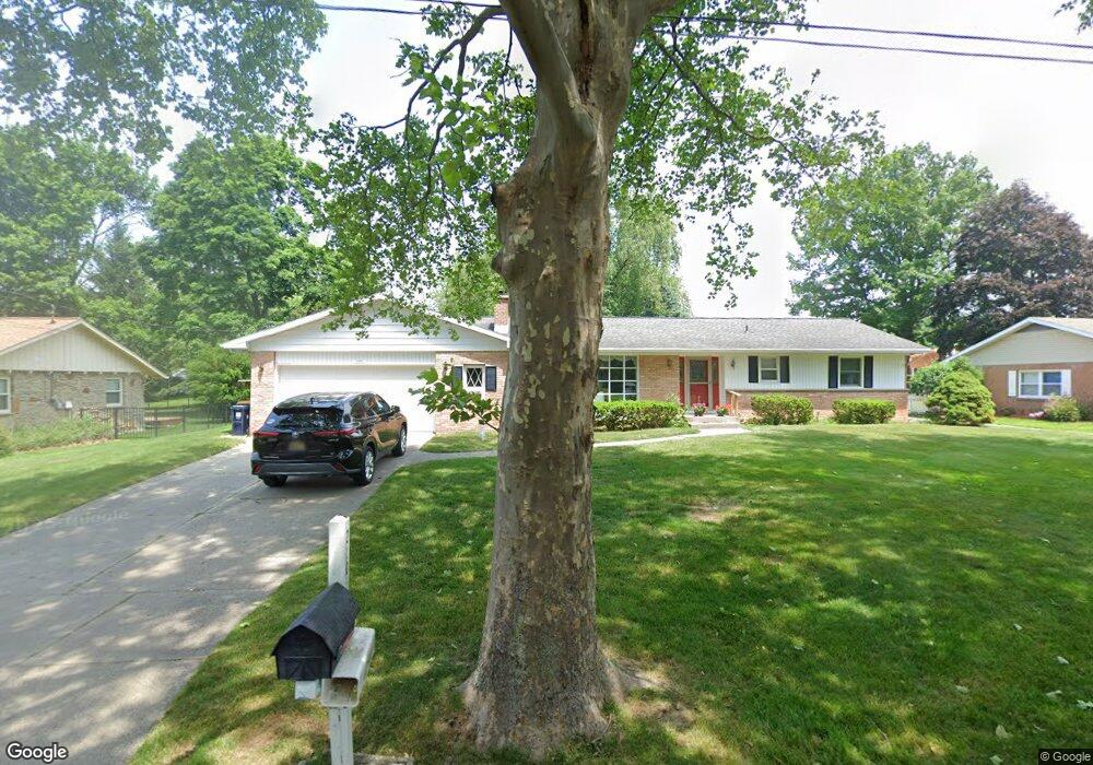
2105 Milford St NW Grand Rapids, MI 49504
Westside Connection NeighborhoodEstimated Value: $375,000 - $511,000
3
Beds
3
Baths
2,500
Sq Ft
$172/Sq Ft
Est. Value
About This Home
This home is located at 2105 Milford St NW, Grand Rapids, MI 49504 and is currently estimated at $431,000, approximately $172 per square foot. 2105 Milford St NW is a home located in Kent County with nearby schools including Harrison Elementary School, Westwood Middle School, and Union High School.
Ownership History
Date
Name
Owned For
Owner Type
Purchase Details
Closed on
Jan 21, 2005
Sold by
Visser George G and Visser Sharon J
Bought by
The George G Visser Trust
Current Estimated Value
Purchase Details
Closed on
Dec 30, 2003
Sold by
The Clarence S Carlson Declaration Of Tr
Bought by
Visser George G
Purchase Details
Closed on
Nov 13, 1995
Sold by
Carlson Carlson and Carlson Ts
Bought by
Visser George G Trust
Purchase Details
Closed on
Feb 27, 1991
Sold by
Carlson Carlson C C and Carlson Ts
Bought by
Visser George G Trust
Purchase Details
Closed on
May 9, 1984
Create a Home Valuation Report for This Property
The Home Valuation Report is an in-depth analysis detailing your home's value as well as a comparison with similar homes in the area
Home Values in the Area
Average Home Value in this Area
Purchase History
| Date | Buyer | Sale Price | Title Company |
|---|---|---|---|
| The George G Visser Trust | -- | -- | |
| Visser George G | $177,000 | -- | |
| Visser George G Trust | -- | -- | |
| Visser George G Trust | -- | -- | |
| -- | $38,000 | -- |
Source: Public Records
Tax History Compared to Growth
Tax History
| Year | Tax Paid | Tax Assessment Tax Assessment Total Assessment is a certain percentage of the fair market value that is determined by local assessors to be the total taxable value of land and additions on the property. | Land | Improvement |
|---|---|---|---|---|
| 2025 | $2,954 | $178,100 | $0 | $0 |
| 2024 | $2,954 | $168,400 | $0 | $0 |
| 2023 | $2,998 | $142,500 | $0 | $0 |
| 2022 | $2,851 | $133,100 | $0 | $0 |
| 2021 | $2,787 | $128,800 | $0 | $0 |
| 2020 | $2,660 | $120,400 | $0 | $0 |
| 2019 | $2,690 | $107,200 | $0 | $0 |
| 2018 | $2,690 | $97,100 | $0 | $0 |
| 2017 | $2,619 | $83,100 | $0 | $0 |
| 2016 | $2,651 | $82,000 | $0 | $0 |
| 2015 | $2,465 | $82,000 | $0 | $0 |
| 2013 | -- | $72,500 | $0 | $0 |
Source: Public Records
Map
Nearby Homes
- 1355 Hillcrest Ave NW
- 1500 Hillcrest Ave NW
- 1439 Parkhurst Ave NW
- 1835 Kerwin St NW
- 1440 Holborn Dr NW
- 1840 Richmond St NW
- 1126 Edison Ave NW
- 1660 Oakleigh Rd NW
- 950 Covell Ave NW
- 1130 Haines St NW
- 1217 El Camino Dr NW
- 1853 Trillium Cir NW Unit 71
- 1924 8th St NW
- 1071 Bristol Ave NW
- 1907 Oakridge Ct NW
- 2024 7th St NW
- 919 Fairfield Ave NW
- 2065 Brandon Dr NW
- 736 Shawmut Blvd NW
- 1029 Woodrow Ave NW
- 2059 Milford St NW
- 2115 Milford St NW
- 2101 Clover Dr NW
- 2100 Milford St NW
- 2053 Milford St NW
- 2058 Milford St NW
- 2121 Milford St NW
- 2128 Lanco Dr NW
- 2041 Milford St NW
- 2054 Milford St NW
- 2130 Milford St NW
- 1330 Westend Ave NW
- 2040 Milford St NW
- 1335 Westend Ave NW
- 2107 Clover Dr NW
- 2037 Milford St NW
- 2138 Lanco Dr NW
- 1322 Westend Ave NW
- 2137 Lanco Dr NW
- 1321 Westend Ave NW