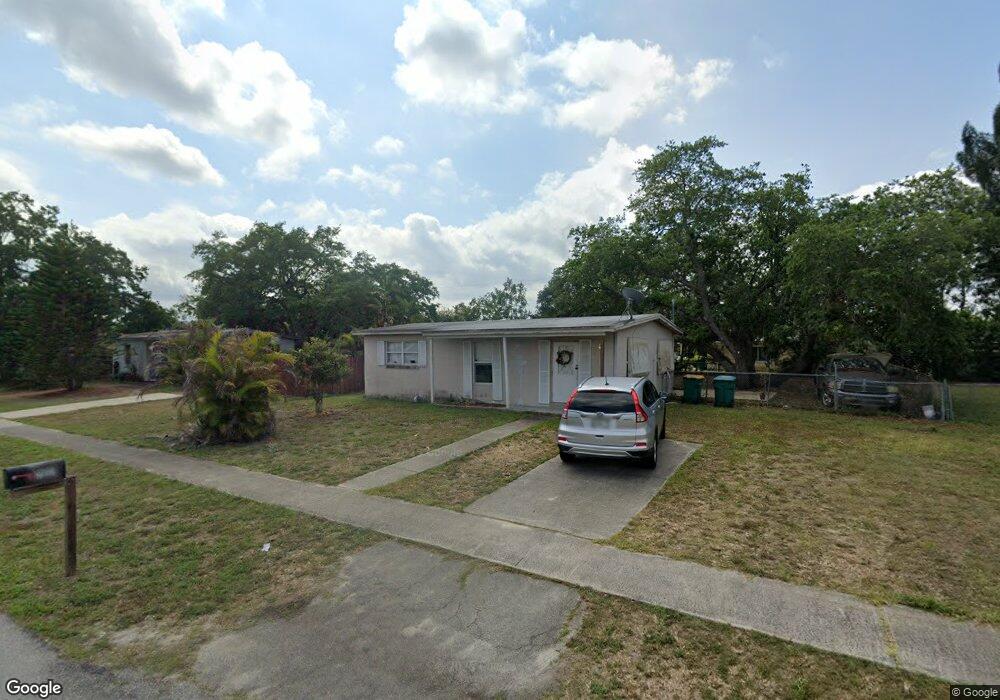
21051 Meehan Ave Port Charlotte, FL 33952
Estimated Value: $158,788 - $169,000
2
Beds
1
Bath
851
Sq Ft
$193/Sq Ft
Est. Value
About This Home
This home is located at 21051 Meehan Ave, Port Charlotte, FL 33952 and is currently estimated at $164,447, approximately $193 per square foot. 21051 Meehan Ave is a home located in Charlotte County with nearby schools including Neil Armstrong Elementary School, Port Charlotte Middle School, and Port Charlotte High School.
Ownership History
Date
Name
Owned For
Owner Type
Purchase Details
Closed on
Apr 28, 2014
Sold by
Biel Reo Llc
Bought by
Carbonaro Edward
Current Estimated Value
Purchase Details
Closed on
Sep 19, 2005
Sold by
Shantel Holdings Ltd
Bought by
21051 Meehan Land Trust Shantel Holdings
Purchase Details
Closed on
Aug 10, 2005
Sold by
21051 Meehan Land Trust
Bought by
Shantel Holdings Ltd
Purchase Details
Closed on
Mar 11, 2005
Sold by
West Tina M
Bought by
Shantel Holdings Inc and 21051 Meehan Land Trust
Create a Home Valuation Report for This Property
The Home Valuation Report is an in-depth analysis detailing your home's value as well as a comparison with similar homes in the area
Home Values in the Area
Average Home Value in this Area
Purchase History
| Date | Buyer | Sale Price | Title Company |
|---|---|---|---|
| Carbonaro Edward | $34,900 | Buyers Title Inc | |
| 21051 Meehan Land Trust Shantel Holdings | -- | -- | |
| Shantel Holdings Ltd | -- | -- | |
| Shantel Holdings Inc | $50,000 | Executive Title Ins Svcs Inc |
Source: Public Records
Tax History Compared to Growth
Tax History
| Year | Tax Paid | Tax Assessment Tax Assessment Total Assessment is a certain percentage of the fair market value that is determined by local assessors to be the total taxable value of land and additions on the property. | Land | Improvement |
|---|---|---|---|---|
| 2023 | $2,209 | $61,214 | $0 | $0 |
| 2022 | $1,802 | $92,871 | $13,600 | $79,271 |
| 2021 | $1,515 | $52,696 | $5,950 | $46,746 |
| 2020 | $1,403 | $46,749 | $4,505 | $42,244 |
| 2019 | $1,312 | $47,199 | $5,015 | $42,184 |
| 2018 | $1,168 | $43,976 | $4,505 | $39,471 |
| 2017 | $1,083 | $35,551 | $3,953 | $31,598 |
| 2016 | $1,030 | $31,413 | $0 | $0 |
| 2015 | $1,026 | $32,042 | $0 | $0 |
| 2014 | $737 | $16,169 | $0 | $0 |
Source: Public Records
Map
Nearby Homes
- 21042 Gladis Ave
- 2217 Ednor St
- 21066 Midway Blvd
- 21034 Midway Blvd
- 1630 Viscaya Dr
- 2259 Lee Terrace
- 21162 Meehan Ave
- 21010 Midway Blvd
- 2313 Ednor St
- 2321 Dallas St
- 2267 Lee Terrace
- 20527 Albury Dr
- 21203 Meehan Ave
- 2314 Lee Terrace
- 2102 Alaric St
- 21227 Gladis Ave
- 1565 Dorchester St
- 21019 Malden Ave
- 21150 Gertrude Ave Unit G3
- 21150 Gertrude Ave Unit 4
- 21059 Meehan Ave
- 21043 Meehan Ave
- 21027 Meehan Ave
- 21043 Avenue
- 21050 Gladis Ave
- 21058 Gladis Ave
- 21067 Meehan Ave
- 21050 Meehan Ave
- 21035 Meehan Ave
- 21058 Meehan Ave
- 21042 Meehan Ave
- 21066 Gladis Ave
- 21034 Gladis Ave
- 21066 Meehan Ave
- 21034 Meehan Ave
- 21075 Meehan Ave
- 21074 Gladis Ave
- 21051 Glendale Ave
- 21051 Gladis Ave
- 21027 Gladis Ave