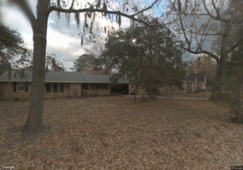
2106 Albert Storm Ave Moncks Corner, SC 29461
Estimated Value: $443,383 - $482,000
Studio
--
Bath
1,616
Sq Ft
$291/Sq Ft
Est. Value
About This Home
This home is located at 2106 Albert Storm Ave, Moncks Corner, SC 29461 and is currently estimated at $470,846, approximately $291 per square foot. 2106 Albert Storm Ave is a home located in Berkeley County with nearby schools including Foxbank Elementary School, Berkeley Middle School, and Berkeley High School.
Ownership History
Date
Name
Owned For
Owner Type
Purchase Details
Closed on
Jul 10, 2008
Sold by
Schwab James R and Schwab Janet M
Bought by
Schwab James R and Schwab Janet M
Current Estimated Value
Purchase Details
Closed on
Aug 26, 2005
Sold by
Mccraw Paul D
Bought by
Schwab James R and Schwab Janet M
Home Financials for this Owner
Home Financials are based on the most recent Mortgage that was taken out on this home.
Original Mortgage
$240,000
Outstanding Balance
$117,845
Interest Rate
4.75%
Mortgage Type
Adjustable Rate Mortgage/ARM
Estimated Equity
$353,001
Purchase Details
Closed on
Apr 4, 2005
Sold by
Warren James A
Bought by
Mccraw Paul D
Home Financials for this Owner
Home Financials are based on the most recent Mortgage that was taken out on this home.
Original Mortgage
$42,800
Interest Rate
5.3%
Mortgage Type
Stand Alone Second
Create a Home Valuation Report for This Property
The Home Valuation Report is an in-depth analysis detailing your home's value as well as a comparison with similar homes in the area
Purchase History
| Date | Buyer | Sale Price | Title Company |
|---|---|---|---|
| Schwab James R | -- | -- | |
| Schwab James R | $300,000 | -- | |
| Mccraw Paul D | $214,200 | -- |
Source: Public Records
Mortgage History
| Date | Status | Borrower | Loan Amount |
|---|---|---|---|
| Open | Schwab James R | $240,000 | |
| Previous Owner | Mccraw Paul D | $42,800 | |
| Previous Owner | Mccraw Paul D | $171,200 |
Source: Public Records
Tax History
| Year | Tax Paid | Tax Assessment Tax Assessment Total Assessment is a certain percentage of the fair market value that is determined by local assessors to be the total taxable value of land and additions on the property. | Land | Improvement |
|---|---|---|---|---|
| 2025 | $5,752 | $384,457 | $110,414 | $274,043 |
| 2024 | $5,665 | $23,068 | $6,625 | $16,443 |
| 2023 | $5,665 | $23,068 | $6,625 | $16,443 |
| 2022 | $5,458 | $20,059 | $11,943 | $8,116 |
| 2021 | $5,501 | $20,060 | $11,943 | $8,116 |
| 2020 | $5,523 | $20,059 | $11,943 | $8,116 |
| 2019 | $5,511 | $20,059 | $11,943 | $8,116 |
| 2018 | $5,053 | $17,244 | $8,640 | $8,604 |
| 2017 | $4,994 | $17,244 | $8,640 | $8,604 |
| 2016 | $5,041 | $17,240 | $8,640 | $8,600 |
| 2015 | $4,799 | $17,240 | $8,640 | $8,600 |
| 2014 | $4,486 | $17,240 | $8,640 | $8,600 |
| 2013 | -- | $17,240 | $8,640 | $8,600 |
Source: Public Records
Map
Nearby Homes
- 2015 Albert Storm Ave
- 554 Point Comfort Rd
- 0 Point Comfort Rd Unit 24030382
- 0 Point Comfort Rd Unit 24030383
- 0 Point Comfort Rd Unit 24028043
- 1305 Old Rice Mill Rd
- 1811 Teal Rd
- 1613 Westminister Way
- 1822 Mallard Cir
- 1629 Pimlico Blvd
- 1003 British Dr
- 1004 Magnolia Ln
- 214 Osprey Dr
- 00 Gertie Ln
- 134 Gertie Ln
- 0 Gertie Ln
- 266 Oglethorpe Cir
- 153 Willow Brook Way
- 415 Camellia Bloom Dr
- 258 Truth Way Unit 3
- 2102 Albert Storm Ave
- 2114 Albert Storm Ave
- 2018 Rock Fish Rd
- 2109 Albert Storm Ave
- 2016 Rock Fish Rd
- 2101 Albert Storm Ave
- 2014 Rock Fish Rd
- 3 Catfish Rd
- 2012 Albert Storm Ave
- 1705 Catfish Rd
- 2015 Rock Fish Rd
- 2013 Rock Fish Rd
- 2012 Rock Fish Rd
- 2017 Albert Storm Ave
- 2011 Rock Fish Rd
- 2010 Albert Storm Ave
- 2010 Rock Fish Rd
- 1702 Catfish Rd
- 2h Point Comfort Rd
- 0 Point Comfort Rd Unit 22030341
Your Personal Tour Guide
Ask me questions while you tour the home.