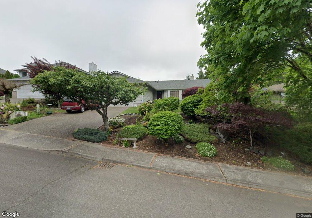
2106 Brookside Rd SW Tumwater, WA 98512
Tumwater Hill NeighborhoodEstimated Value: $500,514 - $599,000
3
Beds
2
Baths
1,850
Sq Ft
$302/Sq Ft
Est. Value
About This Home
This home is located at 2106 Brookside Rd SW, Tumwater, WA 98512 and is currently estimated at $558,379, approximately $301 per square foot. 2106 Brookside Rd SW is a home located in Thurston County with nearby schools including Tumwater Hill Elementary School, Tumwater Middle School, and A.G. West Black Hills High School.
Ownership History
Date
Name
Owned For
Owner Type
Purchase Details
Closed on
Aug 20, 1998
Sold by
Burchett Gary C
Bought by
Mohar Candice R
Current Estimated Value
Purchase Details
Closed on
Mar 28, 1997
Sold by
Borso John L and Borso Rita M
Bought by
Burchett Gary J and Burchett Candice R
Home Financials for this Owner
Home Financials are based on the most recent Mortgage that was taken out on this home.
Original Mortgage
$175,000
Interest Rate
7.63%
Create a Home Valuation Report for This Property
The Home Valuation Report is an in-depth analysis detailing your home's value as well as a comparison with similar homes in the area
Home Values in the Area
Average Home Value in this Area
Purchase History
| Date | Buyer | Sale Price | Title Company |
|---|---|---|---|
| Mohar Candice R | -- | -- | |
| Burchett Gary J | $177,500 | Thurston County Title Co |
Source: Public Records
Mortgage History
| Date | Status | Borrower | Loan Amount |
|---|---|---|---|
| Previous Owner | Burchett Gary J | $175,000 |
Source: Public Records
Tax History Compared to Growth
Tax History
| Year | Tax Paid | Tax Assessment Tax Assessment Total Assessment is a certain percentage of the fair market value that is determined by local assessors to be the total taxable value of land and additions on the property. | Land | Improvement |
|---|---|---|---|---|
| 2024 | $4,210 | $436,400 | $139,500 | $296,900 |
| 2023 | $4,210 | $420,400 | $115,300 | $305,100 |
| 2022 | $4,120 | $404,400 | $87,300 | $317,100 |
| 2021 | $3,874 | $350,000 | $77,200 | $272,800 |
| 2020 | $3,670 | $301,800 | $82,600 | $219,200 |
| 2019 | $2,965 | $277,200 | $67,600 | $209,600 |
| 2018 | $2,923 | $226,400 | $62,400 | $164,000 |
| 2017 | $3,153 | $240,250 | $66,350 | $173,900 |
| 2016 | $3,147 | $236,400 | $67,300 | $169,100 |
| 2014 | -- | $231,000 | $64,900 | $166,100 |
Source: Public Records
Map
Nearby Homes
- 3571 Cassie Dr SW
- 3151 Vista Verde Ln SW
- 3038 Banks Ln SW
- 1748 View Point Ct SW
- 3827 Crosby Blvd SW
- 3184 Vista Verde Ln SW
- 2092 Blackstone Ct SW
- 3037 Hampton Dr SW
- 1271 Bay Loop SW
- 2263 43rd Ln SW
- 1025 Ebbets Dr SW
- 990 Ebbets Dr
- 942 G St SW
- 3568 Simmons Mill Ct SW Unit B
- 3467 Simmons Mill Ct SW Unit B
- 3694 Simmons Mill Ct SW Unit B
- 3627 Simmons Mill Ct SW Unit A
- 217 N 7th Ave SW
- 782 Fenway Ln SW
- 0 XXX Bates St SW
- 2110 Brookside Rd SW
- 2102 Brookside Rd SW
- 2107 Shadycrest Ct SW
- 2111 Shadycrest Ct SW
- 2109 Brookside Rd SW
- 2105 Brookside Rd SW
- 2113 Brookside Rd SW
- 2101 Brookside Rd SW
- 2104 Shadycrest Ct SW
- 2117 Brookside Rd SW
- 3148 Woodland Dr SW
- 3216 Crosby Blvd SW
- 3201 Woodland Dr SW
- 3146 Woodland Dr SW
- 3209 Woodland Dr SW
- 3211 Woodland Dr SW
- 3207 Woodland Dr SW
- 3203 Woodland Dr SW
- 3213 Woodland Dr SW