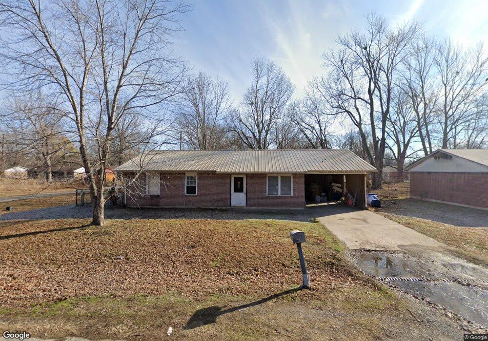
2106 Sunset Dr Pawhuska, OK 74056
Estimated Value: $72,000 - $137,000
3
Beds
1
Bath
1,026
Sq Ft
$97/Sq Ft
Est. Value
About This Home
This home is located at 2106 Sunset Dr, Pawhuska, OK 74056 and is currently estimated at $99,333, approximately $96 per square foot. 2106 Sunset Dr is a home located in Osage County with nearby schools including Indian Camp Elementary School, Pawhuska Elementary School, and Pawhuska Middle School.
Ownership History
Date
Name
Owned For
Owner Type
Purchase Details
Closed on
Jan 16, 2012
Sold by
Bland Herman W
Bought by
Bland Herman W and Kohnle Rhonda A
Current Estimated Value
Purchase Details
Closed on
Mar 28, 2006
Sold by
Williams Juanita and Williams Juanita F
Bought by
Bland Herman
Purchase Details
Closed on
Feb 19, 1996
Sold by
Fortney Jacob A and Fortney Flo L
Bought by
Williams Juanita
Purchase Details
Closed on
May 1, 1995
Sold by
Mcclary Lucinda
Bought by
Fortney Jacob A and Fortney Flo L
Create a Home Valuation Report for This Property
The Home Valuation Report is an in-depth analysis detailing your home's value as well as a comparison with similar homes in the area
Home Values in the Area
Average Home Value in this Area
Purchase History
| Date | Buyer | Sale Price | Title Company |
|---|---|---|---|
| Bland Herman W | -- | None Available | |
| Bland Herman | $21,500 | -- | |
| Williams Juanita | $7,000 | -- | |
| Fortney Jacob A | $1,800 | -- |
Source: Public Records
Tax History Compared to Growth
Tax History
| Year | Tax Paid | Tax Assessment Tax Assessment Total Assessment is a certain percentage of the fair market value that is determined by local assessors to be the total taxable value of land and additions on the property. | Land | Improvement |
|---|---|---|---|---|
| 2024 | $408 | $4,422 | $168 | $4,254 |
| 2023 | $408 | $4,422 | $168 | $4,254 |
| 2022 | $394 | $4,286 | $168 | $4,118 |
| 2021 | $384 | $4,286 | $168 | $4,118 |
| 2020 | $372 | $4,286 | $168 | $4,118 |
| 2019 | $349 | $4,082 | $168 | $3,914 |
| 2018 | $346 | $3,887 | $168 | $3,719 |
| 2017 | $332 | $3,702 | $168 | $3,534 |
| 2016 | $318 | $3,526 | $168 | $3,358 |
| 2015 | $313 | $3,358 | $168 | $3,190 |
| 2014 | $319 | $3,358 | $168 | $3,190 |
| 2013 | $304 | $3,198 | $168 | $3,030 |
Source: Public Records
Map
Nearby Homes
- 2125 Mckenzie Rd
- 1322 Boundary Ave
- 1318 Boundary Ave
- 1119 E 13th St
- 1205 Brenner Ave
- 1700 Grandview Ave
- 1815 Grandview Ave
- 1715 Grandview Ave
- 1419 Leahy Ave
- 421 E 11th St
- 0 Prudom Ave
- 1721 Bighill Ave
- 208 E 12th St
- 312 E 11th St
- 906 Rogers Ave
- 321 E 10th St
- 101 E 11th St
- 501 W 17th St
- 320 E 7th St
- 225 E 6th St
- 2104 Sunset Dr
- 2200 Sunset Dr
- 2107 Bayliss Ave
- 2102 Sunset Dr
- 2107 Sunset Dr
- 2105 Bayliss Ave
- 2201 Bayliss Ave
- 2105 Sunset Dr
- 2103 Balyss Ave
- 2202 Sunset Dr
- 1501 E 21st St
- 2201 Sunset Dr
- 2103 Sunset Dr
- 2203 Bayliss Ave
- 2203 Sunset Dr
- 1507 E 21st St
- 2101 Sunset Dr
- 2204 Sunset Dr
- 2200 Bayliss Ave
- 2106 Balyss Ave