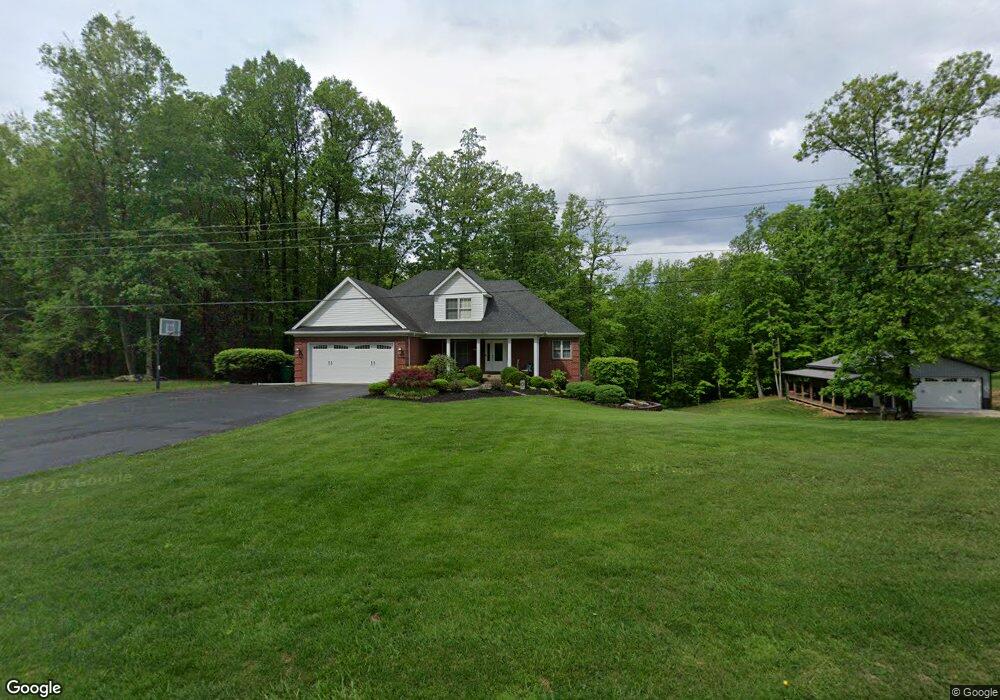
2107 Highway 11 Lanesville, IN 47136
Franklin NeighborhoodEstimated Value: $346,000 - $728,000
3
Beds
3
Baths
1,634
Sq Ft
$336/Sq Ft
Est. Value
About This Home
This home is located at 2107 Highway 11, Lanesville, IN 47136 and is currently estimated at $548,929, approximately $335 per square foot. 2107 Highway 11 is a home located in Floyd County with nearby schools including Georgetown Elementary School, Highland Hills Middle School, and Floyd Central High School.
Ownership History
Date
Name
Owned For
Owner Type
Purchase Details
Closed on
Jul 27, 2018
Sold by
Hadley Richard T and Hadley Denise L
Bought by
Leffler Rodney G and Leffler Leslie W
Current Estimated Value
Home Financials for this Owner
Home Financials are based on the most recent Mortgage that was taken out on this home.
Original Mortgage
$308,000
Outstanding Balance
$267,486
Interest Rate
4.5%
Mortgage Type
New Conventional
Estimated Equity
$281,443
Create a Home Valuation Report for This Property
The Home Valuation Report is an in-depth analysis detailing your home's value as well as a comparison with similar homes in the area
Home Values in the Area
Average Home Value in this Area
Purchase History
| Date | Buyer | Sale Price | Title Company |
|---|---|---|---|
| Leffler Rodney G | -- | None Available |
Source: Public Records
Mortgage History
| Date | Status | Borrower | Loan Amount |
|---|---|---|---|
| Open | Leffler Rodney G | $308,000 |
Source: Public Records
Tax History Compared to Growth
Tax History
| Year | Tax Paid | Tax Assessment Tax Assessment Total Assessment is a certain percentage of the fair market value that is determined by local assessors to be the total taxable value of land and additions on the property. | Land | Improvement |
|---|---|---|---|---|
| 2024 | $3,099 | $399,500 | $37,200 | $362,300 |
| 2023 | $2,721 | $345,700 | $33,600 | $312,100 |
| 2022 | $2,522 | $312,000 | $33,600 | $278,400 |
| 2021 | $2,314 | $292,400 | $33,600 | $258,800 |
| 2020 | $1,737 | $242,800 | $33,600 | $209,200 |
| 2019 | $1,363 | $205,100 | $33,600 | $171,500 |
| 2018 | $1,240 | $192,600 | $33,600 | $159,000 |
| 2017 | $1,358 | $194,400 | $33,600 | $160,800 |
| 2016 | $1,240 | $194,500 | $33,600 | $160,900 |
| 2014 | $1,319 | $183,100 | $33,600 | $149,500 |
| 2013 | -- | $179,800 | $33,600 | $146,200 |
Source: Public Records
Map
Nearby Homes
- 7033 Oaken Ln Unit Lot 236
- 7035 Oaken Lane Lot#235
- 7037 Oaken Ln Unit Lot 234
- 7052 Oaken Ln Unit LOT 211
- 7041 Oaken Lane Lot#232
- 7054 Oaken Ln Unit LOT 212
- 1135 Pinewood Dr
- 7043 Oaken Lane Lot#231
- 7045 Oaken Lane Lot#230
- Avondale Plan at Poplar Woods
- Allen Plan at Poplar Woods
- Laurel Plan at Poplar Woods
- Independence Plan at Poplar Woods
- Valor Plan at Poplar Woods
- New Accord Plan at Poplar Woods
- 6160 Park St
- 6121 State Road 62
- 7017 Oaken Ln
- 7007 Oaken Ln
- 6201 Cherry Grove Ct
- 2107 Highway 11
- 2158 Highway 11
- 2085 Highway 11
- 2211 Highway 11
- 2063 Highway 11
- 2251 Highway 11
- 2057 Highway 11
- 2057 Indiana 11
- 2031 Highway 11
- 0 Tandy Rd
- 2288 Highway 11
- 1992 Highway 11
- 2318 Highway 11
- 2325 Highway 11
- 1953 Highway 11
- 2324 Highway 11
- 7033 Highway 62
- 6704 Sunny Dr
- 1887 Highway 11
- 6961 Highway 62
