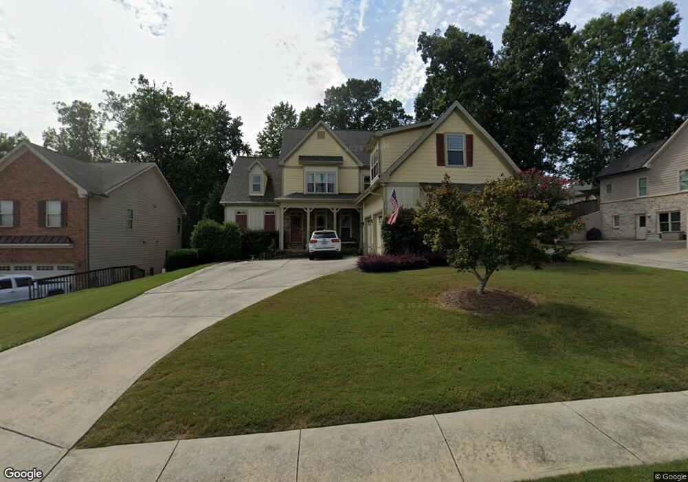
2108 Independence Ln Buford, GA 30519
Estimated Value: $592,000 - $667,000
5
Beds
4
Baths
4,292
Sq Ft
$148/Sq Ft
Est. Value
About This Home
This home is located at 2108 Independence Ln, Buford, GA 30519 and is currently estimated at $636,527, approximately $148 per square foot. 2108 Independence Ln is a home located in Hall County with nearby schools including Friendship Elementary School, Cherokee Bluff Middle School, and Cherokee Bluff High School.
Ownership History
Date
Name
Owned For
Owner Type
Purchase Details
Closed on
Nov 10, 2008
Sold by
James Russell Ents Inc
Bought by
Herndon Richard A and Herndon Kristen J
Current Estimated Value
Home Financials for this Owner
Home Financials are based on the most recent Mortgage that was taken out on this home.
Original Mortgage
$389,750
Outstanding Balance
$257,494
Interest Rate
6.38%
Mortgage Type
New Conventional
Estimated Equity
$379,033
Purchase Details
Closed on
Aug 30, 2007
Sold by
Greenwood Builder Group Inc
Bought by
James Russell Enterprises Inc
Home Financials for this Owner
Home Financials are based on the most recent Mortgage that was taken out on this home.
Original Mortgage
$322,500
Interest Rate
6.65%
Purchase Details
Closed on
Feb 6, 2006
Sold by
Chateau Corners Development Corp
Bought by
Embry Custom Homes Llc
Create a Home Valuation Report for This Property
The Home Valuation Report is an in-depth analysis detailing your home's value as well as a comparison with similar homes in the area
Home Values in the Area
Average Home Value in this Area
Purchase History
| Date | Buyer | Sale Price | Title Company |
|---|---|---|---|
| Herndon Richard A | $410,300 | -- | |
| James Russell Enterprises Inc | $80,000 | -- | |
| Embry Custom Homes Llc | $2,085,000 | -- |
Source: Public Records
Mortgage History
| Date | Status | Borrower | Loan Amount |
|---|---|---|---|
| Open | Herndon Richard A | $389,750 | |
| Previous Owner | James Russell Enterprises Inc | $322,500 |
Source: Public Records
Tax History
| Year | Tax Paid | Tax Assessment Tax Assessment Total Assessment is a certain percentage of the fair market value that is determined by local assessors to be the total taxable value of land and additions on the property. | Land | Improvement |
|---|---|---|---|---|
| 2025 | $6,073 | $251,880 | $47,200 | $204,680 |
| 2024 | $6,446 | $256,880 | $46,640 | $210,240 |
| 2023 | $5,854 | $233,280 | $30,720 | $202,560 |
| 2022 | $5,413 | $207,040 | $29,040 | $178,000 |
| 2021 | $4,750 | $178,320 | $17,000 | $161,320 |
| 2020 | $4,801 | $175,120 | $17,000 | $158,120 |
| 2019 | $4,645 | $167,920 | $16,000 | $151,920 |
| 2018 | $5,033 | $176,120 | $16,000 | $160,120 |
| 2017 | $4,709 | $160,840 | $12,000 | $148,840 |
| 2016 | $3,998 | $139,800 | $12,000 | $127,800 |
| 2015 | $3,699 | $139,800 | $12,000 | $127,800 |
| 2014 | $3,699 | $128,366 | $12,000 | $116,366 |
Source: Public Records
Map
Nearby Homes
- 2244 Mayors Way
- 2209 Independence Ln
- 2978 Legislative Ln
- 2638 Democracy Dr Unit 1
- 7343 Peacebrook Dr
- 7259 Williams Rd
- 7307 Williams Rd
- 7464 Williams Rd
- 2824 Pleasant Oak Dr
- 2747 Pearl Ridge Trace
- 7389 Williams Rd
- 2342 Sparta Way
- 3088 Lantana Way
- 3138 Lantana Way
- 7078 Reserve Ct
- 7115 Spout Springs Rd
- 7207 Spout Springs Rd
- 7230 Thistle Down Way
- 7124 Maple Brook Ln
- 7236 Maple Brook Ln
- 2112 Independence Ln
- 2107 Democracy Dr Unit 3
- 2103 Democracy Dr Unit 3
- 2116 Lot#223 Independence
- 2109 Independence Ln Unit 175
- 2109 Independence Ln
- 2120 Independence Ln
- 2105 Independence Ln
- 2124 Independence Ln
- 2117 Independence Ln
- 2115 Democracy Dr
- 2106 Democracy Dr
- 2110 Democracy Dr Unit 3
- 2096 Democracy Dr Unit 139
- 2128 Independence Ln
- 2114 Democracy Dr
- 2085 Democracy Dr
- 2125 Independence Ln
- 2092 Democracy Dr Unit 140
- 2092 Democracy Dr
Your Personal Tour Guide
Ask me questions while you tour the home.