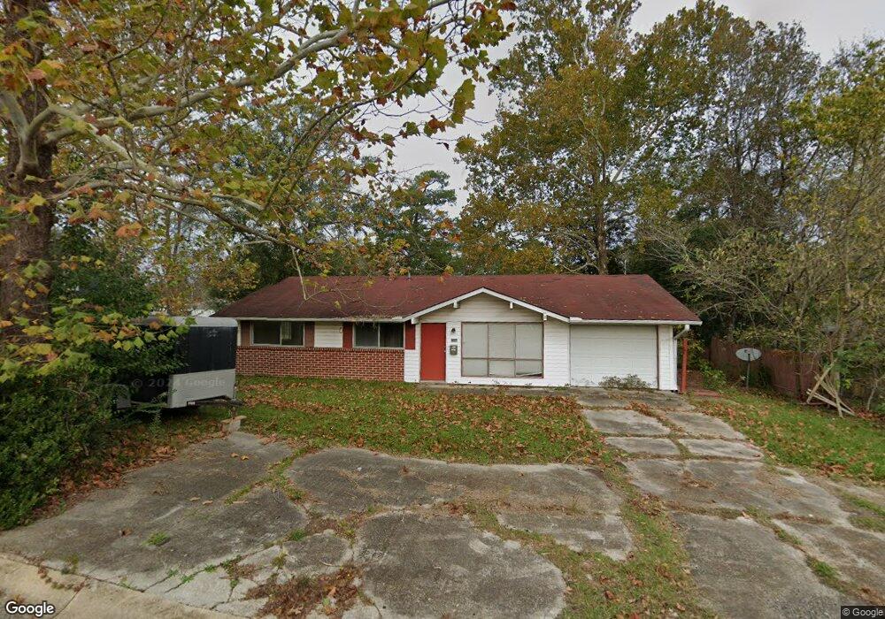
2108 Merritt St Leesville, LA 71446
Estimated Value: $60,000 - $148,000
3
Beds
2
Baths
1,950
Sq Ft
$44/Sq Ft
Est. Value
About This Home
This home is located at 2108 Merritt St, Leesville, LA 71446 and is currently estimated at $84,975, approximately $43 per square foot. 2108 Merritt St is a home located in Vernon Parish with nearby schools including First Assembly Christian Academy, Faith Training Christian Academy Elementary, and Faith Training Christian Academy.
Ownership History
Date
Name
Owned For
Owner Type
Purchase Details
Closed on
May 29, 2015
Sold by
Lakeview Loan Servicing Llc
Bought by
Tibbit James F
Current Estimated Value
Purchase Details
Closed on
Jan 9, 2007
Sold by
Russell Allen Lee and Russell Doris Rebecca
Bought by
Rawles Robert Cleon and Rawles Tiffney Ann
Home Financials for this Owner
Home Financials are based on the most recent Mortgage that was taken out on this home.
Original Mortgage
$80,494
Interest Rate
6.1%
Mortgage Type
VA
Create a Home Valuation Report for This Property
The Home Valuation Report is an in-depth analysis detailing your home's value as well as a comparison with similar homes in the area
Home Values in the Area
Average Home Value in this Area
Purchase History
| Date | Buyer | Sale Price | Title Company |
|---|---|---|---|
| Tibbit James F | $28,500 | None Available | |
| Rawles Robert Cleon | $77,800 | -- |
Source: Public Records
Mortgage History
| Date | Status | Borrower | Loan Amount |
|---|---|---|---|
| Previous Owner | Rawles Robert Cleon | $80,494 |
Source: Public Records
Tax History Compared to Growth
Tax History
| Year | Tax Paid | Tax Assessment Tax Assessment Total Assessment is a certain percentage of the fair market value that is determined by local assessors to be the total taxable value of land and additions on the property. | Land | Improvement |
|---|---|---|---|---|
| 2024 | $284 | $2,410 | $450 | $1,960 |
| 2023 | $264 | $2,250 | $450 | $1,800 |
| 2022 | $260 | $2,250 | $450 | $1,800 |
| 2021 | $276 | $2,250 | $450 | $1,800 |
| 2020 | $284 | $2,250 | $450 | $1,800 |
| 2019 | $293 | $2,250 | $450 | $1,800 |
| 2018 | $292 | $2,250 | $450 | $1,800 |
| 2017 | $292 | $2,250 | $450 | $1,800 |
| 2015 | $336 | $2,650 | $450 | $2,200 |
| 2014 | -- | $7,010 | $450 | $6,560 |
| 2013 | $943 | $7,010 | $450 | $6,560 |
Source: Public Records
Map
Nearby Homes
- 2001 Ginger St
- 2105 Miriam St
- 1404 Aaron Ave
- 1402 Aaron Ave
- 1104 John Paul Jones Ave
- 1007 Pinckney Ave
- 1112 Anderson Dr
- 907 Dennis Ave
- 917 Kings Rd
- 915 Kings Rd
- 812 John Paul Jones Ave
- 1110 Spruce St
- 1008 Spruce St
- 0 Tbd Unit 19-756
- 0 Aaron Milton and Karen Lots Unit 29-1413
- 1213 Port Arthur Terrace
- 805 Dennis Ave
- 1307 S 11th St Unit Street
- 802 Dennis Ave
- 0 Iowa St
- 2000 Merritt St
- 1600 Allison St
- 1616 Allison St
- 1603 Allison St
- 1603 Allison St Unit Street
- 2007 Ginger St
- 1505 Merchants St
- 2009 Ginger St
- 1602 Allison St
- 2104 Merritt St
- 2101 Ginger St
- 1503 Merchants St
- 2105 Ginger St
- 1604 Allison St
- 1501 Merchants St
- 1601 Kings Rd
- 1607 Allison St
- 2000 Ginger St
- 1601 Kings Rd
- 1601 Kings Rd