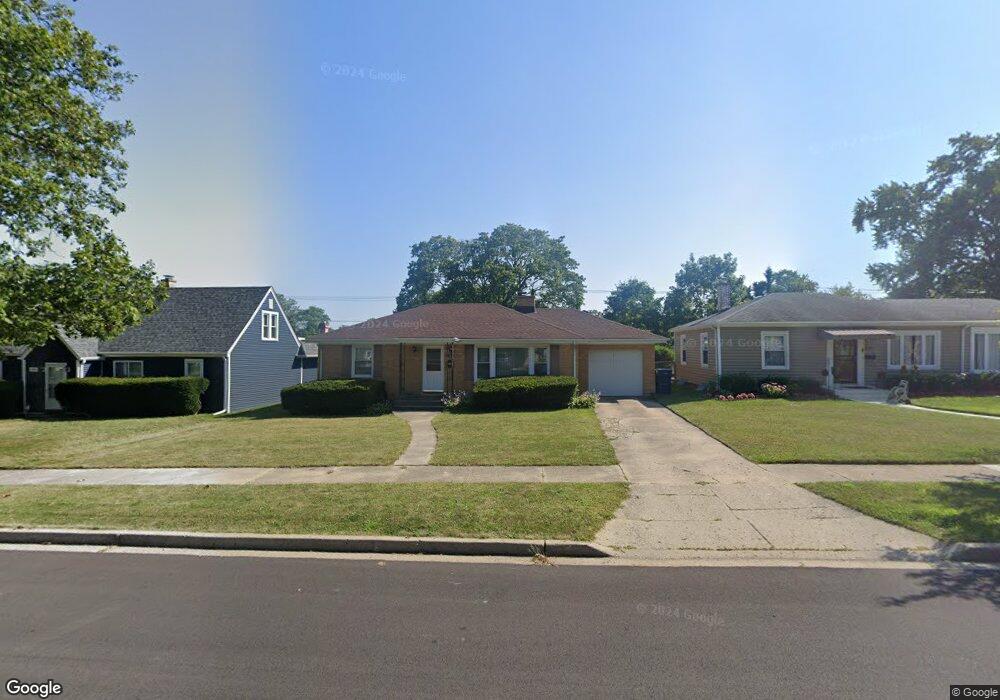
2109 8th Pkwy Waukegan, IL 60085
Norshore Park NeighborhoodEstimated Value: $187,000 - $254,000
2
Beds
2
Baths
1,200
Sq Ft
$194/Sq Ft
Est. Value
About This Home
This home is located at 2109 8th Pkwy, Waukegan, IL 60085 and is currently estimated at $233,075, approximately $194 per square foot. 2109 8th Pkwy is a home located in Lake County with nearby schools including Clearview Elementary School, John R Lewis Middle School, and Waukegan High School.
Ownership History
Date
Name
Owned For
Owner Type
Purchase Details
Closed on
Jan 27, 2012
Sold by
Koncan Gregory F and Julia A Koncan Declaration Of
Bought by
Vanheirseele James R
Current Estimated Value
Home Financials for this Owner
Home Financials are based on the most recent Mortgage that was taken out on this home.
Original Mortgage
$60,000
Outstanding Balance
$41,126
Interest Rate
3.9%
Mortgage Type
New Conventional
Estimated Equity
$191,949
Purchase Details
Closed on
Sep 12, 1997
Sold by
Koncan Julia A
Bought by
Koncan Julia A
Create a Home Valuation Report for This Property
The Home Valuation Report is an in-depth analysis detailing your home's value as well as a comparison with similar homes in the area
Home Values in the Area
Average Home Value in this Area
Purchase History
| Date | Buyer | Sale Price | Title Company |
|---|---|---|---|
| Vanheirseele James R | $75,000 | First American Title | |
| Koncan Julia A | -- | None Available |
Source: Public Records
Mortgage History
| Date | Status | Borrower | Loan Amount |
|---|---|---|---|
| Open | Vanheirseele James R | $60,000 |
Source: Public Records
Tax History Compared to Growth
Tax History
| Year | Tax Paid | Tax Assessment Tax Assessment Total Assessment is a certain percentage of the fair market value that is determined by local assessors to be the total taxable value of land and additions on the property. | Land | Improvement |
|---|---|---|---|---|
| 2024 | $3,913 | $57,801 | $11,342 | $46,459 |
| 2023 | $3,338 | $49,499 | $9,713 | $39,786 |
| 2022 | $3,338 | $40,145 | $8,422 | $31,723 |
| 2021 | $3,523 | $39,795 | $8,349 | $31,446 |
| 2020 | $3,522 | $37,074 | $7,778 | $29,296 |
| 2019 | $3,492 | $33,972 | $7,127 | $26,845 |
| 2018 | $3,245 | $31,476 | $9,170 | $22,306 |
| 2017 | $3,108 | $27,848 | $8,113 | $19,735 |
| 2016 | $2,812 | $24,199 | $7,050 | $17,149 |
| 2015 | $2,645 | $21,659 | $6,310 | $15,349 |
| 2014 | $2,721 | $21,622 | $6,689 | $14,933 |
| 2012 | $3,592 | $23,425 | $7,247 | $16,178 |
Source: Public Records
Map
Nearby Homes
- 819 S Fulton Ave
- 1712 11th St
- 12601 W Atlantic Ave
- 2116 & 2101 Williamsburg Dr
- 2726 W Hidden Glen Dr
- 910 Cummings Ave
- 1511 14th St
- 3027 Belvidere Rd
- 446 S Jackson St
- 49 S Lewis Ave
- 815 Prescott St
- 671 Oldsmar Ln
- 1521 Catalpa Ave
- 1244 Victoria Ave
- 724 10th St
- 3159 Jeanette Ave
- 1521 Seymour Ave
- 631 8th St
- 1210 Park Ave
- 600 Sunderlin St
- 2103 8th Pkwy
- 2111 8th Pkwy
- 2119 8th Pkwy
- 2106 Pearsall Pkwy
- 2102 Pearsall Pkwy
- 2110 Pearsall Pkwy
- 2118 Pearsall Pkwy
- 2017 8th Pkwy
- 2121 8th Pkwy
- 2110 8th Pkwy
- 2100 8th Pkwy
- 2116 8th Pkwy
- 2122 Pearsall Pkwy
- 2016 Pearsall Pkwy
- 2120 8th Pkwy
- 2013 8th Pkwy
- 2205 8th Pkwy
- 2018 8th Pkwy
- 2200 Pearsall Pkwy
- 2010 Pearsall Pkwy