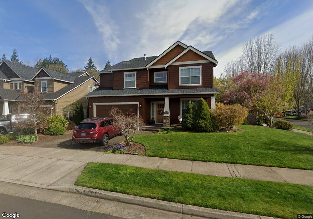
2109 Bobcat Ave SW Albany, OR 97321
South Albany NeighborhoodEstimated Value: $589,786 - $616,000
4
Beds
3
Baths
2,988
Sq Ft
$202/Sq Ft
Est. Value
About This Home
This home is located at 2109 Bobcat Ave SW, Albany, OR 97321 and is currently estimated at $602,893, approximately $201 per square foot. 2109 Bobcat Ave SW is a home located in Linn County with nearby schools including Liberty Elementary School, Memorial Middle School, and West Albany High School.
Ownership History
Date
Name
Owned For
Owner Type
Purchase Details
Closed on
Apr 8, 2008
Sold by
Kim Kun Hwan and Kim Hyon Sil
Bought by
Dorn Daniel A and Dorn Catherine L
Current Estimated Value
Home Financials for this Owner
Home Financials are based on the most recent Mortgage that was taken out on this home.
Original Mortgage
$262,000
Outstanding Balance
$167,381
Interest Rate
6.22%
Mortgage Type
Purchase Money Mortgage
Estimated Equity
$435,512
Purchase Details
Closed on
Jul 1, 2004
Sold by
Cornerstone Building Co
Bought by
Kim Kun Hwan and Kim Hyon Sil
Home Financials for this Owner
Home Financials are based on the most recent Mortgage that was taken out on this home.
Original Mortgage
$222,750
Interest Rate
6.27%
Mortgage Type
Balloon
Create a Home Valuation Report for This Property
The Home Valuation Report is an in-depth analysis detailing your home's value as well as a comparison with similar homes in the area
Home Values in the Area
Average Home Value in this Area
Purchase History
| Date | Buyer | Sale Price | Title Company |
|---|---|---|---|
| Dorn Daniel A | $329,000 | Fidelity Natl Title Co Of Or | |
| Kim Kun Hwan | $247,500 | Fidelity National Title Comp |
Source: Public Records
Mortgage History
| Date | Status | Borrower | Loan Amount |
|---|---|---|---|
| Open | Dorn Daniel A | $262,000 | |
| Previous Owner | Kim Kun Hwan | $222,750 |
Source: Public Records
Tax History Compared to Growth
Tax History
| Year | Tax Paid | Tax Assessment Tax Assessment Total Assessment is a certain percentage of the fair market value that is determined by local assessors to be the total taxable value of land and additions on the property. | Land | Improvement |
|---|---|---|---|---|
| 2025 | $7,143 | $358,920 | -- | -- |
| 2024 | $6,936 | $348,470 | -- | -- |
| 2023 | $6,739 | $338,330 | $0 | $0 |
| 2022 | $6,632 | $328,480 | $0 | $0 |
| 2021 | $6,242 | $318,920 | $0 | $0 |
| 2020 | $6,159 | $309,640 | $0 | $0 |
| 2019 | $6,015 | $300,630 | $0 | $0 |
| 2018 | $5,859 | $291,880 | $0 | $0 |
| 2017 | $5,604 | $283,380 | $0 | $0 |
| 2016 | $5,116 | $275,130 | $0 | $0 |
| 2015 | $4,756 | $267,120 | $0 | $0 |
| 2014 | $4,638 | $259,340 | $0 | $0 |
Source: Public Records
Map
Nearby Homes
- 1987 Bobcat Ave SW
- 2170 Bobcat Ave SW
- 1851 Cougar Ave SW
- 1691 Bobcat Ave SW
- 1776 Antelope Cir SW
- PP2020-49 Lot#2 SW Osprey Ct
- 2
- 1664 Elk Cir SW
- 1562 Beaver Ct SW
- 4714 Willetta St SW
- 1221 36th Ave SW
- 1023 37th Ave SW
- 3810 Pacific Blvd SW
- 1124 Lakewood Dr SW
- 1004 Lakewood Dr SW
- 3282 Pacific Place SW
- 6259 Chapman Place SW
- 1712 25th Ave SW
- 530 34th (-536) Ave SE
- 31405 Allen Ln
- 2117 Bobcat Ave SW
- 2110 Salmon Ct SW
- 2120 Salmon Ct SW
- 2133 Bobcat Ave SW
- 2001 Bobcat Ave SW
- 2104 Bobcat Ave SW
- 1990 Salmon Run SW
- 2118 Bobcat Ave SW
- 2167 Bobcat Ave SW
- 2140 Bobcat Ave SW
- 2140 Salmon Ct SW
- 2000 Bobcat Ave SW
- 1972 Salmon Run SW
- 2107 Salmon Ct SW
- 2103 Marten Ave SW
- 2115 Salmon Ct SW
- 2119 Marten Ave SW
- 2175 Bobcat Ave SW
- 1994 Bobcat Ave SW
- 2135 Salmon Ct SW