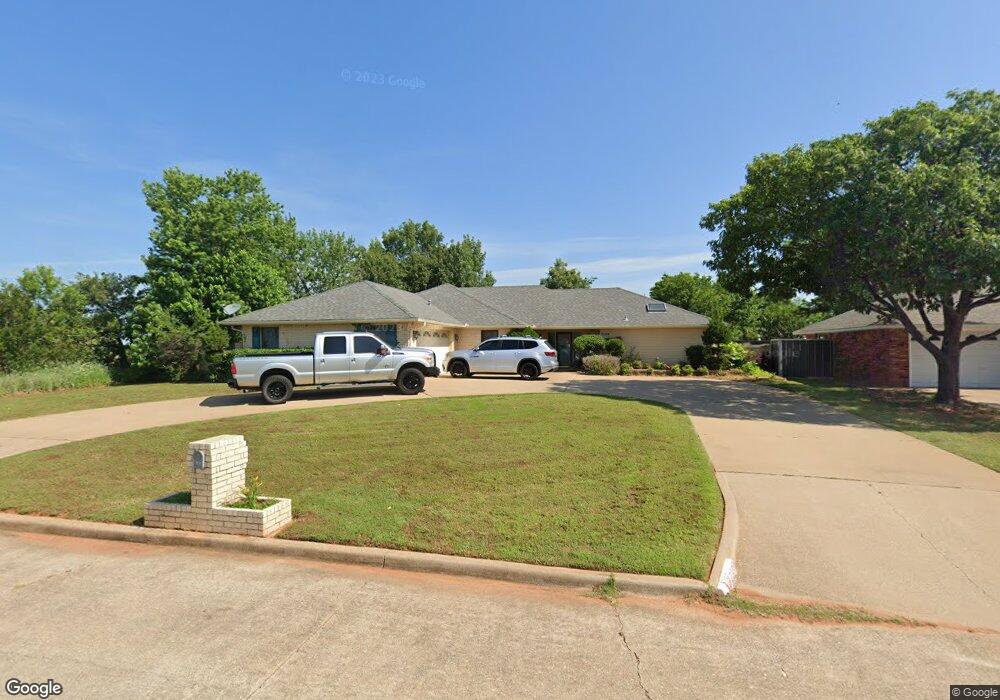
2109 Crossgate Rd Duncan, OK 73533
Estimated Value: $238,000 - $267,000
3
Beds
4
Baths
2,151
Sq Ft
$116/Sq Ft
Est. Value
About This Home
This home is located at 2109 Crossgate Rd, Duncan, OK 73533 and is currently estimated at $248,882, approximately $115 per square foot. 2109 Crossgate Rd is a home located in Stephens County with nearby schools including Horace Mann Elementary School, Duncan Middle School, and Duncan High School.
Ownership History
Date
Name
Owned For
Owner Type
Purchase Details
Closed on
Jan 15, 2015
Sold by
Hokit Nada and Hokit Nada R
Bought by
Crain Christopher D and Crain Michelle F
Current Estimated Value
Home Financials for this Owner
Home Financials are based on the most recent Mortgage that was taken out on this home.
Original Mortgage
$154,156
Outstanding Balance
$117,337
Interest Rate
3.75%
Mortgage Type
FHA
Estimated Equity
$131,545
Purchase Details
Closed on
Oct 21, 1989
Sold by
Chilcoat Hughie and Chilcoat Edna
Bought by
Hokit Ronald G
Create a Home Valuation Report for This Property
The Home Valuation Report is an in-depth analysis detailing your home's value as well as a comparison with similar homes in the area
Home Values in the Area
Average Home Value in this Area
Purchase History
| Date | Buyer | Sale Price | Title Company |
|---|---|---|---|
| Crain Christopher D | $157,000 | None Available | |
| Crain Christopher D | $157,000 | None Available | |
| Hokit Ronald G | $114,000 | -- |
Source: Public Records
Mortgage History
| Date | Status | Borrower | Loan Amount |
|---|---|---|---|
| Open | Crain Christopher D | $154,156 |
Source: Public Records
Tax History Compared to Growth
Tax History
| Year | Tax Paid | Tax Assessment Tax Assessment Total Assessment is a certain percentage of the fair market value that is determined by local assessors to be the total taxable value of land and additions on the property. | Land | Improvement |
|---|---|---|---|---|
| 2025 | $1,584 | $19,371 | $1,374 | $17,997 |
| 2024 | $1,584 | $18,601 | $1,374 | $17,227 |
| 2023 | $1,584 | $18,601 | $1,374 | $17,227 |
| 2022 | $1,434 | $17,161 | $1,374 | $15,787 |
| 2021 | $1,368 | $16,068 | $1,428 | $14,640 |
| 2020 | $1,496 | $17,328 | $1,428 | $15,900 |
| 2019 | $1,428 | $16,503 | $1,428 | $15,075 |
| 2018 | $1,570 | $18,299 | $1,428 | $16,871 |
| 2017 | $1,443 | $16,791 | $1,428 | $15,363 |
| 2016 | $1,478 | $17,386 | $1,428 | $15,958 |
| 2015 | $1,075 | $14,515 | $1,169 | $13,346 |
| 2014 | $1,075 | $14,092 | $1,134 | $12,958 |
Source: Public Records
Map
Nearby Homes
- 3990 N Ridgeview Dr
- 1927 High Meadow Dr
- 30 Canterbury Ln
- 28 Canterbury Ln
- 2018 Woodrock Dr
- 2814 2814 Springdale Ln
- 2403 Meadow View Dr
- 1829 1829 Terrace Dr
- 1706 Windsor Dr
- 2360 Rockwell Dr
- 2321 Rockwell Dr
- 2129 W Mallard Dr
- 2201 W Club Rd
- 1706 1706 Foxboro
- 2110 W Club Rd
- 2108 W Club Rd
- 1705 Foxboro Dr
- 3005 W Foxboro
- 2901 2901 Timber Ridge
- 2518 Wildwood Place
- 2105 Crossgate Rd
- 2018 Woodcrest Dr
- 2014 Woodcrest Dr
- 2110 Crossgate Rd
- 2101 Crossgate Rd
- 2106 Crossgate Rd
- 2102 Crossgate Rd
- 2013 Crossgate Rd
- 2017 Woodcrest Dr
- 2103 Crestmont Dr
- 2014 Crossgate Rd
- 2014 2014 Crossgate
- 2006 Woodcrest Dr
- 2023 Crestmont Dr
- 3930 N Ridgeview Dr
- 2009 Crossgate Rd
- 2013 Woodcrest Dr
- 2010 2010 Crossgate
- 2019 Crestmont Dr
- 2009 Woodcrest Dr