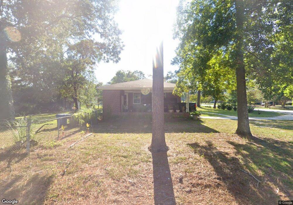
2109 Holland St West Columbia, SC 29169
Estimated Value: $241,000 - $276,000
3
Beds
2
Baths
1,636
Sq Ft
$154/Sq Ft
Est. Value
About This Home
This home is located at 2109 Holland St, West Columbia, SC 29169 and is currently estimated at $252,606, approximately $154 per square foot. 2109 Holland St is a home located in Lexington County with nearby schools including Riverbank Elementary, Northside Middle, and Brookland-Cayce High School.
Ownership History
Date
Name
Owned For
Owner Type
Purchase Details
Closed on
Dec 13, 2024
Sold by
Jn Investments Of Sc Llc
Bought by
Novarro Rosa
Current Estimated Value
Purchase Details
Closed on
Jul 3, 2024
Sold by
Kniphfer Katelyn Olivia
Bought by
Jn Investments Of Sc Llc
Purchase Details
Closed on
Jul 29, 2022
Sold by
Teresa Mewhorter
Bought by
Kniphfer Katelyn Olivia
Home Financials for this Owner
Home Financials are based on the most recent Mortgage that was taken out on this home.
Original Mortgage
$191,468
Interest Rate
5.78%
Mortgage Type
FHA
Create a Home Valuation Report for This Property
The Home Valuation Report is an in-depth analysis detailing your home's value as well as a comparison with similar homes in the area
Home Values in the Area
Average Home Value in this Area
Purchase History
| Date | Buyer | Sale Price | Title Company |
|---|---|---|---|
| Novarro Rosa | -- | None Listed On Document | |
| Jn Investments Of Sc Llc | $240,000 | None Listed On Document | |
| Kniphfer Katelyn Olivia | $195,000 | Gove John R | |
| Kniphfer Katelyn Olivia | $195,000 | Gove John R |
Source: Public Records
Mortgage History
| Date | Status | Borrower | Loan Amount |
|---|---|---|---|
| Previous Owner | Kniphfer Katelyn Olivia | $191,468 |
Source: Public Records
Tax History Compared to Growth
Tax History
| Year | Tax Paid | Tax Assessment Tax Assessment Total Assessment is a certain percentage of the fair market value that is determined by local assessors to be the total taxable value of land and additions on the property. | Land | Improvement |
|---|---|---|---|---|
| 2024 | $5,392 | $11,700 | $2,100 | $9,600 |
| 2023 | $4,619 | $5,229 | $1,400 | $3,829 |
| 2022 | $2,931 | $7,843 | $2,100 | $5,743 |
| 2020 | $2,779 | $7,843 | $2,100 | $5,743 |
| 2019 | $932 | $4,925 | $1,400 | $3,525 |
| 2018 | $942 | $4,925 | $1,400 | $3,525 |
| 2017 | $904 | $4,925 | $1,400 | $3,525 |
| 2016 | $930 | $4,924 | $1,400 | $3,524 |
| 2014 | $655 | $4,572 | $920 | $3,652 |
| 2013 | -- | $4,570 | $920 | $3,650 |
Source: Public Records
Map
Nearby Homes
- 207 Woodhaven Dr
- 215 Sandel Ln
- 2004 Dew Ave
- 0 Platt Springs Rd Unit 606355
- 623 Hook Ave
- 165 Cavendish Dr
- 339 Gum Swamp Trail
- 349 Gum Swamp Trail
- 116 Silver Run Place
- 135 Silver Run Place
- 529 Finnegan Ln
- 500 Finnegan Ln
- 212 Alexandria St
- 913 Harper Rose Ct
- 309 Hammond Ave
- 617 Holland Cir
- 106 Earl Ct
- 1615 Holland St
- 1802 D Ave
- 179 War Admiral Dr
- 2113 Holland St
- 210 Sandel Ln
- 2108 Holland St
- 2110 Holland St
- 2116 Holland St
- 208 Sandel Ln
- 109 Menscer Dr
- 2120 Holland St
- 2213 Holland St
- 213 Sandel Ln
- 2212 Holland St
- 2105 Hooklawn Dr
- 108 Menscer Dr
- 301 Woodhaven Dr
- 206 Sandel Ln
- 2217 Holland St
- 2214 Holland St
- 116 Menscer Dr
- 209 Sandel Ln
- 300 Woodhaven Dr