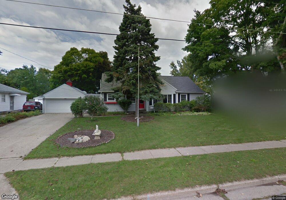
2109 Newport St SW Wyoming, MI 49519
Wyoming Park NeighborhoodEstimated Value: $308,000 - $350,000
4
Beds
2
Baths
1,912
Sq Ft
$174/Sq Ft
Est. Value
About This Home
This home is located at 2109 Newport St SW, Wyoming, MI 49519 and is currently estimated at $332,432, approximately $173 per square foot. 2109 Newport St SW is a home located in Kent County with nearby schools including Oriole Park Elementary School, Parkview Elementary School, and Wyoming Intermediate School.
Ownership History
Date
Name
Owned For
Owner Type
Purchase Details
Closed on
Jun 27, 2007
Sold by
Brower James D and Brower Pamela S
Bought by
Brower James D and Brower Pamela S
Current Estimated Value
Purchase Details
Closed on
Nov 1, 2004
Sold by
Baker Randy and Baker Jane
Bought by
Brower James D and Brower Pamela S
Home Financials for this Owner
Home Financials are based on the most recent Mortgage that was taken out on this home.
Original Mortgage
$74,000
Interest Rate
5.8%
Mortgage Type
Purchase Money Mortgage
Create a Home Valuation Report for This Property
The Home Valuation Report is an in-depth analysis detailing your home's value as well as a comparison with similar homes in the area
Home Values in the Area
Average Home Value in this Area
Purchase History
| Date | Buyer | Sale Price | Title Company |
|---|---|---|---|
| Brower James D | -- | None Available | |
| Brower James D | $154,900 | Chicago Title |
Source: Public Records
Mortgage History
| Date | Status | Borrower | Loan Amount |
|---|---|---|---|
| Closed | Brower James D | $74,000 |
Source: Public Records
Tax History Compared to Growth
Tax History
| Year | Tax Paid | Tax Assessment Tax Assessment Total Assessment is a certain percentage of the fair market value that is determined by local assessors to be the total taxable value of land and additions on the property. | Land | Improvement |
|---|---|---|---|---|
| 2025 | $3,235 | $172,600 | $0 | $0 |
| 2024 | $3,235 | $157,700 | $0 | $0 |
| 2023 | $3,346 | $143,100 | $0 | $0 |
| 2022 | $3,082 | $125,700 | $0 | $0 |
| 2021 | $3,009 | $112,900 | $0 | $0 |
| 2020 | $2,746 | $103,600 | $0 | $0 |
| 2019 | $2,943 | $91,800 | $0 | $0 |
| 2018 | $2,888 | $83,100 | $0 | $0 |
| 2017 | $2,814 | $73,900 | $0 | $0 |
| 2016 | $2,716 | $68,600 | $0 | $0 |
| 2015 | $2,684 | $68,600 | $0 | $0 |
| 2013 | -- | $69,600 | $0 | $0 |
Source: Public Records
Map
Nearby Homes
- 2225 Thornwood St SW
- 2670 Central Ave SW
- 2866 West Ave SW
- 2440 Cherrywood Ct SW
- 2716 Byron Center Ave SW
- 2939 Taft Ave SW
- 2338 Lee St SW
- 3045 Perry Ave SW
- 2333 Wyoming Ave SW
- 2919 Byron Center Ave SW Unit F
- 2945 Byron Center Ave SW Unit F
- 2446 31st St SW
- 1935 Ithaca St SW
- 2126 Wyoming Ave SW
- 2435 Prairie St SW
- 2141 Greenfield Ave SW
- 2437 Parkdale Ave SW
- 3257 Gladiola Ave SW
- 3329 Boone Ave SW
- 2051 Collingwood Ave SW
- 2119 Newport St SW
- 2101 Newport St SW
- 2125 Newport St SW
- 2108 Wrenwood St SW
- 2114 Wrenwood St SW
- 2100 Wrenwood St SW
- 2663 Sharon Ct SW
- 2705 Sharon Ct SW
- 2131 Newport St SW
- 2120 Wrenwood St SW
- 2655 Sharon Ct SW
- 2713 Sharon Ct SW
- 2126 Wrenwood St SW
- 2700 Boulevard Dr SW
- 2112 Newport St SW
- 2106 Newport St SW
- 2118 Newport St SW
- 2721 Sharon Ct SW
- 2130 Wrenwood St SW
- 2100 Newport St SW