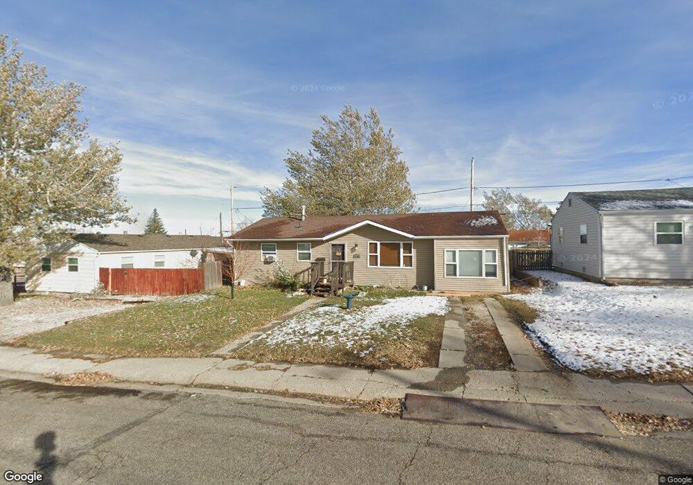
2109 S Richard St Casper, WY 82601
Central Casper NeighborhoodEstimated Value: $175,000 - $214,286
4
Beds
1
Bath
1,222
Sq Ft
$164/Sq Ft
Est. Value
About This Home
This home is located at 2109 S Richard St, Casper, WY 82601 and is currently estimated at $200,095, approximately $163 per square foot. 2109 S Richard St is a home located in Natrona County with nearby schools including Wyoming Behavioral Institute.
Ownership History
Date
Name
Owned For
Owner Type
Purchase Details
Closed on
Apr 4, 2024
Sold by
Bill Nielson Trucking Inc
Bought by
Nielson Bill
Current Estimated Value
Purchase Details
Closed on
Oct 31, 2022
Sold by
Creel-Salazar Deborah M
Bought by
Bill Nielson Trucking Inc
Purchase Details
Closed on
Sep 8, 2016
Sold by
Hebert Dustin and Hebert Rebecca C
Bought by
Creel Salazar Deborah M
Purchase Details
Closed on
Jun 30, 2014
Sold by
Kevin Curtis Kevin Curtis and Mckin Ashley C
Bought by
Hebert Dustin M and Hebert Rebecca C
Create a Home Valuation Report for This Property
The Home Valuation Report is an in-depth analysis detailing your home's value as well as a comparison with similar homes in the area
Home Values in the Area
Average Home Value in this Area
Purchase History
| Date | Buyer | Sale Price | Title Company |
|---|---|---|---|
| Nielson Bill | -- | None Listed On Document | |
| Bill Nielson Trucking Inc | -- | First American Title | |
| Creel Salazar Deborah M | -- | American Title Agency | |
| Hebert Dustin M | -- | -- |
Source: Public Records
Tax History Compared to Growth
Tax History
| Year | Tax Paid | Tax Assessment Tax Assessment Total Assessment is a certain percentage of the fair market value that is determined by local assessors to be the total taxable value of land and additions on the property. | Land | Improvement |
|---|---|---|---|---|
| 2025 | $912 | $12,705 | $2,392 | $10,313 |
| 2024 | $1,170 | $16,288 | $3,067 | $13,221 |
| 2023 | $1,198 | $16,429 | $2,987 | $13,442 |
| 2022 | $1,152 | $15,808 | $3,112 | $12,696 |
| 2021 | $1,008 | $13,834 | $3,215 | $10,619 |
| 2020 | $1,111 | $15,245 | $5,130 | $10,115 |
| 2019 | $1,274 | $17,473 | $2,793 | $14,680 |
| 2018 | $1,169 | $16,042 | $3,491 | $12,551 |
| 2017 | $1,177 | $16,153 | $3,491 | $12,662 |
| 2015 | $1,099 | $15,084 | $3,491 | $11,593 |
| 2014 | $753 | $10,326 | $3,491 | $6,835 |
Source: Public Records
Map
Nearby Homes
- 2109 S Mckinley St
- 1224 S Mckinley St
- 821 E 19th St
- Lots 1-16 Mckinley Heights
- 2443 Lennox Ave
- 1819 S Washington St
- 2665 Allendale Blvd
- 17th Street
- 2322 Shattuck Ave
- 1854 Lennox Ave
- 1601 E 26th St
- 1831 Glendale Ave
- 0 15th St Unit 20251555
- 730 E 15th St
- 720 E 15th St
- 633 E 14th St
- 1711 Elk Ave
- 1505 E 15th St
- 637 E 13th St
- 2732 Player Dr
- 2129 S Richard St
- 2119 S Richard St
- 2139 S Richard St
- 2128 S Richard St
- 2118 S Richard St
- 2118 S Richard St Unit 21st
- 2138 S Richard St
- 2108 S Richard St
- 2149 S Richard St
- 2149 S Richard St Unit 21st Street
- 2118 S Mitchell St
- 2128 S Mitchell St
- 715 E 21st St
- 2108 S Mitchell St
- 2138 S Mitchell St
- 645 E 21st St
- 745 E 21st St
- 2148 S Mitchell St
- 2158 S Mitchell St
- 714 E 22nd St