Estimated Value: $229,000 - $252,743
3
Beds
2
Baths
1,484
Sq Ft
$164/Sq Ft
Est. Value
About This Home
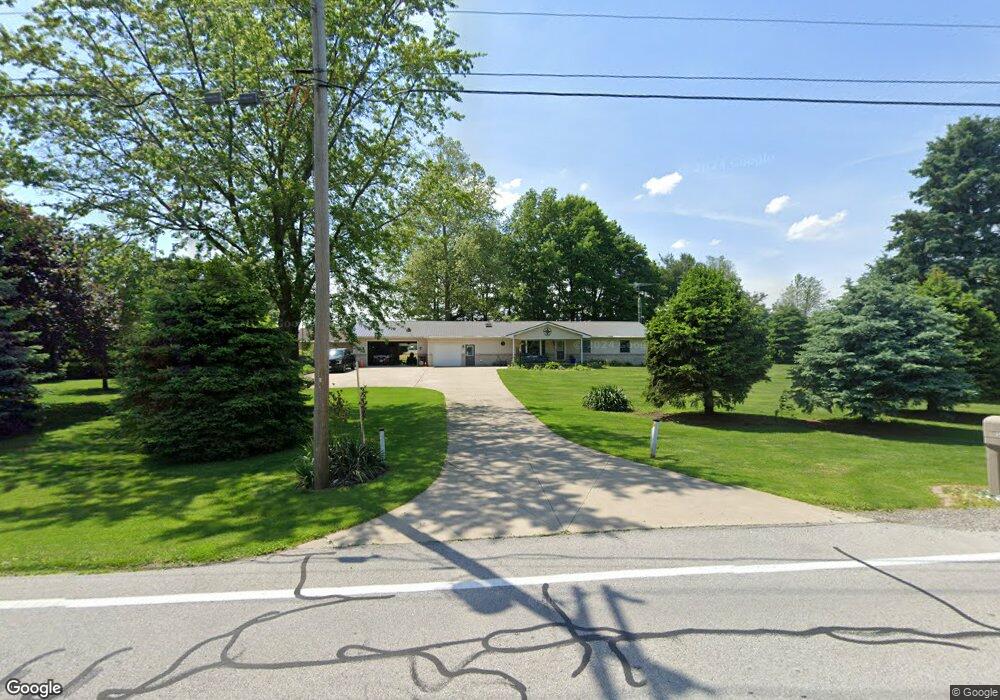
This home is located at 2109 State Route 109, Delta, OH 43515 and is currently estimated at $243,186, approximately $163 per square foot. 2109 State Route 109 is a home located in Fulton County with nearby schools including Delta Elementary School, Pike-Delta-York Middle School, and Pike-Delta-York High School.
Ownership History
Date
Name
Owned For
Owner Type
Purchase Details
Closed on
Sep 19, 2022
Sold by
White Virginia L
Bought by
Sheely Bernard George
Current Estimated Value
Home Financials for this Owner
Home Financials are based on the most recent Mortgage that was taken out on this home.
Original Mortgage
$180,000
Outstanding Balance
$171,802
Interest Rate
5.13%
Mortgage Type
Balloon
Estimated Equity
$71,384
Purchase Details
Closed on
Jan 1, 1990
Bought by
White Terry L and White Virginia
Create a Home Valuation Report for This Property
The Home Valuation Report is an in-depth analysis detailing your home's value as well as a comparison with similar homes in the area
Purchase History
| Date | Buyer | Sale Price | Title Company |
|---|---|---|---|
| Sheely Bernard George | $200,000 | Erie Title Barristers Group | |
| White Terry L | -- | -- |
Source: Public Records
Mortgage History
| Date | Status | Borrower | Loan Amount |
|---|---|---|---|
| Open | Sheely Bernard George | $180,000 |
Source: Public Records
Tax History
| Year | Tax Paid | Tax Assessment Tax Assessment Total Assessment is a certain percentage of the fair market value that is determined by local assessors to be the total taxable value of land and additions on the property. | Land | Improvement |
|---|---|---|---|---|
| 2024 | $2,803 | $64,300 | $10,470 | $53,830 |
| 2023 | $2,544 | $64,300 | $10,470 | $53,830 |
| 2022 | $2,598 | $51,770 | $8,720 | $43,050 |
| 2021 | $2,633 | $51,770 | $8,720 | $43,050 |
| 2020 | $2,658 | $51,770 | $8,720 | $43,050 |
| 2019 | $2,171 | $44,000 | $8,300 | $35,700 |
| 2018 | $1,118 | $44,000 | $8,300 | $35,700 |
| 2017 | $2,183 | $44,000 | $8,300 | $35,700 |
| 2016 | $2,033 | $40,750 | $8,300 | $32,450 |
| 2015 | $1,935 | $40,750 | $8,300 | $32,450 |
| 2014 | $1,931 | $40,750 | $8,300 | $32,450 |
| 2013 | $2,169 | $45,010 | $8,750 | $36,260 |
Source: Public Records
Map
Nearby Homes
- 6881 County Road B
- 1797 County Road 5
- 8351 County Road U
- 761 Marlow Dr
- 692 Ariel Ct
- 665 Ariel Ct
- 0 County Road 4
- 3859 County Road C
- 9136 County Road Ef
- U105 County Road 10
- 447 Washington St
- 331 E Maple St
- 5835 County Road 10
- 318 Hidden Ridge Dr
- 2061 Redbud Ln
- 320 Crabtree Ln
- 315 Cherrytree Ln
- 2049 Pear Tree Ln
- 2158 Redbud Ln
- 11470 County Rd E
- 2147 State Route 109
- 2148 State Route 109
- 2040 State Route 109
- 2148 Ohio 109
- 1991 State Route 109
- 7400 County Road B
- 7571 County Road B
- 7571 Co Rd B
- 7605 County Road B
- 1937 State Route 109
- 7350 County Road B
- 1903 State Route 109
- 7300 County Road B
- 2338 State Route 109
- 1852 State Route 109
- 7270 County Road B
- 7220 County Road B
- 7855 County Road B
- 1772 State Route 109
- 7170 County Road B
Your Personal Tour Guide
Ask me questions while you tour the home.