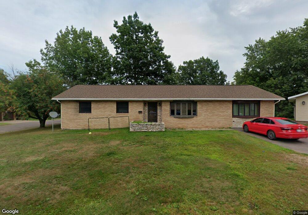
211 10th Ave N Hurley, WI 54534
Estimated Value: $175,000 - $222,124
3
Beds
2
Baths
1,526
Sq Ft
$134/Sq Ft
Est. Value
About This Home
This home is located at 211 10th Ave N, Hurley, WI 54534 and is currently estimated at $204,031, approximately $133 per square foot. 211 10th Ave N is a home located in Iron County with nearby schools including Hurley Elementary School, Hurley High School, and All Saints Catholic Academy.
Ownership History
Date
Name
Owned For
Owner Type
Purchase Details
Closed on
Sep 16, 2011
Sold by
Gentile Geraldine and Gentile Geraldine D
Bought by
Colassaco Justin A
Current Estimated Value
Home Financials for this Owner
Home Financials are based on the most recent Mortgage that was taken out on this home.
Original Mortgage
$85,000
Outstanding Balance
$39,604
Interest Rate
7.5%
Mortgage Type
Adjustable Rate Mortgage/ARM
Estimated Equity
$164,427
Create a Home Valuation Report for This Property
The Home Valuation Report is an in-depth analysis detailing your home's value as well as a comparison with similar homes in the area
Home Values in the Area
Average Home Value in this Area
Purchase History
| Date | Buyer | Sale Price | Title Company |
|---|---|---|---|
| Colassaco Justin A | $141,750 | Assoc Title |
Source: Public Records
Mortgage History
| Date | Status | Borrower | Loan Amount |
|---|---|---|---|
| Open | Colassaco Justin A | $85,000 |
Source: Public Records
Tax History Compared to Growth
Tax History
| Year | Tax Paid | Tax Assessment Tax Assessment Total Assessment is a certain percentage of the fair market value that is determined by local assessors to be the total taxable value of land and additions on the property. | Land | Improvement |
|---|---|---|---|---|
| 2024 | $3,567 | $205,900 | $12,600 | $193,300 |
| 2023 | $3,184 | $103,200 | $7,000 | $96,200 |
| 2022 | $3,081 | $103,200 | $7,000 | $96,200 |
| 2021 | $2,967 | $103,200 | $7,000 | $96,200 |
| 2020 | $3,043 | $103,200 | $7,000 | $96,200 |
| 2019 | $3,143 | $103,200 | $7,000 | $96,200 |
| 2018 | $3,074 | $103,200 | $7,000 | $96,200 |
| 2017 | $3,156 | $103,200 | $7,000 | $96,200 |
| 2016 | $3,038 | $103,200 | $7,000 | $96,200 |
| 2015 | $2,569 | $89,500 | $7,000 | $82,500 |
| 2014 | $2,569 | $95,000 | $7,000 | $88,000 |
| 2013 | $2,496 | $95,000 | $7,000 | $88,000 |
Source: Public Records
Map
Nearby Homes
- 408 6th Ave N
- 509 Poplar St
- ON Oak St
- 202 Copper St
- 400 Silver St
- 334 W Ayer St
- TBD U S Highway 2
- 500 W Cloverland Dr Unit US2
- 230 W Michigan Ave
- 112 W Pewabic St
- 505 W Southland Ave
- 615 N Lowell St
- 126 W Michigan Ave
- 227 W Birch St
- 235 W Birch St
- 119 W Oak St
- 224 E Coolidge Ave
- 213 S Mansfield St
- 146 E Midland Ave
- 101 S Mansfield St
- 903 Maple St
- 910 Maple St
- 210 9th Ave N
- 906 Division St
- 303 10th Ave N
- 910 Division St
- 900 Maple St
- 900 Division St
- 300 10th Ave N
- 5304W County Road D
- 305 10th Ave N
- 911 Division St
- 306 9th Ave N
- 810 Division St
- 1001 Division St
- 209 9th Ave N
- 120 9th Ave N
- 5316W County Road D
- 1003 Division St
- 310 9th Ave N