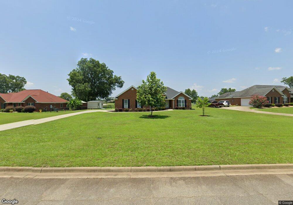
211 Ambleside Dr Leesburg, GA 31763
Estimated Value: $282,066 - $303,000
3
Beds
2
Baths
1,770
Sq Ft
$167/Sq Ft
Est. Value
About This Home
This home is located at 211 Ambleside Dr, Leesburg, GA 31763 and is currently estimated at $296,017, approximately $167 per square foot. 211 Ambleside Dr is a home located in Lee County with nearby schools including Lee County Primary School, Lee County Elementary School, and Lee County Middle School - West Campus.
Ownership History
Date
Name
Owned For
Owner Type
Purchase Details
Closed on
May 21, 2018
Sold by
Merkal Brian C
Bought by
Mullins Wesley D and Mullins Sandra G
Current Estimated Value
Home Financials for this Owner
Home Financials are based on the most recent Mortgage that was taken out on this home.
Original Mortgage
$100,000
Outstanding Balance
$86,103
Interest Rate
4.4%
Mortgage Type
New Conventional
Estimated Equity
$209,914
Purchase Details
Closed on
Aug 23, 2007
Sold by
Ray Lloyd Realty & Constru
Bought by
Merkal Brian C
Home Financials for this Owner
Home Financials are based on the most recent Mortgage that was taken out on this home.
Original Mortgage
$164,250
Interest Rate
6.65%
Mortgage Type
New Conventional
Purchase Details
Closed on
Dec 1, 2004
Sold by
Holly Plantation Partners
Bought by
Ray Lloyd Realty
Create a Home Valuation Report for This Property
The Home Valuation Report is an in-depth analysis detailing your home's value as well as a comparison with similar homes in the area
Home Values in the Area
Average Home Value in this Area
Purchase History
| Date | Buyer | Sale Price | Title Company |
|---|---|---|---|
| Mullins Wesley D | $149,900 | -- | |
| Merkal Brian C | $182,500 | -- | |
| Ray Lloyd Realty | $27,900 | -- |
Source: Public Records
Mortgage History
| Date | Status | Borrower | Loan Amount |
|---|---|---|---|
| Open | Mullins Wesley D | $100,000 | |
| Previous Owner | Merkal Brian C | $164,250 |
Source: Public Records
Tax History Compared to Growth
Tax History
| Year | Tax Paid | Tax Assessment Tax Assessment Total Assessment is a certain percentage of the fair market value that is determined by local assessors to be the total taxable value of land and additions on the property. | Land | Improvement |
|---|---|---|---|---|
| 2024 | $2,228 | $75,720 | $8,000 | $67,720 |
| 2023 | $2,079 | $75,720 | $8,000 | $67,720 |
| 2022 | $2,079 | $75,720 | $8,000 | $67,720 |
| 2021 | $2,138 | $75,720 | $8,000 | $67,720 |
| 2020 | $1,828 | $57,160 | $10,160 | $47,000 |
| 2019 | $1,860 | $57,160 | $10,160 | $47,000 |
| 2018 | $1,926 | $57,160 | $10,160 | $47,000 |
| 2017 | $1,824 | $57,160 | $10,160 | $47,000 |
| 2016 | $1,824 | $57,160 | $10,160 | $47,000 |
| 2015 | $1,834 | $57,160 | $10,160 | $47,000 |
| 2014 | $2,167 | $67,280 | $11,960 | $55,320 |
| 2013 | -- | $67,280 | $11,960 | $55,320 |
Source: Public Records
Map
Nearby Homes
- 112 Beowulf Ln
- 107 Beowulf Ln
- 260 Hawkstead Dr
- 307 Ambleside Dr
- 324 Ambleside Dr
- 695 Winifred Rd
- 4922 van Cise Ln
- 252 Wiregrass Way
- 123 Larkspur Dr
- 122 Bay Ct
- 227 Longleaf Dr
- 2624 Crofton Dr
- 4817 Coachlight Ct
- 2813 W Doublegate Dr
- 3811 Burton Ct
- 3806 Burton Ct
- 3805 Burton Ct
- 102 Fair Oaks Ct
- 2507 Daylor Ct
- 2511 Fox Ridge Dr
- 215 Ambleside Dr
- 207 Ambleside Dr
- 219 Ambleside Dr
- 210 Ambleside Dr
- 172 Hawkstead Dr
- 199 Ambleside Dr
- 212 Ambleside Dr
- 214 Ambleside Dr
- 223 Ambleside Dr
- 218 Ambleside Dr
- 153 Hawkstead Dr
- 178 Hawkstead Dr
- 191 Ambleside Dr
- 128 Beowulf Ln
- 222 Ambleside Dr
- 198 Ambleside Dr
- 184 Hawkstead Dr
- 124 Beowulf Ln
- 227 Ambleside Dr
- 148 Hawkstead Dr