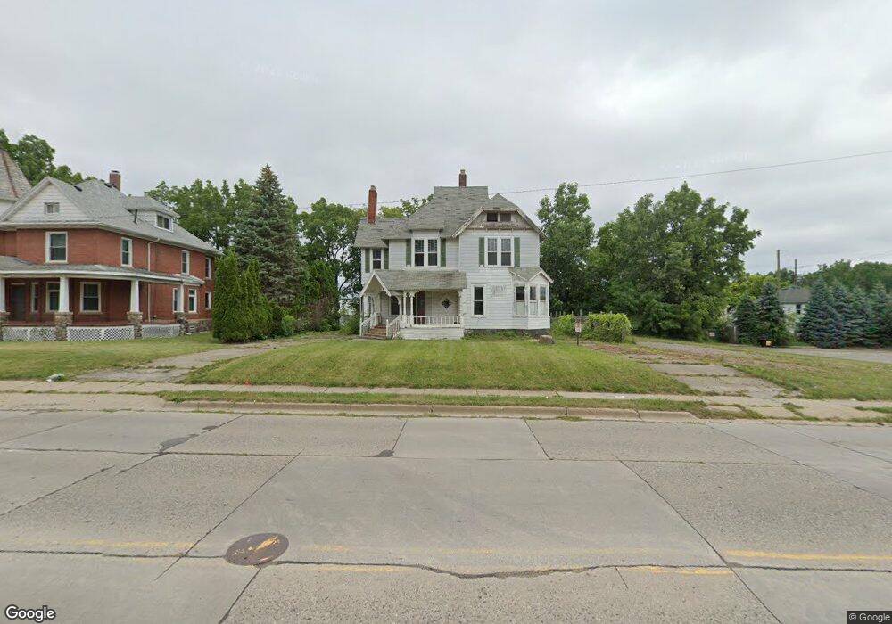
211 Auburn Ave Pontiac, MI 48342
Estimated Value: $126,000 - $238,000
5
Beds
3
Baths
3,483
Sq Ft
$56/Sq Ft
Est. Value
About This Home
This home is located at 211 Auburn Ave, Pontiac, MI 48342 and is currently estimated at $196,375, approximately $56 per square foot. 211 Auburn Ave is a home with nearby schools including Walt Whitman Elementary School, Pontiac Middle School, and Pontiac High School.
Ownership History
Date
Name
Owned For
Owner Type
Purchase Details
Closed on
Oct 5, 2022
Sold by
Sina Homes Llc
Bought by
Brown Billy W
Current Estimated Value
Purchase Details
Closed on
Feb 1, 2019
Sold by
Sina Fatjon
Bought by
Sina Homes Llc
Purchase Details
Closed on
Mar 10, 2015
Sold by
Harmon Eddie and Nc Servo Technology
Bought by
Kirk Eric L
Purchase Details
Closed on
Jun 23, 2014
Sold by
Kirk Brenda L
Bought by
Nc Servo Technology
Purchase Details
Closed on
May 20, 2013
Sold by
Kirk Eric L
Bought by
Kirk Brenda L
Purchase Details
Closed on
Aug 28, 2012
Sold by
Kirk Eric L
Bought by
Kirk Brenda L and Kirk Eric L
Create a Home Valuation Report for This Property
The Home Valuation Report is an in-depth analysis detailing your home's value as well as a comparison with similar homes in the area
Home Values in the Area
Average Home Value in this Area
Purchase History
| Date | Buyer | Sale Price | Title Company |
|---|---|---|---|
| Brown Billy W | $65,000 | -- | |
| Sina Homes Llc | -- | None Available | |
| Kirk Eric L | -- | None Available | |
| Nc Servo Technology | -- | None Available | |
| Kirk Brenda L | -- | None Available | |
| Kirk Brenda L | -- | None Available |
Source: Public Records
Tax History Compared to Growth
Tax History
| Year | Tax Paid | Tax Assessment Tax Assessment Total Assessment is a certain percentage of the fair market value that is determined by local assessors to be the total taxable value of land and additions on the property. | Land | Improvement |
|---|---|---|---|---|
| 2024 | $2,032 | $48,810 | $0 | $0 |
| 2023 | $2,389 | $43,460 | $0 | $0 |
| 2022 | $1,931 | $38,590 | $0 | $0 |
| 2021 | $1,873 | $35,980 | $0 | $0 |
| 2020 | $1,960 | $32,050 | $0 | $0 |
| 2019 | $1,660 | $28,540 | $0 | $0 |
| 2018 | $4,667 | $69,340 | $0 | $0 |
| 2017 | $3,878 | $69,460 | $0 | $0 |
| 2015 | -- | $69,200 | $0 | $0 |
| 2014 | -- | $67,700 | $0 | $0 |
| 2011 | -- | $92,660 | $0 | $0 |
Source: Public Records
Map
Nearby Homes
- 306 Whittemore St
- 18 S Shirley St
- 328 Whittemore St
- 59 Bellevue St
- 54 Bellevue St
- 0 Woodward Ave
- 55 N Roselawn St
- 57 N Roselawn St
- 33 S Tasmania St
- 70 N Roselawn St
- 240 S Shirley St
- 000 Wall St
- 97 N Roselawn St
- 397 S Jessie St
- 187 Wall St
- 176 S Francis Ave
- 505 Auburn Ave
- 511 E Pike St
- 0000 N Ardmore St
- 92 N Ardmore St
- 203 Auburn Ave
- 225 Auburn Ave
- 191 Auburn Ave
- 104 S Paddock St
- 100 S Paddock St
- 92 S Paddock St
- 90 S Paddock St
- 194 Auburn Ave
- 243 Auburn Ave
- 84 S Paddock St
- 101 S Paddock St
- 179 Auburn Ave
- 17 Perkins St
- 111 Parkhurst St
- 80 S Paddock St
- 207 E Judson St
- 178 Auburn Ave
- 103 Parkhurst St
- 211 E Judson St
- 97 S Paddock St