NOT LISTED FOR SALE

211 Brentwood St Bucyrus, OH 44820

Estimated Value: $262,000 - $368,000

0.31 Acre
$1,037,961 Price per Acre
13,569 Sq Ft Lot

Last Sold November 28, 2017

Last sale price $20,000

Est. 1,517% increase in value since last sale

Current estimated payment $2,069/month

46 Days on Market

About This Lot

As of November 2017

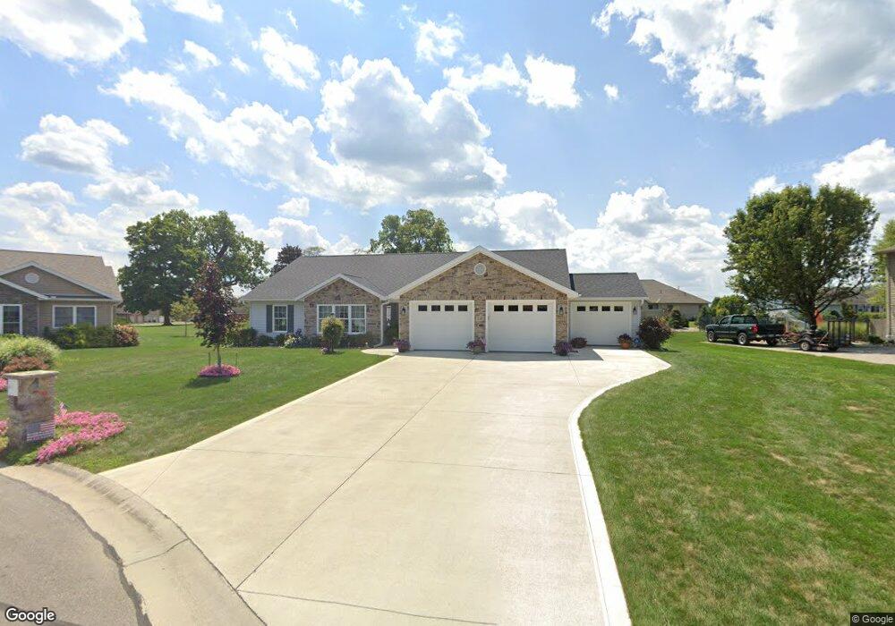
Sold at public auction on October 26, 2017. Build your dream home on this nice cul-de-sac lot with public utilities available. Sold as is.

Last Agent to Sell the Property

Craig Miley

Craig A. Miley Realty & Auction License #370294 Listed on: 09/13/2017

Last Buyer's Agent

Craig Miley

Craig A. Miley Realty & Auction License #370294 Listed on: 09/13/2017

Property Details

Property Type

  • Land

Est. Annual Taxes

  • $355

Lot Details

  • 0.31 Acre Lot
  • Cul-De-Sac
  • Level Lot
  • Open Lot
  • Irregular Lot

Location

  • City Lot

Listing and Financial Details

  • Assessor Parcel Number 80016197.034

Property Details

Property Type

Land

Est. Annual Taxes

$355

Lot Details

0

Listing Details

  • Property Sub Type: Unimproved Land
  • Prop. Type: Land
  • Lot Size Acres: 0.3115
  • Lot Size: 96.98 x 139.91
  • Directions: West on Southern, north on Rosewood then east on Brentwood.
  • Special Features: None

Interior Features

  • Possible Use: Residential

Exterior Features

  • Lot Features: Irregular Lot, Level, Cul-De-Sac, Curbs, Open Lot, City Lot
  • Topography: Level
  • Home Warranty: No

Utilities

  • Sewer: Other
  • Utilities: Water, Sewer - No taps paid
  • Water Source: Other

Schools

  • Junior High Dist: Bucyrus City School District

Lot Info

  • Land Lease: No
  • Lot Size Sq Ft: 13568.4718
  • Farm Land Area Units: Square Feet
  • Parcel #: 80016197.034
  • ResoLotSizeUnits: SquareFeet

Green Features

Multi Family

Tax Info

  • Tax Annual Amount: 354.84

Ownership History

Date Name Owned For Owner Type

Purchase Details

Closed on
Jun 21, 2018
Sold by
Rindfuss Matthew P
Bought by
Rindfuss Lindsey M
Current Estimated Value
$323,325
Source: Public Records

Range of Values:

--
Value Increase
--
Percent Increase
--
Adjusted for Inflation
Collateral Analytics

Collateral Analytics Collateral Analytics AVMs (Automated Valuation Model) employ a number of statistical approaches combined with neighborhood-specific comparable selection guarantees the most up-to-date and precise valuations.

Not Available

Collateral Analytics does not have data for the current month. Please view the chart for historical values.

ICE

ICE Mortgage Technology ICE Mortgage Technology’s AVM (Automated Valuation Model) is a state-of-the-art online residential property valuation tool that provides a quick and accurate estimate of the value of almost any home in the U.S.

Not Available

ICE Mortgage Technology does not have data for the current month. Please view the chart for historical values.

First American

First American First American Data & Analytics’ next-generation AVM combines unrivaled data assets with a blended ensemble of valuation models to produce highly accurate, reliable valuations you can trust.

Not Available

First American does not have data for the current month. Please view the chart for historical values.

Quantarium

Quantarium Quantarium’s valuation service, repeatedly proven the industry’s most accurate and comprehensive, is supercharged with a self-learning and auto-tuning AI engine that continually becomes smarter and more accurate as it processes daily inputs from the industry’s leading RE data lake.

Not Available

Quantarium does not have data for the current month. Please view the chart for historical values.

Average Value
Not Available
List Price
Sold Price
Create a Home Valuation Report for This Property
The Home Valuation Report is an in-depth analysis detailing your home's value as well as a comparison with similar homes in the area

Home Values in the Area

Source: Public Records

Average Home Value in this Area


Source: Public Records

Purchase History

Date Buyer Sale Price Title Company
Rindfuss Lindsey M -- None Available
Source: Public Records

Property History

Date Event Price List to Sale Price per Sq Ft
11/28/2017 11/28/17 Sold $20,000 0.0% --
10/29/2017 10/29/17 Pending -- -- --
09/13/2017 09/13/17 For Sale $20,000 -- --
Source: Mansfield Association of REALTORS®

Tax History Compared to Growth

Source: Public Records

Tax History

Year Tax Paid Tax Assessment Tax Assessment Total Assessment is a certain percentage of the fair market value that is determined by local assessors to be the total taxable value of land and additions on the property. Land Improvement
2024 $4,414 $97,840 $7,500 $90,340
2023 $4,414 $72,070 $6,180 $65,890
2022 $3,056 $57,280 $6,180 $51,100
2021 $3,049 $57,280 $6,180 $51,100
2020 $2,561 $45,600 $6,180 $39,420
2019 $2,618 $45,600 $6,180 $39,420
2018 $353 $6,180 $6,180 $0
2017 $366 $6,180 $6,180 $0
2016 $355 $6,180 $6,180 $0
2015 $350 $6,180 $6,180 $0
2014 $348 $6,180 $6,180 $0
2013 $348 $6,180 $6,180 $0
Source: Public Records

Agents Affiliated with this Home

  • Section Image
See All Agents

Map

Source: Mansfield Association of REALTORS®

MLS Number: 9038940

Mansfield Association of REALTORS®

APN: 08-0016197.034