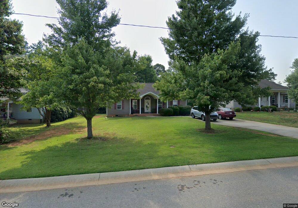
211 Briarcliff Rd Troutman, NC 28166
Estimated Value: $250,000 - $306,000
3
Beds
2
Baths
1,276
Sq Ft
$213/Sq Ft
Est. Value
About This Home
This home is located at 211 Briarcliff Rd, Troutman, NC 28166 and is currently estimated at $272,124, approximately $213 per square foot. 211 Briarcliff Rd is a home located in Iredell County with nearby schools including Troutman Elementary School, Troutman Middle School, and South Iredell High School.
Ownership History
Date
Name
Owned For
Owner Type
Purchase Details
Closed on
Dec 12, 2005
Sold by
Wesley Community Development Corp
Bought by
Bridges Shenita A
Current Estimated Value
Home Financials for this Owner
Home Financials are based on the most recent Mortgage that was taken out on this home.
Original Mortgage
$92,400
Outstanding Balance
$58,386
Interest Rate
6.1%
Mortgage Type
Purchase Money Mortgage
Estimated Equity
$213,738
Purchase Details
Closed on
Mar 1, 1986
Purchase Details
Closed on
Jun 1, 1981
Create a Home Valuation Report for This Property
The Home Valuation Report is an in-depth analysis detailing your home's value as well as a comparison with similar homes in the area
Home Values in the Area
Average Home Value in this Area
Purchase History
| Date | Buyer | Sale Price | Title Company |
|---|---|---|---|
| Bridges Shenita A | $121,000 | -- | |
| -- | -- | -- | |
| -- | -- | -- |
Source: Public Records
Mortgage History
| Date | Status | Borrower | Loan Amount |
|---|---|---|---|
| Open | Bridges Shenita A | $92,400 | |
| Closed | Bridges Shenita A | $20,000 |
Source: Public Records
Tax History Compared to Growth
Tax History
| Year | Tax Paid | Tax Assessment Tax Assessment Total Assessment is a certain percentage of the fair market value that is determined by local assessors to be the total taxable value of land and additions on the property. | Land | Improvement |
|---|---|---|---|---|
| 2025 | $2,803 | $249,350 | $45,000 | $204,350 |
| 2024 | $2,803 | $249,350 | $45,000 | $204,350 |
| 2023 | $2,803 | $249,350 | $45,000 | $204,350 |
| 2022 | $1,483 | $122,910 | $18,000 | $104,910 |
| 2021 | $1,466 | $122,910 | $18,000 | $104,910 |
| 2020 | $1,466 | $122,910 | $18,000 | $104,910 |
| 2019 | $1,436 | $122,910 | $18,000 | $104,910 |
| 2018 | $1,223 | $104,790 | $14,500 | $90,290 |
| 2017 | $1,223 | $104,790 | $14,500 | $90,290 |
| 2016 | $1,223 | $104,790 | $14,500 | $90,290 |
| 2015 | $1,171 | $104,790 | $14,500 | $90,290 |
| 2014 | $1,092 | $101,990 | $12,000 | $89,990 |
Source: Public Records
Map
Nearby Homes
- 126 Ari Ave
- 123 S Shayna Rd
- 109 Tradesmen Trail
- 124 N Shayna Rd
- 114 Tradesmen Trail
- Ashley Plan at Colonial Crossing
- Cary Plan at Colonial Crossing
- Birch Plan at Colonial Crossing
- Alamance Plan at Colonial Crossing
- Hartford Plan at Colonial Crossing
- Davidson Plan at Colonial Crossing
- Burton Plan at Colonial Crossing
- 125 Colonial Reserve Ave
- 103 Tanner Loop
- Azalea Plan at Brookside
- Clifton Plan at Brookside
- Arlington Plan at Brookside
- Bristol Plan at Brookside
- Claiborne Plan at Brookside
- 159 Tanner Loop
- 209 Briarcliff Rd
- 213 Briarcliff Rd
- 207 Briarcliff Rd
- 215 Briarcliff Rd
- 200 Briarcliff Rd
- 205 Briarcliff Rd
- 206 Briarcliff Rd
- 208 Briarcliff Rd
- 210 Briarcliff Rd
- 204 Briarcliff Rd
- 212 Briarcliff Rd
- 203 Briarcliff Dr
- 203 Briarcliff Rd
- 110 Barndale Rd
- 202 Briarcliff Rd
- Lot 8 Barndale Rd
- 0 Barndale Dr
- 26 Briarcliff Rd
- 102 Briarcliff Rd
- Lot 9 Barndale Rd