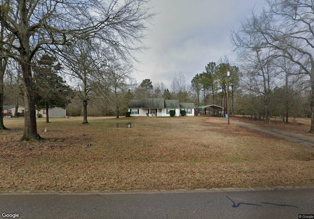
211 Brooks Rd Jackson, GA 30233
Southwest Butts NeighborhoodEstimated Value: $224,000 - $297,000
3
Beds
2
Baths
1,504
Sq Ft
$180/Sq Ft
Est. Value
About This Home
This home is located at 211 Brooks Rd, Jackson, GA 30233 and is currently estimated at $270,838, approximately $180 per square foot. 211 Brooks Rd is a home located in Butts County with nearby schools including Jackson High School.
Ownership History
Date
Name
Owned For
Owner Type
Purchase Details
Closed on
Aug 11, 2020
Sold by
Taylor Samuel James
Bought by
Kiser Mark
Current Estimated Value
Home Financials for this Owner
Home Financials are based on the most recent Mortgage that was taken out on this home.
Original Mortgage
$175,168
Outstanding Balance
$154,031
Interest Rate
2.9%
Mortgage Type
FHA
Estimated Equity
$116,807
Purchase Details
Closed on
Jan 3, 2020
Sold by
Taylor Christina B
Bought by
Taylor Samuel James
Purchase Details
Closed on
Dec 30, 2010
Sold by
The Bank Of New York Mello
Bought by
Taylor Christina B
Purchase Details
Closed on
Feb 3, 2005
Sold by
Poss Tammy
Bought by
Poss William Wayne
Create a Home Valuation Report for This Property
The Home Valuation Report is an in-depth analysis detailing your home's value as well as a comparison with similar homes in the area
Home Values in the Area
Average Home Value in this Area
Purchase History
| Date | Buyer | Sale Price | Title Company |
|---|---|---|---|
| Kiser Mark | $178,400 | -- | |
| Taylor Samuel James | $80,000 | -- | |
| Taylor Christina B | $56,000 | -- | |
| Poss William Wayne | -- | -- |
Source: Public Records
Mortgage History
| Date | Status | Borrower | Loan Amount |
|---|---|---|---|
| Open | Kiser Mark | $175,168 |
Source: Public Records
Tax History
| Year | Tax Paid | Tax Assessment Tax Assessment Total Assessment is a certain percentage of the fair market value that is determined by local assessors to be the total taxable value of land and additions on the property. | Land | Improvement |
|---|---|---|---|---|
| 2025 | $2,440 | $108,343 | $13,984 | $94,359 |
| 2024 | $2,440 | $108,343 | $13,984 | $94,359 |
| 2023 | $2,566 | $97,180 | $10,944 | $86,236 |
| 2022 | $1,904 | $72,163 | $10,944 | $61,219 |
| 2021 | $2,073 | $71,360 | $10,881 | $60,479 |
| 2020 | $1,803 | $59,770 | $10,944 | $48,826 |
| 2019 | $1,423 | $48,788 | $10,944 | $37,844 |
| 2018 | $1,315 | $43,204 | $10,944 | $32,260 |
| 2017 | $1,369 | $44,200 | $10,944 | $33,256 |
| 2016 | $1,364 | $42,921 | $10,944 | $31,977 |
| 2015 | $1,356 | $42,921 | $10,944 | $31,977 |
| 2014 | $1,362 | $40,814 | $10,944 | $29,870 |
Source: Public Records
Map
Nearby Homes
- 245 Brooks Rd
- 3036 High Falls Rd
- 142 Post Oak Dr
- 142 Post Oak Dr Unit 136
- 144 Post Oak Dr
- 144 Post Oak Dr Unit 137
- 146 Post Oak Dr Unit 138
- 146 Post Oak Dr
- 148 Post Oak Dr Unit 139
- 148 Post Oak Dr
- 132 Post Oak Dr Unit 131
- 131 Post Oak Dr Unit 209
- 135 Post Oak Dr Unit 207
- 139 Post Oak Dr Unit 202
- 135 Post Oak Dr
- 139 Post Oak Dr
- 130 Post Oak Dr
- Hemingway Plan at The Woodlands Preserve
- Mira II Plan at The Woodlands Preserve
- Walker Plan at The Woodlands Preserve
- 207 Brooks Rd
- 225 Brooks Rd
- 199 Brooks Rd
- 215 Brooks Rd Unit TANE
- 215 Brooks Rd Unit 6
- 231 Brooks Rd
- 182 Brooks Rd
- 234 Brooks Rd
- 179 Brooks Rd
- 168 Brooks Rd
- 274 Brooks Rd
- 265 Brooks Rd
- 291 Brooks Rd
- 298 Brooks Rd
- 171 Tom Goddard Rd
- 316 Brooks Rd Unit A
- 316B Brooks Rd
- 316 Brooks Rd
- 316 Brooks Rd Unit A
- 310 Brooks Rd
