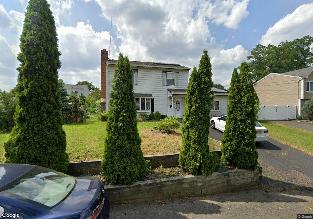
211 Brookside Ave South Amboy, NJ 08879
Estimated Value: $510,243 - $593,000
4
Beds
2
Baths
1,764
Sq Ft
$313/Sq Ft
Est. Value
About This Home
This home is located at 211 Brookside Ave, South Amboy, NJ 08879 and is currently estimated at $551,561, approximately $312 per square foot. 211 Brookside Ave is a home located in Middlesex County with nearby schools including Old Bridge High School, St. Joseph Elementary School, and Matawan Montessori Academy.
Ownership History
Date
Name
Owned For
Owner Type
Purchase Details
Closed on
Jan 29, 2010
Sold by
Melo Dinarte and Melo Nadith
Bought by
Kotowski Slawomir
Current Estimated Value
Home Financials for this Owner
Home Financials are based on the most recent Mortgage that was taken out on this home.
Original Mortgage
$253,817
Outstanding Balance
$169,823
Interest Rate
5.25%
Mortgage Type
FHA
Estimated Equity
$381,738
Purchase Details
Closed on
Oct 2, 2003
Sold by
211 Brookside Land Trust
Bought by
Melo Dinarte and Melo Nadith
Home Financials for this Owner
Home Financials are based on the most recent Mortgage that was taken out on this home.
Original Mortgage
$184,000
Interest Rate
5.82%
Create a Home Valuation Report for This Property
The Home Valuation Report is an in-depth analysis detailing your home's value as well as a comparison with similar homes in the area
Home Values in the Area
Average Home Value in this Area
Purchase History
| Date | Buyer | Sale Price | Title Company |
|---|---|---|---|
| Kotowski Slawomir | $258,500 | Lawyers Title Insurance Corp | |
| Melo Dinarte | $240,000 | -- |
Source: Public Records
Mortgage History
| Date | Status | Borrower | Loan Amount |
|---|---|---|---|
| Open | Kotowski Slawomir | $253,817 | |
| Previous Owner | Melo Dinarte | $184,000 |
Source: Public Records
Tax History Compared to Growth
Tax History
| Year | Tax Paid | Tax Assessment Tax Assessment Total Assessment is a certain percentage of the fair market value that is determined by local assessors to be the total taxable value of land and additions on the property. | Land | Improvement |
|---|---|---|---|---|
| 2025 | $7,820 | $136,500 | $45,000 | $91,500 |
| 2024 | $7,499 | $136,500 | $45,000 | $91,500 |
| 2023 | $7,499 | $136,500 | $45,000 | $91,500 |
| 2022 | $7,297 | $136,500 | $45,000 | $91,500 |
| 2021 | $5,350 | $136,500 | $45,000 | $91,500 |
| 2020 | $7,076 | $136,500 | $45,000 | $91,500 |
| 2019 | $6,963 | $136,500 | $45,000 | $91,500 |
| 2018 | $6,885 | $136,500 | $45,000 | $91,500 |
| 2017 | $6,671 | $136,500 | $45,000 | $91,500 |
| 2016 | $6,538 | $136,500 | $45,000 | $91,500 |
| 2015 | $6,424 | $136,500 | $45,000 | $91,500 |
| 2014 | $6,346 | $136,500 | $45,000 | $91,500 |
Source: Public Records
Map
Nearby Homes
- 250 Brookside Ave
- 281 Prospect Ave
- 274 Prospect Ave
- 146 Orchard Ave
- 438 Brookside Ave
- 169 Norwood Ave
- 198 Hillcrest Ave
- 696 Grove Ave
- 269 Garfield Ave
- 622 Forrest Ave
- 235 Garfield Ave
- 310 Woodland Ave
- 763 Prospect Ave
- 301 Shoreland Cir
- 21 Lantana Way
- 107 Boulevard W
- 106 Boulevard W
- 809 Summerfield Ave
- 429 Lea Ave
- 270 Greenwood Dr
- 214 Brookside Ave
- 191 Orchard Ave
- 190 Orchard Ave
- 192 Orchard Ave
- 208 Brookside Ave
- 188 Orchard Ave
- 216 Brookside Ave
- 186 Orchard Ave
- 205 Brookside Ave
- 255 Brookside Ave
- 185 Orchard Ave
- 252 Brookside Ave
- 257 Brookside Ave
- 196 Orchard Ave
- 259 Brookside Ave
- 198 Orchard Ave
- 220 Brookside Ave
- 183 Orchard Ave
- 247 Brookside Ave
- 201 Brookside Ave