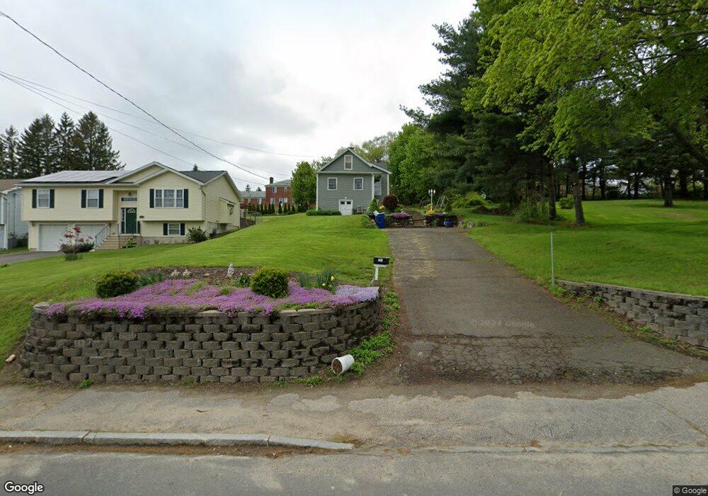
211 Bucks Hill Rd Waterbury, CT 06704
Bucks Hill NeighborhoodEstimated Value: $260,000 - $334,000
3
Beds
2
Baths
1,168
Sq Ft
$255/Sq Ft
Est. Value
About This Home
This home is located at 211 Bucks Hill Rd, Waterbury, CT 06704 and is currently estimated at $297,690, approximately $254 per square foot. 211 Bucks Hill Rd is a home located in New Haven County with nearby schools including Bucks Hill Elementary School, North End Middle School, and Wilby High School.
Ownership History
Date
Name
Owned For
Owner Type
Purchase Details
Closed on
Feb 15, 2011
Sold by
Doner Joseph J
Bought by
Doner Mary L
Current Estimated Value
Purchase Details
Closed on
Nov 1, 1983
Bought by
Doner Mary L
Create a Home Valuation Report for This Property
The Home Valuation Report is an in-depth analysis detailing your home's value as well as a comparison with similar homes in the area
Home Values in the Area
Average Home Value in this Area
Purchase History
| Date | Buyer | Sale Price | Title Company |
|---|---|---|---|
| Doner Mary L | -- | -- | |
| Doner Mary L | $39,000 | -- |
Source: Public Records
Mortgage History
| Date | Status | Borrower | Loan Amount |
|---|---|---|---|
| Open | Doner Mary L | $59,550 | |
| Previous Owner | Doner Mary L | $70,000 | |
| Previous Owner | Doner Mary L | $75,500 |
Source: Public Records
Tax History Compared to Growth
Tax History
| Year | Tax Paid | Tax Assessment Tax Assessment Total Assessment is a certain percentage of the fair market value that is determined by local assessors to be the total taxable value of land and additions on the property. | Land | Improvement |
|---|---|---|---|---|
| 2025 | $3,958 | $87,990 | $23,030 | $64,960 |
| 2024 | $4,350 | $87,990 | $23,030 | $64,960 |
| 2023 | $4,768 | $87,990 | $23,030 | $64,960 |
| 2022 | $3,762 | $62,480 | $23,030 | $39,450 |
| 2021 | $3,762 | $62,480 | $23,030 | $39,450 |
| 2020 | $3,762 | $62,480 | $23,030 | $39,450 |
| 2019 | $3,762 | $62,480 | $23,030 | $39,450 |
| 2018 | $3,762 | $62,480 | $23,030 | $39,450 |
| 2017 | $4,404 | $73,150 | $23,020 | $50,130 |
| 2016 | $3,595 | $59,710 | $23,020 | $36,690 |
| 2015 | $3,476 | $59,710 | $23,020 | $36,690 |
| 2014 | $3,476 | $59,710 | $23,020 | $36,690 |
Source: Public Records
Map
Nearby Homes
- 64 Deerwood Ln Unit 10
- 64 Deerwood Ln Unit 2
- 119 Lincolndale Dr
- 45 Fieldstream Dr
- 8 Hayfield Rd
- 0 Goff St
- 36 Randall Place
- 0 Montoe Rd
- 245 Montoe Rd
- 20 Society Hill Rd
- 79 Fieldstone Rd
- 474 Chestnut Hill Ave
- 241 Judith Ln Unit 2
- 440 Chestnut Hill Ave
- 15 Yorktown Ridge Unit Lot 2
- 189 Fieldwood Rd
- 16 Kingsley Ct Unit Lot 9
- 00 Halperin Ct
- 24 Holiday Hill
- 123 Chipper Rd
- 207 Bucks Hill Rd
- 214 Bucks Hill Rd
- 218 Bucks Hill Rd
- 208 Bucks Hill Rd
- 201 Bucks Hill Rd
- 226 Bucks Hill Rd
- 200 Bucks Hill Rd
- 229 Bucks Hill Rd
- 195 Bucks Hill Rd
- 230 Bucks Hill Rd
- 192 Bucks Hill Rd
- 239 Bucks Hill Rd
- 189 Bucks Hill Rd
- 240 Bucks Hill Rd
- 186 Bucks Hill Rd
- 181 Bucks Hill Rd
- 246 Bucks Hill Rd
- 247 Bucks Hill Rd
- 180 Bucks Hill Rd
- 252 Bucks Hill Rd