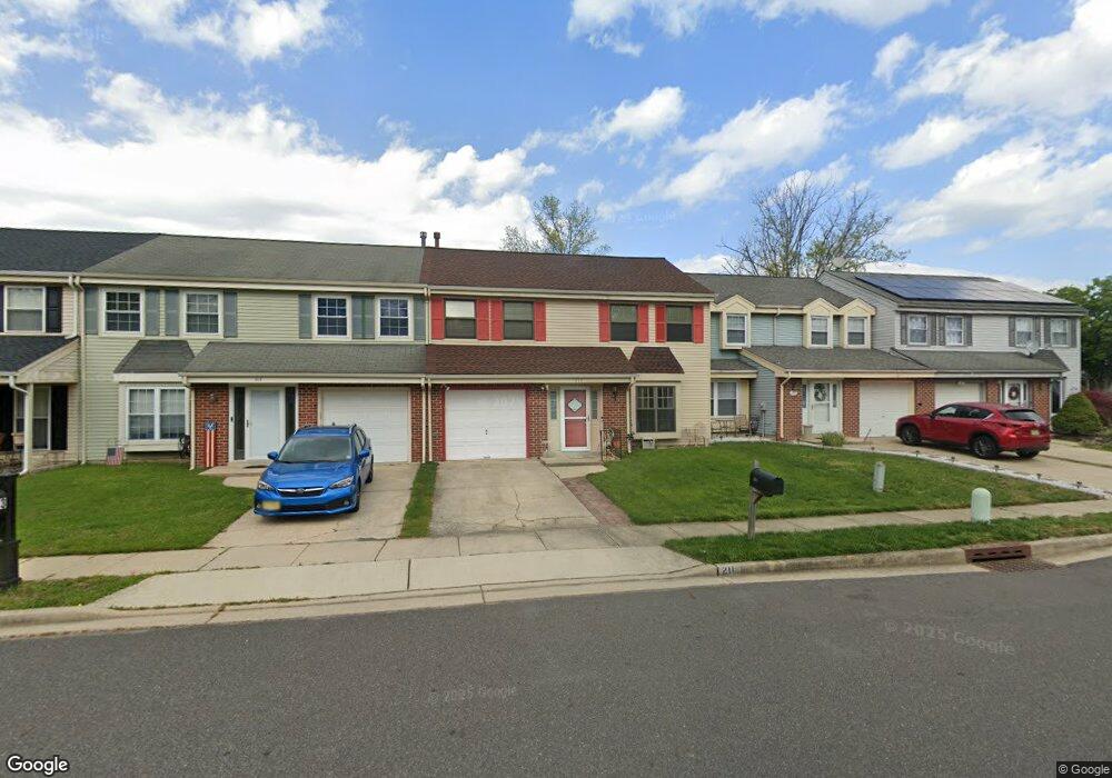
211 Burnamwood Dr Mount Laurel, NJ 08054
Estimated Value: $378,000 - $400,000
3
Beds
3
Baths
1,816
Sq Ft
$213/Sq Ft
Est. Value
About This Home
This home is located at 211 Burnamwood Dr, Mount Laurel, NJ 08054 and is currently estimated at $386,622, approximately $212 per square foot. 211 Burnamwood Dr is a home located in Burlington County with nearby schools including Larchmont Elementary School, Mount Laurel Hartford School, and T.E. Harrington Middle School.
Ownership History
Date
Name
Owned For
Owner Type
Purchase Details
Closed on
Mar 14, 2003
Sold by
Kracun Anica and Gies Jeffrey B
Bought by
Britton Dawn E
Current Estimated Value
Home Financials for this Owner
Home Financials are based on the most recent Mortgage that was taken out on this home.
Original Mortgage
$152,250
Outstanding Balance
$65,595
Interest Rate
5.91%
Mortgage Type
Purchase Money Mortgage
Estimated Equity
$321,027
Purchase Details
Closed on
Aug 23, 1999
Sold by
Cancelliere Angela G and Cancelliere Judith M
Bought by
Kracun Anica and Kracun Nadica
Home Financials for this Owner
Home Financials are based on the most recent Mortgage that was taken out on this home.
Original Mortgage
$124,969
Interest Rate
7.65%
Mortgage Type
FHA
Create a Home Valuation Report for This Property
The Home Valuation Report is an in-depth analysis detailing your home's value as well as a comparison with similar homes in the area
Home Values in the Area
Average Home Value in this Area
Purchase History
| Date | Buyer | Sale Price | Title Company |
|---|---|---|---|
| Britton Dawn E | $165,000 | Congress Title Corp | |
| Kracun Anica | $126,000 | -- |
Source: Public Records
Mortgage History
| Date | Status | Borrower | Loan Amount |
|---|---|---|---|
| Open | Britton Dawn E | $152,250 | |
| Previous Owner | Kracun Anica | $124,969 |
Source: Public Records
Tax History Compared to Growth
Tax History
| Year | Tax Paid | Tax Assessment Tax Assessment Total Assessment is a certain percentage of the fair market value that is determined by local assessors to be the total taxable value of land and additions on the property. | Land | Improvement |
|---|---|---|---|---|
| 2025 | $5,635 | $178,500 | $53,500 | $125,000 |
| 2024 | $5,423 | $178,500 | $53,500 | $125,000 |
| 2023 | $5,423 | $178,500 | $53,500 | $125,000 |
| 2022 | $5,405 | $178,500 | $53,500 | $125,000 |
| 2021 | $5,303 | $178,500 | $53,500 | $125,000 |
| 2020 | $5,200 | $178,500 | $53,500 | $125,000 |
| 2019 | $5,146 | $178,500 | $53,500 | $125,000 |
| 2018 | $5,107 | $178,500 | $53,500 | $125,000 |
| 2017 | $4,975 | $178,500 | $53,500 | $125,000 |
| 2016 | $4,900 | $178,500 | $53,500 | $125,000 |
| 2015 | $4,843 | $178,500 | $53,500 | $125,000 |
| 2014 | $4,795 | $178,500 | $53,500 | $125,000 |
Source: Public Records
Map
Nearby Homes
- 438B Willow Turn
- 540A Willow Turn Unit A
- 358B Willow Turn Unit 358B
- 21 Whitechapel Dr
- 220 Hartford Rd
- 36 Whitechapel Dr
- 130 Banwell Ln
- 143 Banwell Ln
- 121A Arden Ct
- 115 Banwell Ln
- 210 Stratton Ct
- 216 Martins Way Unit 216
- 161A Bradford Ct Unit 161
- 5214C Aberdeen Dr Unit C
- 5 Hampton Ct
- 5116C Aberdeen Dr
- 0 Hartford Rd
- 4610B Aberdeen Dr Unit 4610
- 208B Sedgefield Dr Unit 208B
- 106B Sedgefield Dr Unit 106
- 209 Burnamwood Dr
- 213 Burnamwood Dr
- 215 Burnamwood Dr
- 207 Burnam Wood Dr
- 207 Burnamwood Dr
- 205 Burnamwood Dr
- 217 Burnamwood Dr
- 203 Burnamwood Dr
- 218 Burnamwood Dr
- 219 Burnamwood Dr
- 201 Burnamwood Dr
- 220 Burnamwood Dr
- 216 Burnamwood Dr
- 221 Burnam Wood Dr
- 216 Burnam Wood Dr
- 221 Burnamwood Dr
- 214 Burnam Wood Dr
- 222 Burnamwood Dr
- 208 Burnam Wood Dr
- 212 Burnamwood Dr