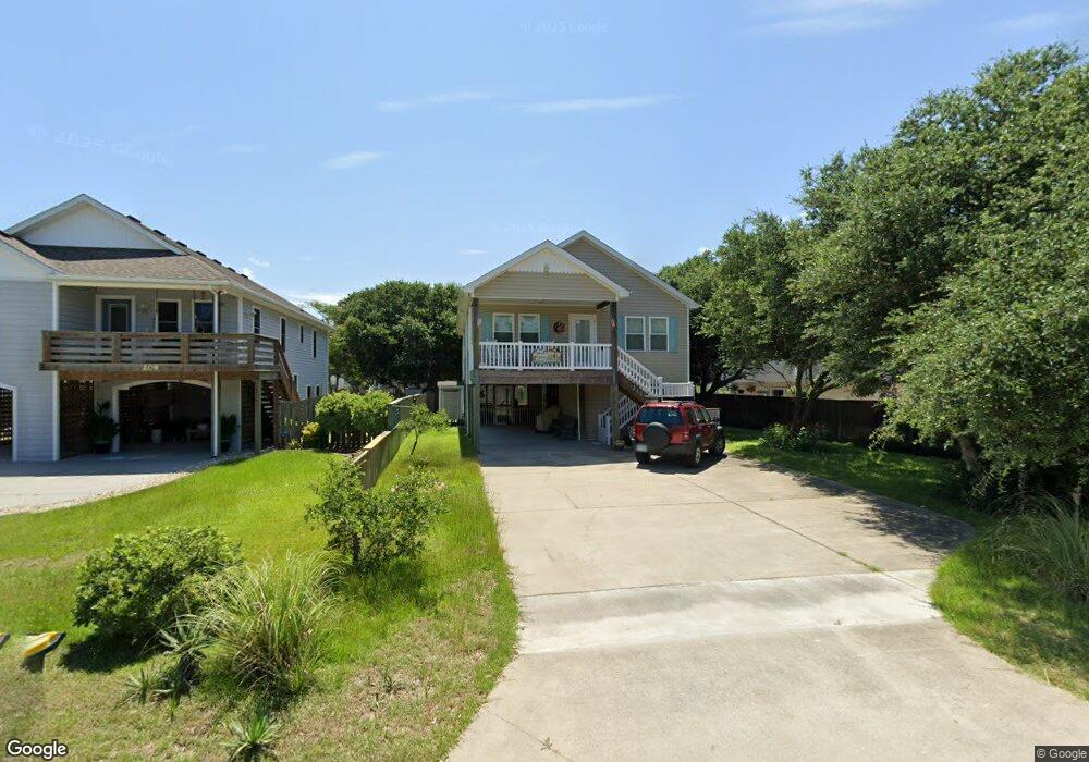
211 Burns Dr Unit 11 Kill Devil Hills, NC 27948
Estimated Value: $482,660 - $533,000
3
Beds
2
Baths
1,408
Sq Ft
$368/Sq Ft
Est. Value
About This Home
This home is located at 211 Burns Dr Unit 11, Kill Devil Hills, NC 27948 and is currently estimated at $517,665, approximately $367 per square foot. 211 Burns Dr Unit 11 is a home located in Dare County with nearby schools including Nags Head Elementary School, Manteo Middle School, and Manteo High School.
Ownership History
Date
Name
Owned For
Owner Type
Purchase Details
Closed on
Jul 29, 2011
Sold by
R & P Investments Llc
Bought by
Novak William J and Novak Joyce A
Current Estimated Value
Home Financials for this Owner
Home Financials are based on the most recent Mortgage that was taken out on this home.
Original Mortgage
$191,920
Outstanding Balance
$132,160
Interest Rate
4.53%
Mortgage Type
New Conventional
Estimated Equity
$385,505
Purchase Details
Closed on
Dec 17, 2010
Sold by
Webster Sterling and Webster Elizabeth J
Bought by
R & P Investments Llc
Create a Home Valuation Report for This Property
The Home Valuation Report is an in-depth analysis detailing your home's value as well as a comparison with similar homes in the area
Home Values in the Area
Average Home Value in this Area
Purchase History
| Date | Buyer | Sale Price | Title Company |
|---|---|---|---|
| Novak William J | $240,000 | None Available | |
| R & P Investments Llc | $70,000 | None Available |
Source: Public Records
Mortgage History
| Date | Status | Borrower | Loan Amount |
|---|---|---|---|
| Open | Novak William J | $191,920 |
Source: Public Records
Tax History
| Year | Tax Paid | Tax Assessment Tax Assessment Total Assessment is a certain percentage of the fair market value that is determined by local assessors to be the total taxable value of land and additions on the property. | Land | Improvement |
|---|---|---|---|---|
| 2025 | $2,650 | $487,900 | $157,500 | $330,400 |
| 2024 | $2,417 | $319,900 | $87,500 | $232,400 |
| 2023 | $1,281 | $319,900 | $87,500 | $232,400 |
| 2022 | $2,305 | $319,900 | $87,500 | $232,400 |
| 2021 | $1,152 | $319,900 | $87,500 | $232,400 |
| 2020 | $2,305 | $319,900 | $87,500 | $232,400 |
| 2019 | $1,877 | $215,800 | $60,600 | $155,200 |
| 2018 | $1,836 | $215,800 | $60,600 | $155,200 |
| 2017 | $1,836 | $215,800 | $60,600 | $155,200 |
| 2016 | $1,750 | $215,800 | $60,600 | $155,200 |
| 2014 | $1,685 | $215,800 | $60,600 | $155,200 |
Source: Public Records
Map
Nearby Homes
- 311 Gunas Dr Unit 17
- 311 Gunas Dr
- 1511 Wrightsville Blvd Unit Lot 64
- 209 E Lake Dr Unit Lot18
- 205 W Atlantic St Unit Lot 3
- 1308 Theodore St Unit 5
- 111 Carolyn Dr Unit E
- 1306 Theodore St Unit Lot 4
- 1208 Swan St Unit 4
- 1208 Swan St Unit 2
- 1208 Swan St Unit 5
- 1208 Swan St Unit 1
- 1208 -2 Swan St Unit 2
- 1208 -1 Swan St Unit 1
- 209 E Fresh Pond Dr Unit Lot 10
- 2010 S Virginia Dare Trail Unit 104
- 0 W Boundary St Unit Lot 1-R 130568
- 2009 Wrightsville Blvd Unit 1-B
- 2009 Wrightsville Blvd Unit 3A
- 2009 Wrightsville Blvd Unit 4-B
- 209 Burns Dr
- 213 Burns Dr
- 207 Burns Dr Unit 7
- 215 Burns Dr
- 208 W Ocean Acres Dr
- 210 W Ocean Acres Dr Unit 12
- 210 W Ocean Acres Dr
- 206 W Ocean Acres Dr
- 212 W Ocean Acres Dr Unit 14
- 212 W Ocean Acres Dr
- 205 Burns Dr
- 212 Burns Dr
- 214 Burns Dr Unit 1/lot 8
- 214 Burns Dr
- 204 W Ocean Acres Dr
- 216 Burns Dr
- 210 Burns Dr Unit 6
- 217 Burns Dr
- 203 Burns Dr
- 208 Burns Dr Unit 1/lot5
Your Personal Tour Guide
Ask me questions while you tour the home.