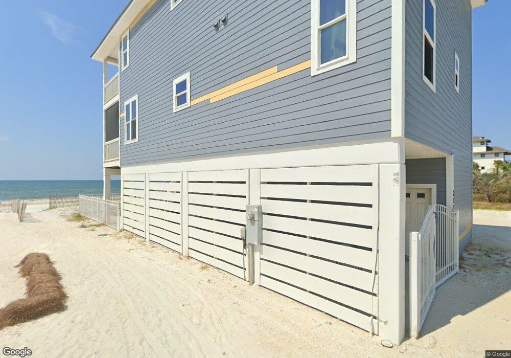
211 Catamaran Dr Port Saint Joe, FL 32456
North Cape San Blas NeighborhoodEstimated Value: $1,480,653 - $1,746,000
5
Beds
5
Baths
2,729
Sq Ft
$583/Sq Ft
Est. Value
About This Home
This home is located at 211 Catamaran Dr, Port Saint Joe, FL 32456 and is currently estimated at $1,590,413, approximately $582 per square foot. 211 Catamaran Dr is a home.
Ownership History
Date
Name
Owned For
Owner Type
Purchase Details
Closed on
Mar 17, 2014
Sold by
Cahill Laurie L
Bought by
Blake Beach Rental Llc
Current Estimated Value
Purchase Details
Closed on
Sep 5, 2012
Sold by
Mcgowin William T
Bought by
Cahill Laurie L
Purchase Details
Closed on
Apr 2, 2008
Sold by
Francone Laura L
Bought by
Russell Jeannie M
Purchase Details
Closed on
Feb 24, 2004
Sold by
Palmer Roger and Palmer Kelle
Bought by
Moore Pat G
Home Financials for this Owner
Home Financials are based on the most recent Mortgage that was taken out on this home.
Original Mortgage
$140,000
Interest Rate
7%
Mortgage Type
Seller Take Back
Purchase Details
Closed on
Nov 1, 2002
Sold by
Mackay Properties Inc
Bought by
Lemmond Donna D
Home Financials for this Owner
Home Financials are based on the most recent Mortgage that was taken out on this home.
Original Mortgage
$620,000
Interest Rate
5.93%
Mortgage Type
Balloon
Create a Home Valuation Report for This Property
The Home Valuation Report is an in-depth analysis detailing your home's value as well as a comparison with similar homes in the area
Home Values in the Area
Average Home Value in this Area
Purchase History
| Date | Buyer | Sale Price | Title Company |
|---|---|---|---|
| Blake Beach Rental Llc | $215,000 | Attorney | |
| Cahill Laurie L | $190,000 | Attorney | |
| Russell Jeannie M | -- | Attorney | |
| Moore Pat G | $160,000 | -- | |
| Lemmond Donna D | -- | Security First Title Partner |
Source: Public Records
Mortgage History
| Date | Status | Borrower | Loan Amount |
|---|---|---|---|
| Previous Owner | Moore Pat G | $140,000 | |
| Previous Owner | Lemmond Donna D | $620,000 |
Source: Public Records
Tax History Compared to Growth
Tax History
| Year | Tax Paid | Tax Assessment Tax Assessment Total Assessment is a certain percentage of the fair market value that is determined by local assessors to be the total taxable value of land and additions on the property. | Land | Improvement |
|---|---|---|---|---|
| 2024 | $13,939 | $1,419,705 | $690,000 | $729,705 |
| 2023 | $12,752 | $827,314 | $0 | $0 |
| 2022 | $12,772 | $1,186,070 | $506,000 | $680,070 |
| 2021 | $10,277 | $754,178 | $340,400 | $413,778 |
| 2020 | $9,875 | $717,749 | $297,500 | $420,249 |
| 2019 | $8,604 | $565,067 | $297,500 | $267,567 |
| 2018 | $10,226 | $702,756 | $0 | $0 |
| 2017 | $9,488 | $656,011 | $0 | $0 |
| 2016 | $8,679 | $553,317 | $0 | $0 |
| 2015 | $3,048 | $200,000 | $0 | $0 |
| 2014 | $2,515 | $175,000 | $0 | $0 |
Source: Public Records
Map
Nearby Homes
- LOT 2A-1 Catamaran Dr
- 178 Sea Dunes Dr
- 224 Seahorse Ln
- 219 Haven Rd
- 224 Haven Rd
- 219B Haven Rd
- 0 Haven Rd Unit 774136
- Lot 3 Haven Rd
- Lot 5 Haven Rd
- 301 Haven Rd
- 166 Cozumel Dr
- 337 Haven Rd
- 107 Barbados Dr
- 222 Seagrass Cir
- 101 Barbados Dr
- Lot 4 Barbados Dr
- 172 Aruba Dr
- 168 Aruba Dr
- 120 Aruba Dr
- 229 Seagrass Cir
- 5291 Clipper Way
- 191 Catamaran Dr
- 111 Beach To Bay Dr
- 5267 Clipper Way
- 5231 Clipper Way
- 109 Bay To Beach Dr
- 109 Beach To Bay Dr
- 5209 Clipper Way
- 5230 Clipper Way Unit Lot 11
- 5230 Clipper Way
- 108 Clearwater Dr
- 0 Clipper Way Unit 6508
- 5263 Clipper Way
- 5263 Clipper Way Unit Lot 2
- 5290 Clipper Way
- 0 Clipper Way Unit Tba
- 168 Sea Dunes Dr
- 174 Catamaran Dr
- 110 Beach To Bay Dr Unit Lot 6
- 140 Catamaran Dr