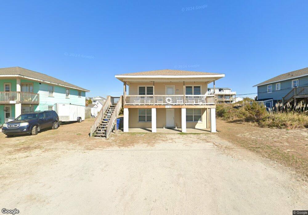
211 Club Colony Dr Unit B Atlantic Beach, NC 28512
Estimated Value: $992,000 - $1,275,000
2
Beds
1
Bath
900
Sq Ft
$1,269/Sq Ft
Est. Value
About This Home
This home is located at 211 Club Colony Dr Unit B, Atlantic Beach, NC 28512 and is currently estimated at $1,142,429, approximately $1,269 per square foot. 211 Club Colony Dr Unit B is a home located in Carteret County with nearby schools including Morehead City Primary School, Morehead Elementary School at Camp Glenn, and Morehead City Middle School.
Ownership History
Date
Name
Owned For
Owner Type
Purchase Details
Closed on
Feb 29, 2024
Sold by
Biggs William Wood
Bought by
Robertson Barry Ford and Mcconnell Stephenson Harriet
Current Estimated Value
Home Financials for this Owner
Home Financials are based on the most recent Mortgage that was taken out on this home.
Original Mortgage
$753,750
Outstanding Balance
$740,628
Interest Rate
6.69%
Mortgage Type
New Conventional
Estimated Equity
$401,801
Create a Home Valuation Report for This Property
The Home Valuation Report is an in-depth analysis detailing your home's value as well as a comparison with similar homes in the area
Home Values in the Area
Average Home Value in this Area
Purchase History
| Date | Buyer | Sale Price | Title Company |
|---|---|---|---|
| Robertson Barry Ford | $1,155,000 | None Listed On Document | |
| Robertson Barry Ford | $1,155,000 | None Listed On Document |
Source: Public Records
Mortgage History
| Date | Status | Borrower | Loan Amount |
|---|---|---|---|
| Open | Robertson Barry Ford | $753,750 | |
| Closed | Robertson Barry Ford | $753,750 |
Source: Public Records
Tax History Compared to Growth
Tax History
| Year | Tax Paid | Tax Assessment Tax Assessment Total Assessment is a certain percentage of the fair market value that is determined by local assessors to be the total taxable value of land and additions on the property. | Land | Improvement |
|---|---|---|---|---|
| 2025 | $2,752 | $1,179,413 | $497,500 | $681,913 |
| 2024 | $1,624 | $448,753 | $310,500 | $138,253 |
| 2023 | $1,541 | $448,753 | $310,500 | $138,253 |
| 2022 | $1,496 | $448,753 | $310,500 | $138,253 |
| 2021 | $1,496 | $448,753 | $310,500 | $138,253 |
| 2020 | $1,496 | $448,753 | $310,500 | $138,253 |
| 2019 | $1,574 | $502,874 | $381,570 | $121,304 |
| 2017 | $1,574 | $502,874 | $381,570 | $121,304 |
| 2016 | $1,574 | $502,874 | $381,570 | $121,304 |
| 2015 | $1,524 | $502,874 | $381,570 | $121,304 |
| 2014 | $1,134 | $373,045 | $262,320 | $110,725 |
Source: Public Records
Map
Nearby Homes
- 106 Willis Ave Unit A
- 1100 E Fort MacOn Rd Unit A
- 100 Dunes Ave Unit A
- 1116 E Fort MacOn Rd
- 102 Freeman Ln
- 9 E Fort MacOn Rd
- 115 Island Quay Dr
- 408 Caswell St Unit B
- 105 Winston Ave Unit A&B
- 303 Henderson Blvd Unit 14
- 301 Henderson Blvd Unit 24
- 205 Barefoot Ln
- 300 Ocean Boulevard Extension Unit B
- 301 Commerce Way Unit 252
- 301 Commerce Way Unit 360
- 301 Commerce Way Unit 260
- 301 Commerce Way Unit 117
- 301 Commerce Way Unit 104
- 301 Commerce Way Unit 258
- 301 Commerce Way Unit 142
- 211 Club Colony Dr
- 211 Club Colony Dr Unit A
- 209 Club Colony Dr
- 213 Club Colony Dr
- 207 Club Colony Dr
- 215 Club Colony Dr
- 112 Robin Ave Unit B
- 112 Robin Ave Unit A
- 205 Club Colony Dr
- 210 Club Colony Dr
- 217 Club Colony Dr
- 214 Club Colony Dr
- 114 Robin Ave Unit B
- 114 Robin Ave Unit C
- 114 Robin Ave Unit A
- 110 Robin Ave Unit A
- 208 Club Colony Dr
- 212 Club Colony Dr
- 216 Club Colony Dr
- 206 Club Colony Dr