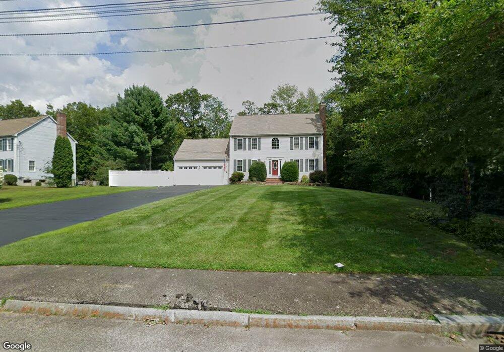
211 Colonial Rd North Attleboro, MA 02760
North Attleboro NeighborhoodEstimated Value: $700,098 - $868,000
3
Beds
3
Baths
1,829
Sq Ft
$414/Sq Ft
Est. Value
About This Home
This home is located at 211 Colonial Rd, North Attleboro, MA 02760 and is currently estimated at $757,275, approximately $414 per square foot. 211 Colonial Rd is a home located in Bristol County with nearby schools including North Attleboro High School and St John The Evangelist School.
Ownership History
Date
Name
Owned For
Owner Type
Purchase Details
Closed on
May 23, 1997
Sold by
Whatmough Corp
Bought by
Dimare Christopher and Dimare Karen Lee
Current Estimated Value
Purchase Details
Closed on
Apr 10, 1997
Sold by
Whatmough Corp
Bought by
First Trade Union Bk
Purchase Details
Closed on
May 17, 1995
Sold by
Renee Cohen T
Bought by
Whatmough Corp
Create a Home Valuation Report for This Property
The Home Valuation Report is an in-depth analysis detailing your home's value as well as a comparison with similar homes in the area
Home Values in the Area
Average Home Value in this Area
Purchase History
| Date | Buyer | Sale Price | Title Company |
|---|---|---|---|
| Dimare Christopher | $215,000 | -- | |
| First Trade Union Bk | $148,000 | -- | |
| Whatmough Corp | $51,000 | -- |
Source: Public Records
Mortgage History
| Date | Status | Borrower | Loan Amount |
|---|---|---|---|
| Open | Whatmough Corp | $233,200 | |
| Closed | Whatmough Corp | $30,000 |
Source: Public Records
Tax History Compared to Growth
Tax History
| Year | Tax Paid | Tax Assessment Tax Assessment Total Assessment is a certain percentage of the fair market value that is determined by local assessors to be the total taxable value of land and additions on the property. | Land | Improvement |
|---|---|---|---|---|
| 2025 | $7,069 | $599,600 | $134,700 | $464,900 |
| 2024 | $7,125 | $617,400 | $141,500 | $475,900 |
| 2023 | $6,861 | $536,400 | $141,500 | $394,900 |
| 2022 | $6,647 | $477,200 | $154,900 | $322,300 |
| 2021 | $6,847 | $479,800 | $175,100 | $304,700 |
| 2020 | $6,664 | $464,400 | $168,400 | $296,000 |
| 2019 | $6,268 | $440,200 | $140,900 | $299,300 |
| 2018 | $5,637 | $422,600 | $140,900 | $281,700 |
| 2017 | $5,587 | $422,600 | $140,900 | $281,700 |
| 2016 | $5,460 | $413,000 | $163,400 | $249,600 |
| 2015 | $5,503 | $418,800 | $183,800 | $235,000 |
| 2014 | $5,105 | $385,600 | $149,300 | $236,300 |
Source: Public Records
Map
Nearby Homes
- 47 Glenfield Rd
- 11 Primrose Terrace
- 82 Reservoir St
- 31 Walnut Rd
- 121 E Washington St Unit 13
- 121 E Washington St Unit 11
- 121 E Washington St Unit 12
- 121 E Washington St Unit 8
- 121 E Washington St Unit 6
- 90 Walnut Rd
- 47 Juniper Rd Unit F9
- 30 Juniper Rd Unit 37
- 1 Diamond St
- 25 Gregory Way
- 49 Hoppin Hill Ave
- 130 E Washington St Unit 36
- 130 E Washington St Unit 84
- 130 E Washington St Unit 71
- 334 S Washington St
- 0 Anawan Rd
- 201 Colonial Rd
- 221 Colonial Rd
- 194 Colonial Rd
- 128 Eden Park Dr
- 191 Colonial Rd
- 231 Colonial Rd
- 78 Carlgate Rd
- 135 Eden Park Dr
- 118 Eden Park Dr
- 181 Colonial Rd
- 212 Colonial Rd
- 125 Eden Park Dr
- 150 Colonial Rd
- 84 John f Mason Rd
- 192 Glenfield Rd
- 58 Carlgate Rd
- 202 Glenfield Rd
- 180 Glenfield Rd
- 234 Colonial Rd
- 115 Eden Park Dr