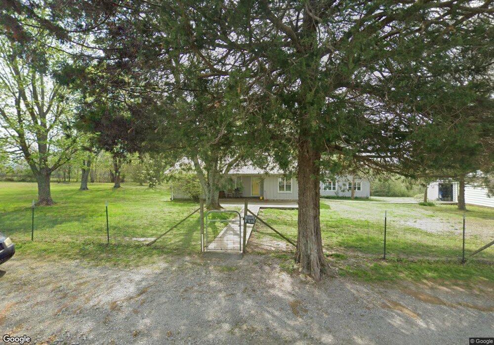
211 Comer Rd Morrison, TN 37357
Estimated Value: $190,000 - $338,000
Studio
1
Bath
1,624
Sq Ft
$149/Sq Ft
Est. Value
About This Home
This home is located at 211 Comer Rd, Morrison, TN 37357 and is currently estimated at $241,254, approximately $148 per square foot. 211 Comer Rd is a home located in Warren County with nearby schools including Morrison Elementary School and Warren County High School.
Ownership History
Date
Name
Owned For
Owner Type
Purchase Details
Closed on
Mar 14, 2014
Sold by
Henegar Terry Ernest
Bought by
Holland Karen E and Holland Raymond T
Current Estimated Value
Home Financials for this Owner
Home Financials are based on the most recent Mortgage that was taken out on this home.
Original Mortgage
$61,964
Outstanding Balance
$46,726
Interest Rate
4.36%
Mortgage Type
New Conventional
Estimated Equity
$194,528
Purchase Details
Closed on
Dec 12, 2000
Sold by
Henegar Ernest T
Bought by
Bobby Merriman
Home Financials for this Owner
Home Financials are based on the most recent Mortgage that was taken out on this home.
Original Mortgage
$65,960
Interest Rate
7.81%
Purchase Details
Closed on
Jan 1, 1985
Bought by
Henegar Ernest T and Henegar Doris
Create a Home Valuation Report for This Property
The Home Valuation Report is an in-depth analysis detailing your home's value as well as a comparison with similar homes in the area
Purchase History
| Date | Buyer | Sale Price | Title Company |
|---|---|---|---|
| Holland Karen E | $61,783 | -- | |
| Bobby Merriman | $68,500 | -- | |
| Henegar Ernest T | $17,000 | -- |
Source: Public Records
Mortgage History
| Date | Status | Borrower | Loan Amount |
|---|---|---|---|
| Open | Holland Karen E | $61,964 | |
| Previous Owner | Henegar Ernest T | $65,960 |
Source: Public Records
Tax History
| Year | Tax Paid | Tax Assessment Tax Assessment Total Assessment is a certain percentage of the fair market value that is determined by local assessors to be the total taxable value of land and additions on the property. | Land | Improvement |
|---|---|---|---|---|
| 2025 | $728 | $60,250 | $17,200 | $43,050 |
| 2024 | $602 | $30,575 | $4,250 | $26,325 |
| 2023 | $583 | $30,575 | $4,250 | $26,325 |
| 2022 | $583 | $29,650 | $4,250 | $25,400 |
| 2021 | $583 | $29,650 | $4,250 | $25,400 |
| 2020 | $499 | $29,650 | $4,250 | $25,400 |
| 2019 | $571 | $25,400 | $3,750 | $21,650 |
| 2018 | $488 | $25,400 | $3,750 | $21,650 |
| 2017 | $488 | $24,825 | $3,750 | $21,075 |
| 2016 | $379 | $24,825 | $3,750 | $21,075 |
| 2015 | $385 | $19,275 | $3,750 | $15,525 |
| 2014 | $455 | $19,275 | $3,750 | $15,525 |
| 2013 | $455 | $22,778 | $0 | $0 |
Source: Public Records
Map
Nearby Homes
- 184 Mcgowan Rd
- 2152 Old Well Rd
- 132 Tenpenny Rd
- 318 Autumn Rd
- 100 Nancy Ln
- 5071 Shelbyville Rd
- 0 Old Wells Rd
- 7817 Shelbyville Rd
- 990 Miriah Dr
- 940 Miriah Dr
- 1073 Arch Cope Rd
- 49 Thunder Ridge Ct
- 759 Miriah Dr
- 96 Harvest Farm Lake Rd
- 73 Three Point Cir
- 8557 Manchester Hwy
- 0 Manchester Hwy Unit 3
- 0 Manchester Hwy Unit RTC2817165
- 0 Manchester Hwy Unit 2
- 0 Manchester Hwy Unit 220028
Your Personal Tour Guide
Ask me questions while you tour the home.