Estimated Value: $195,000 - $270,000
3
Beds
2
Baths
1,144
Sq Ft
$201/Sq Ft
Est. Value
About This Home
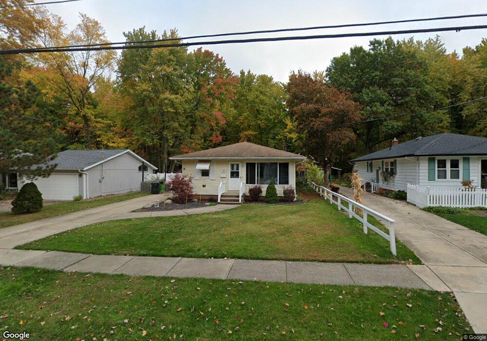
This home is located at 211 Dorland Ave, Berea, OH 44017 and is currently estimated at $230,080, approximately $201 per square foot. 211 Dorland Ave is a home located in Cuyahoga County with nearby schools including Grindstone Elementary School, Berea-Midpark Middle School, and Berea-Midpark High School.
Ownership History
Date
Name
Owned For
Owner Type
Purchase Details
Closed on
Jun 4, 1985
Sold by
Yahnkow Leonard W and Yahnkow Audrey M
Bought by
Yahnkow Leonard W
Current Estimated Value
Purchase Details
Closed on
Mar 30, 1979
Sold by
Madison Raymond L
Bought by
Yahnkow Leonard W and Yahnkow Audrey M
Purchase Details
Closed on
Dec 1, 1977
Sold by
Gates David and Gates Donna
Bought by
Madison Raymond L
Purchase Details
Closed on
Jan 1, 1975
Bought by
Gates David and Gates Donna
Create a Home Valuation Report for This Property
The Home Valuation Report is an in-depth analysis detailing your home's value as well as a comparison with similar homes in the area
Home Values in the Area
Average Home Value in this Area
Purchase History
| Date | Buyer | Sale Price | Title Company |
|---|---|---|---|
| Yahnkow Leonard W | -- | -- | |
| Yahnkow Leonard W | $66,300 | -- | |
| Madison Raymond L | $56,000 | -- | |
| Gates David | -- | -- |
Source: Public Records
Tax History Compared to Growth
Tax History
| Year | Tax Paid | Tax Assessment Tax Assessment Total Assessment is a certain percentage of the fair market value that is determined by local assessors to be the total taxable value of land and additions on the property. | Land | Improvement |
|---|---|---|---|---|
| 2024 | $3,668 | $61,985 | $10,955 | $51,030 |
| 2023 | $3,359 | $47,570 | $9,730 | $37,840 |
| 2022 | $3,338 | $47,570 | $9,730 | $37,840 |
| 2021 | $3,312 | $47,570 | $9,730 | $37,840 |
| 2020 | $3,165 | $40,320 | $8,260 | $32,060 |
| 2019 | $3,082 | $115,200 | $23,600 | $91,600 |
| 2018 | $2,806 | $40,320 | $8,260 | $32,060 |
| 2017 | $2,725 | $33,260 | $7,530 | $25,730 |
| 2016 | $2,705 | $33,260 | $7,530 | $25,730 |
| 2015 | $3,012 | $33,260 | $7,530 | $25,730 |
| 2014 | $3,012 | $39,130 | $7,910 | $31,220 |
Source: Public Records
Map
Nearby Homes
- 9401 Pheasant Run Place
- 84 Sprague Rd
- 104 Whitehall Dr
- 8627 Courtland Dr
- 19419 Fowles Rd
- 740 Fair St
- 8036 Fair Rd
- 148 Meadow Cir
- 18737 Evergreen Dr
- 23 Hamilton St
- 74 Aaron St
- 243 Jananna Dr
- 20424 Scotch Pine Way
- 101 S Rocky River Dr Unit 401
- 8902 Lincolnshire Blvd
- 18433 Whitney Rd
- 19890 Idlewood Trail
- 21176 Hickory Branch Trail
- 18203 Broxton Dr
- 20050 Idlewood Trail
- 217 Dorland Ave
- 223 Dorland Ave
- 203 Dorland Ave
- 197 Dorland Ave
- 212 Dorland Ave
- 220 Dorland Ave
- 208 Dorland Ave
- 235 Dorland Ave
- 224 Dorland Ave
- 191 Dorland Ave
- 200 Dorland Ave
- 230 Dorland Ave
- 185 Dorland Ave
- 236 Dorland Ave
- 243 Dorland Ave
- 190 Dorland Ave
- 181 Dorland Ave
- 240 Dorland Ave
- 184 Dorland Ave
- 217 Milton St