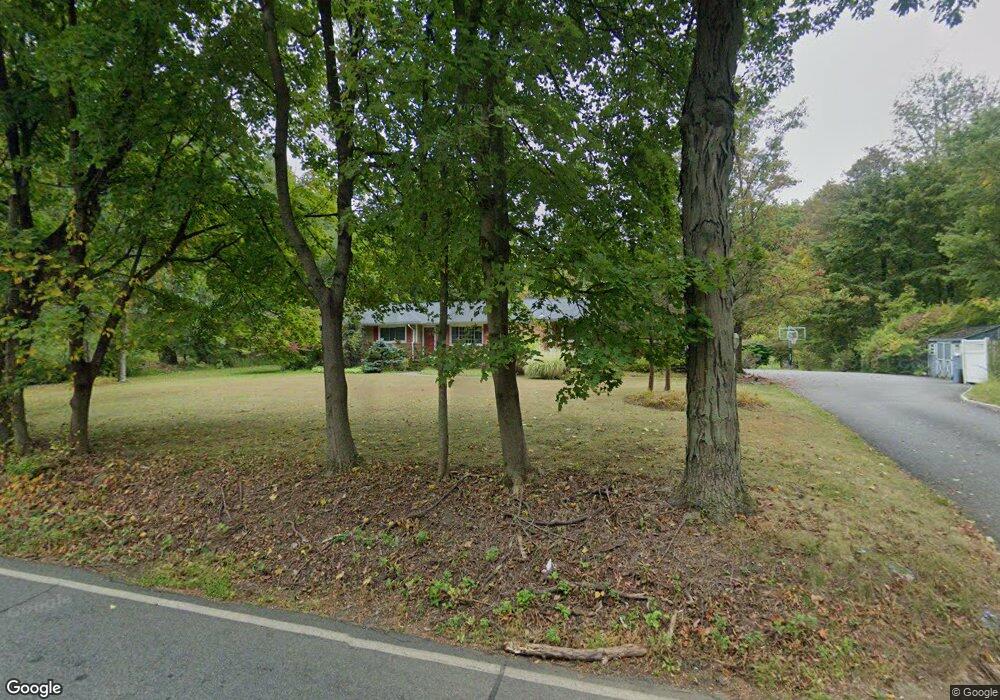
211 Drakestown Rd Long Valley, NJ 07853
Washington Township Morris NeighborhoodEstimated Value: $520,811 - $592,000
--
Bed
--
Bath
1,516
Sq Ft
$359/Sq Ft
Est. Value
About This Home
This home is located at 211 Drakestown Rd, Long Valley, NJ 07853 and is currently estimated at $544,953, approximately $359 per square foot. 211 Drakestown Rd is a home located in Morris County with nearby schools including Benedict A. Cucinella School, Long Valley Middle School, and West Morris Central High School.
Ownership History
Date
Name
Owned For
Owner Type
Purchase Details
Closed on
Mar 15, 2019
Sold by
Blaine Donald J
Bought by
Mansolino David and Mansolino Taryn
Current Estimated Value
Home Financials for this Owner
Home Financials are based on the most recent Mortgage that was taken out on this home.
Original Mortgage
$342,000
Outstanding Balance
$300,064
Interest Rate
4.3%
Mortgage Type
New Conventional
Estimated Equity
$244,889
Create a Home Valuation Report for This Property
The Home Valuation Report is an in-depth analysis detailing your home's value as well as a comparison with similar homes in the area
Home Values in the Area
Average Home Value in this Area
Purchase History
| Date | Buyer | Sale Price | Title Company |
|---|---|---|---|
| Mansolino David | $380,000 | Fidelity National Ttl Ins Co |
Source: Public Records
Mortgage History
| Date | Status | Borrower | Loan Amount |
|---|---|---|---|
| Open | Mansolino David | $342,000 |
Source: Public Records
Tax History Compared to Growth
Tax History
| Year | Tax Paid | Tax Assessment Tax Assessment Total Assessment is a certain percentage of the fair market value that is determined by local assessors to be the total taxable value of land and additions on the property. | Land | Improvement |
|---|---|---|---|---|
| 2025 | $8,190 | $282,300 | $135,700 | $146,600 |
| 2024 | $8,006 | $282,300 | $135,700 | $146,600 |
| 2023 | $8,006 | $282,300 | $135,700 | $146,600 |
| 2022 | $7,574 | $282,300 | $135,700 | $146,600 |
| 2021 | $7,574 | $282,300 | $135,700 | $146,600 |
| 2020 | $7,450 | $282,300 | $135,700 | $146,600 |
| 2019 | $7,374 | $282,300 | $135,700 | $146,600 |
| 2018 | $7,210 | $282,300 | $135,700 | $146,600 |
| 2017 | $7,055 | $282,300 | $135,700 | $146,600 |
| 2016 | $6,840 | $282,300 | $135,700 | $146,600 |
| 2015 | $6,702 | $282,300 | $135,700 | $146,600 |
| 2014 | $6,643 | $282,300 | $135,700 | $146,600 |
Source: Public Records
Map
Nearby Homes
- 24 Church Rd
- 13 Church Rd
- 2 Brock Ln
- 96 Winding Hill Dr
- 286 Drakestown Rd
- 10 Nancy Terrace
- 169 Winding Hill Dr
- 14 Kim Ln
- 20 Mine Hill Rd
- 43 Saunders Ln
- 108 U S 46
- 45 Saunders Ln
- 5 Francis Terrace
- 28 Mine Hill Rd
- 16 Whipporwill Rd
- 11 Shadow Hill Way
- 16 Setting Sun Dr
- 30 Tudor Place
- 55 Saxton Dr
- 12 Hunter Dr
- 207 Drakestown Rd
- 299 Drakestown Rd
- 203 Drakestown Rd
- 199 Drakestown Rd
- 198 Drakestown Rd
- 212 Drakestown Rd
- 556 Naughright Rd
- 560 Naughright Rd
- 550 Naughright Rd
- 546 Naughright Rd
- 214 Drakestown Rd
- 208 Drakestown Rd
- 296 Drakestown Rd
- 296 Drakestown Rd Unit A
- 544 Naughright Rd
- 18 Church Rd
- 3 Yorkshire Dr
- 540 Naughright Rd
- 2 Yorkshire Dr
- 22 Church Rd