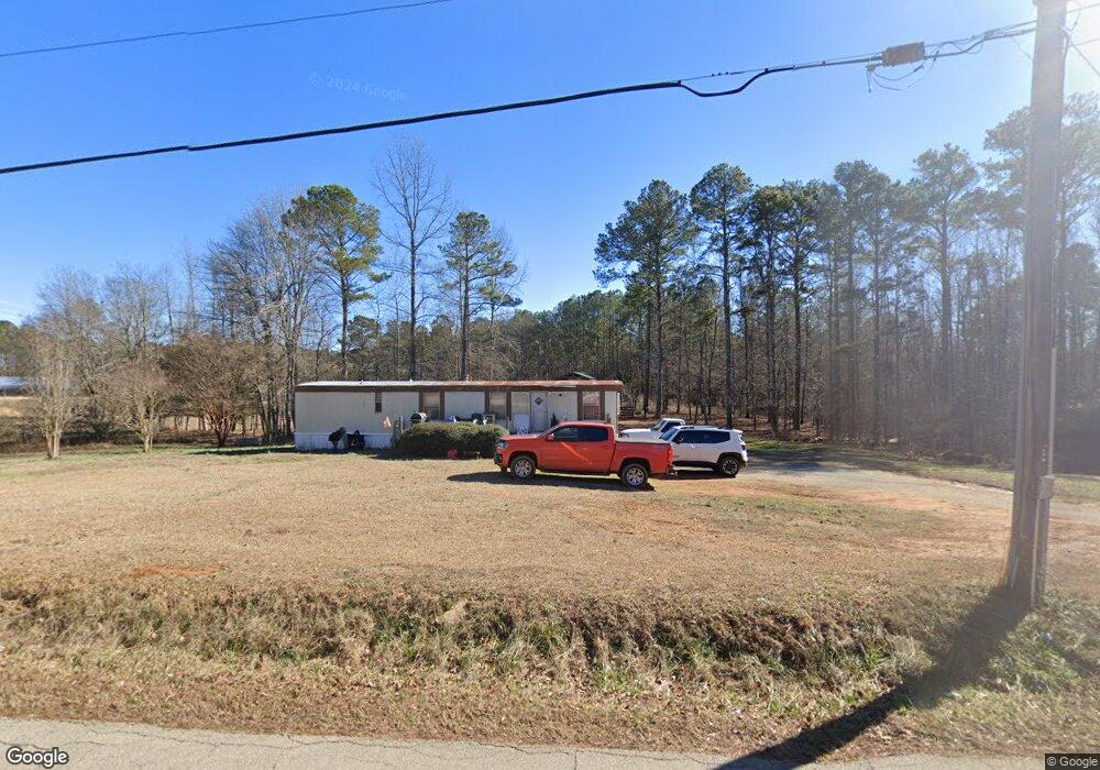
211 Dugdown Rd Cedartown, GA 30125
Estimated Value: $41,893 - $181,000
2
Beds
1
Bath
672
Sq Ft
$191/Sq Ft
Est. Value
About This Home
This home is located at 211 Dugdown Rd, Cedartown, GA 30125 and is currently estimated at $128,473, approximately $191 per square foot. 211 Dugdown Rd is a home.
Ownership History
Date
Name
Owned For
Owner Type
Purchase Details
Closed on
Aug 1, 2024
Sold by
Green Denise Stephens
Bought by
Ridgeway Edward Dale
Current Estimated Value
Home Financials for this Owner
Home Financials are based on the most recent Mortgage that was taken out on this home.
Original Mortgage
$35,000
Interest Rate
6.95%
Mortgage Type
New Conventional
Purchase Details
Closed on
Dec 1, 2021
Sold by
Stephens Danny L
Bought by
Green Denise Stephens
Purchase Details
Closed on
Apr 7, 2003
Sold by
Dwight L Walraven Investments Inc
Bought by
Stephens Danny L
Purchase Details
Closed on
Mar 28, 2003
Sold by
Slaughter Slaughter E and Slaughter Major Z
Bought by
Dwight L Walraven Investments Inc*(M/P)
Create a Home Valuation Report for This Property
The Home Valuation Report is an in-depth analysis detailing your home's value as well as a comparison with similar homes in the area
Purchase History
| Date | Buyer | Sale Price | Title Company |
|---|---|---|---|
| Ridgeway Edward Dale | $48,010 | -- | |
| Green Denise Stephens | -- | -- | |
| Stephens Danny L | $15,000 | -- | |
| Dwight L Walraven Investments Inc*(M/P) | $15,100 | -- |
Source: Public Records
Mortgage History
| Date | Status | Borrower | Loan Amount |
|---|---|---|---|
| Closed | Ridgeway Edward Dale | $35,000 |
Source: Public Records
Tax History
| Year | Tax Paid | Tax Assessment Tax Assessment Total Assessment is a certain percentage of the fair market value that is determined by local assessors to be the total taxable value of land and additions on the property. | Land | Improvement |
|---|---|---|---|---|
| 2025 | $250 | $11,129 | $7,265 | $3,864 |
| 2024 | $188 | $8,997 | $4,541 | $4,456 |
| 2023 | $190 | $3,702 | $0 | $3,702 |
| 2022 | $178 | $3,326 | $0 | $3,326 |
| 2021 | $180 | $3,326 | $0 | $3,326 |
| 2020 | $132 | $3,326 | $0 | $3,326 |
| 2019 | $230 | $3,326 | $0 | $3,326 |
| 2018 | $236 | $8,577 | $2,539 | $6,038 |
| 2017 | $163 | $7,991 | $2,539 | $5,452 |
| 2016 | $208 | $9,632 | $4,180 | $5,452 |
| 2015 | $244 | $10,956 | $4,180 | $6,776 |
| 2014 | $252 | $11,171 | $4,180 | $6,991 |
Source: Public Records
Map
Nearby Homes
- 300 Dugdown Rd
- 5159 Buchanan Hwy
- 340 Wray Rd
- 508 Mckibben Rd
- 4267 Buchanan Hwy
- 0 Ten Oaks Rd
- 0 Felton Rockmart Rd Unit 7745747
- 0 Felton Rockmart Rd Unit 10723383
- 4550 Buchanan Hwy
- 0 Youngs Farm Rd Unit 26490185
- 0 Buchanan Hwy Unit 10558945
- 102 acres Youngs Farm Rd
- 1585 Golden Pond Pass
- 1719 Tallapoosa Hwy
- 0 Carnes Rd Unit 147233
- 45 York Cir
- 1706 Antioch Rd
- 768 Lime Branch Rd
- 2840 Tallapoosa Hwy
- 8381 Georgia 100
- 214 Dugdown Rd
- 222 Dugdown Rd
- 297 Dugdown Rd
- 125 Dugdown Rd
- 0 Little Rd Unit 8358442
- 0 Little Rd Unit 5912965
- 0 Little Rd Unit 20139947
- 0 Little Rd Unit 7219101
- 0 Little Rd Unit 10161279
- 0 Little Rd Unit 8086006
- 0 Little Rd Unit 8263983
- 0 Little Rd Unit 6526354
- 0 Little Rd Unit 8551854
- 339 Dugdown Rd
- 110 Dugdown Rd
- 116 Little Rd
- 340 Dug Down Rd
- 340 Dugdown Rd
- 327 Dugdown Rd
- 11 Walter Rd
Your Personal Tour Guide
Ask me questions while you tour the home.