Estimated Value: $172,000 - $230,000
4
Beds
2
Baths
2,440
Sq Ft
$83/Sq Ft
Est. Value
About This Home
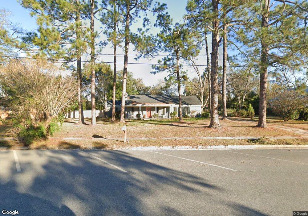
This home is located at 211 E 5th St, Adel, GA 31620 and is currently estimated at $202,346, approximately $82 per square foot. 211 E 5th St is a home located in Cook County with nearby schools including Cook Primary School, Cook Elementary School, and Cook County Middle School.
Ownership History
Date
Name
Owned For
Owner Type
Purchase Details
Closed on
Sep 20, 2013
Sold by
Costigan Stephen
Bought by
Sills Larae
Current Estimated Value
Home Financials for this Owner
Home Financials are based on the most recent Mortgage that was taken out on this home.
Original Mortgage
$89,693
Outstanding Balance
$67,379
Interest Rate
4.57%
Mortgage Type
New Conventional
Estimated Equity
$134,967
Purchase Details
Closed on
May 16, 2006
Sold by
Brookshier Kay C
Bought by
Costigan Stephen and Costigan Juliet A
Create a Home Valuation Report for This Property
The Home Valuation Report is an in-depth analysis detailing your home's value as well as a comparison with similar homes in the area
Home Values in the Area
Average Home Value in this Area
Purchase History
| Date | Buyer | Sale Price | Title Company |
|---|---|---|---|
| Sills Larae | $87,900 | -- | |
| Costigan Stephen | $70,000 | -- |
Source: Public Records
Mortgage History
| Date | Status | Borrower | Loan Amount |
|---|---|---|---|
| Open | Sills Larae | $89,693 |
Source: Public Records
Tax History
| Year | Tax Paid | Tax Assessment Tax Assessment Total Assessment is a certain percentage of the fair market value that is determined by local assessors to be the total taxable value of land and additions on the property. | Land | Improvement |
|---|---|---|---|---|
| 2024 | $1,535 | $48,243 | $5,600 | $42,643 |
| 2023 | $1,319 | $41,691 | $5,000 | $36,691 |
| 2022 | $1,319 | $41,691 | $5,000 | $36,691 |
| 2021 | $1,178 | $35,003 | $5,000 | $30,003 |
| 2020 | $1,178 | $35,003 | $5,000 | $30,003 |
| 2019 | $1,179 | $35,003 | $5,000 | $30,003 |
| 2018 | $1,236 | $35,003 | $5,000 | $30,003 |
| 2017 | $1,181 | $35,003 | $5,000 | $30,003 |
| 2016 | $1,182 | $35,003 | $5,000 | $30,003 |
| 2015 | $1,184 | $35,003 | $5,000 | $30,003 |
| 2014 | $1,185 | $35,003 | $5,000 | $30,003 |
| 2013 | -- | $35,003 | $5,000 | $30,003 |
Source: Public Records
Map
Nearby Homes
- 211 S Gordon Ave
- 411 S Hutchinson Ave
- 317 Brookside Dr
- 509 E 8th St
- 609 E 4th St
- 507 S Poplar St
- 322 Magnolia Dr
- 708 Town And Country Dr
- 804 S Forrest Ave
- 315 Newton Dr
- 701 Gloria St
- 814 N Cleveland Ave
- 309 Wayne St
- 806 S Forrest Ave
- 729 W 7th St
- 703 N Elm St
- 526 E Mitchell St
- 321 Spanish Moss Ln
- 414 Birch St
- 1402 Bear Creek Rd
- 215 E 5th St
- 207 E 5th St
- 203 E 5th St
- 201 E 5th St
- 301 E 5th St
- 200 E 5th St
- 109 S Cleveland Ave
- 300 E 5th St
- 215 E 4th St
- 112 E 4th St
- 201 E 4th St
- 306 E 5th St
- 207 S Cleveland Ave
- 206 S Parrish Ave
- 121 S Hutchinson Ave
- 105 N Cleveland Ave
- 102 S Hutchinson Ave
- 204 S Gordon Ave
- 208 S Parrish Ave
- 101 S Hutchinson Ave
Your Personal Tour Guide
Ask me questions while you tour the home.