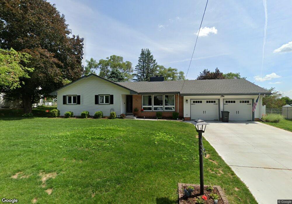
211 E Florence Ave Glenwood, IA 51534
Estimated Value: $260,000 - $304,000
4
Beds
2
Baths
1,194
Sq Ft
$236/Sq Ft
Est. Value
About This Home
This home is located at 211 E Florence Ave, Glenwood, IA 51534 and is currently estimated at $282,087, approximately $236 per square foot. 211 E Florence Ave is a home located in Mills County with nearby schools including Northeast Elementary School, West Elementary School, and Glenwood Middle School.
Ownership History
Date
Name
Owned For
Owner Type
Purchase Details
Closed on
Sep 28, 2018
Sold by
Sell Lila Jean Est
Bought by
Tucker Kevin and Tucker Alison
Current Estimated Value
Home Financials for this Owner
Home Financials are based on the most recent Mortgage that was taken out on this home.
Original Mortgage
$165,000
Outstanding Balance
$143,903
Interest Rate
4.6%
Mortgage Type
New Conventional
Estimated Equity
$138,184
Create a Home Valuation Report for This Property
The Home Valuation Report is an in-depth analysis detailing your home's value as well as a comparison with similar homes in the area
Home Values in the Area
Average Home Value in this Area
Purchase History
| Date | Buyer | Sale Price | Title Company |
|---|---|---|---|
| Tucker Kevin | -- | -- | |
| Tucker Kevin | $180,000 | -- |
Source: Public Records
Mortgage History
| Date | Status | Borrower | Loan Amount |
|---|---|---|---|
| Open | Tucker Kevin | $165,000 |
Source: Public Records
Tax History
| Year | Tax Paid | Tax Assessment Tax Assessment Total Assessment is a certain percentage of the fair market value that is determined by local assessors to be the total taxable value of land and additions on the property. | Land | Improvement |
|---|---|---|---|---|
| 2025 | $4,290 | $284,601 | $50,880 | $233,721 |
| 2024 | $4,290 | $255,898 | $50,880 | $205,018 |
| 2023 | $4,464 | $250,096 | $29,982 | $220,114 |
| 2022 | $4,352 | $209,454 | $29,982 | $179,472 |
| 2021 | $4,004 | $209,454 | $29,982 | $179,472 |
| 2020 | $4,004 | $181,843 | $29,982 | $151,861 |
| 2019 | $3,592 | $168,038 | $0 | $0 |
| 2018 | $3,514 | $168,038 | $0 | $0 |
| 2017 | $3,274 | $161,193 | $0 | $0 |
| 2016 | $2,968 | $161,193 | $0 | $0 |
| 2015 | $2,970 | $161,193 | $0 | $0 |
| 2014 | $2,954 | $161,193 | $0 | $0 |
Source: Public Records
Map
Nearby Homes
- 1106B N Linn St
- 123 Hillcrest Ave
- 103 Linn Ct
- 601 N Hazel St
- 410 N Vine St
- 203 Fairview Dr
- 407 N Myrtle St
- 311 N Grove St
- 206 N Hazel St
- 41 Gingry Ln
- 25 Gingry Ln
- 22475 Grande View Ave
- 13 ACRES 245th St
- 56107 Grande Oak Ln
- 56274 Grande Oak Ln
- 206 S Locust St
- 402 Nuckolls St
- 55623 230th St
- 55378 230th St
- 55272 230th St
- 209 E Florence Ave
- 213 E Florence Ave
- 406 Louise Ave
- 404 Louise Ave
- 207 E Florence Ave
- 208 E Florence Ave
- 212 E Florence Ave
- 402 Louise Ave
- 214 E Florence Ave
- 206 E Florence Ave
- 408 Louise Ave
- 205 E Florence Ave
- 400 Louise Ave
- 246 W Florence Ave
- 301 E Florence Ave
- 114 Center St
- 204 E Florence Ave
- 216 E Florence Ave
- 112 Center St
- 248 W Florence Ave
Your Personal Tour Guide
Ask me questions while you tour the home.