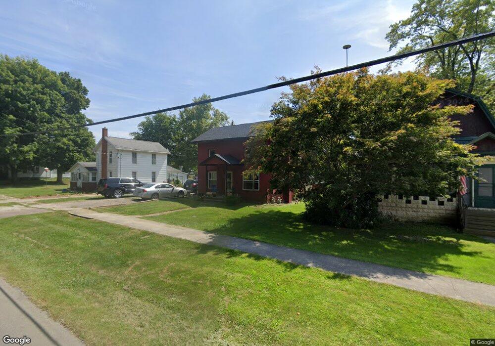
211 E Main St Unit MAIN North Adams, MI 49262
Estimated Value: $131,651 - $290,000
4
Beds
1
Bath
1,392
Sq Ft
$134/Sq Ft
Est. Value
About This Home
This home is located at 211 E Main St Unit MAIN, North Adams, MI 49262 and is currently estimated at $185,913, approximately $133 per square foot. 211 E Main St Unit MAIN is a home located in Hillsdale County with nearby schools including North Adams-Jerome Elementary School and North Adams-Jerome Middle/High School.
Ownership History
Date
Name
Owned For
Owner Type
Purchase Details
Closed on
Feb 28, 2018
Sold by
Carr Justin B
Bought by
Trudell Kasey
Current Estimated Value
Home Financials for this Owner
Home Financials are based on the most recent Mortgage that was taken out on this home.
Original Mortgage
$48,500
Outstanding Balance
$41,332
Interest Rate
4.15%
Mortgage Type
New Conventional
Estimated Equity
$144,581
Purchase Details
Closed on
Feb 27, 2015
Sold by
Dunbar Lem Gene and Dunbar Beverly Jean
Bought by
Carr Justin and Trudell Kasey
Home Financials for this Owner
Home Financials are based on the most recent Mortgage that was taken out on this home.
Original Mortgage
$47,295
Interest Rate
3.66%
Mortgage Type
New Conventional
Purchase Details
Closed on
Jul 7, 2011
Sold by
Dunbar Lem Gene and Dunbar Beverly J
Bought by
Kathleen Marie Cooley Revocable Living T
Purchase Details
Closed on
Apr 6, 2010
Sold by
Mortgage Electronic Registration Systems
Bought by
Hsbc Mortgage Services Inc
Purchase Details
Closed on
Apr 2, 2010
Sold by
Cook Theodore W and Cook Angela V
Bought by
Mortgage Electronic Registration Systems and Oak Street Mortgage Llc
Purchase Details
Closed on
Sep 2, 2005
Sold by
Thornton Jeffery
Bought by
Cook Theodore W and Cook Angela V
Home Financials for this Owner
Home Financials are based on the most recent Mortgage that was taken out on this home.
Original Mortgage
$55,120
Interest Rate
6.75%
Mortgage Type
Fannie Mae Freddie Mac
Purchase Details
Closed on
Jul 20, 1984
Sold by
Morehead Stephen A and Morehead Laura K
Bought by
Thornton Jeffery
Purchase Details
Closed on
Apr 11, 1978
Bought by
Morehead Stephen A and Morehead Laura K
Purchase Details
Closed on
Jun 8, 1976
Sold by
Faulkner Linda L
Bought by
United States Of America
Purchase Details
Closed on
May 25, 1976
Sold by
Faulkner Terry M
Bought by
United States Of America
Purchase Details
Closed on
Oct 27, 1972
Sold by
Ingles Keith L and Ingles Kay N
Bought by
Faulkner Terry M and Faulkner Linda L
Create a Home Valuation Report for This Property
The Home Valuation Report is an in-depth analysis detailing your home's value as well as a comparison with similar homes in the area
Purchase History
| Date | Buyer | Sale Price | Title Company |
|---|---|---|---|
| Trudell Kasey | -- | None Available | |
| Carr Justin | $46,350 | Public Title Agency | |
| Kathleen Marie Cooley Revocable Living T | $6,000 | Midstate Title | |
| Hsbc Mortgage Services Inc | -- | None Available | |
| Mortgage Electronic Registration Systems | $18,000 | None Available | |
| Cook Theodore W | $68,900 | Public Title Agency | |
| Thornton Jeffery | $21,700 | -- | |
| Morehead Stephen A | $13,000 | -- | |
| United States Of America | -- | -- | |
| United States Of America | -- | -- | |
| Faulkner Terry M | $14,500 | -- |
Source: Public Records
Mortgage History
| Date | Status | Borrower | Loan Amount |
|---|---|---|---|
| Open | Trudell Kasey | $48,500 | |
| Previous Owner | Carr Justin | $47,295 | |
| Previous Owner | Cook Theodore W | $55,120 | |
| Previous Owner | Cook Theodore W | $13,780 |
Source: Public Records
Tax History
| Year | Tax Paid | Tax Assessment Tax Assessment Total Assessment is a certain percentage of the fair market value that is determined by local assessors to be the total taxable value of land and additions on the property. | Land | Improvement |
|---|---|---|---|---|
| 2025 | $694 | $49,100 | $0 | $0 |
| 2024 | $7 | $38,000 | $0 | $0 |
| 2023 | $643 | $39,400 | $0 | $0 |
| 2022 | $927 | $36,600 | $0 | $0 |
| 2021 | $907 | $34,100 | $0 | $0 |
| 2020 | $909 | $30,100 | $0 | $0 |
| 2019 | $898 | $27,400 | $0 | $0 |
| 2018 | $873 | $27,300 | $0 | $0 |
| 2017 | $872 | $27,330 | $0 | $0 |
| 2016 | $868 | $26,110 | $0 | $0 |
| 2015 | $250 | $26,110 | $0 | $0 |
| 2013 | $290 | $27,010 | $0 | $0 |
| 2012 | $283 | $25,849 | $0 | $0 |
Source: Public Records
Map
Nearby Homes
- 3685 Holcomb Rd
- 5435 State Rd
- 6551 Brown Rd
- 4149 Kim Dr
- 4794 Keith Rd
- 10191 Wood Rd
- 6838 Moreland Rd
- 1111 N Lake Pleasant Rd
- 11480 N Adams Rd
- 9632 Fowle Rd
- 3465 E Bacon Rd
- 0 Oakridge Dr
- 6635 E Chicago Rd
- 2175 Bird Lake Rd S
- 4291 Waldron Rd
- 3151 E Bacon Rd
- 10720 E Bacon Rd
- 9621 Lakeview Dr
- 7200 Waldron Rd
- 320 River St
Your Personal Tour Guide
Ask me questions while you tour the home.