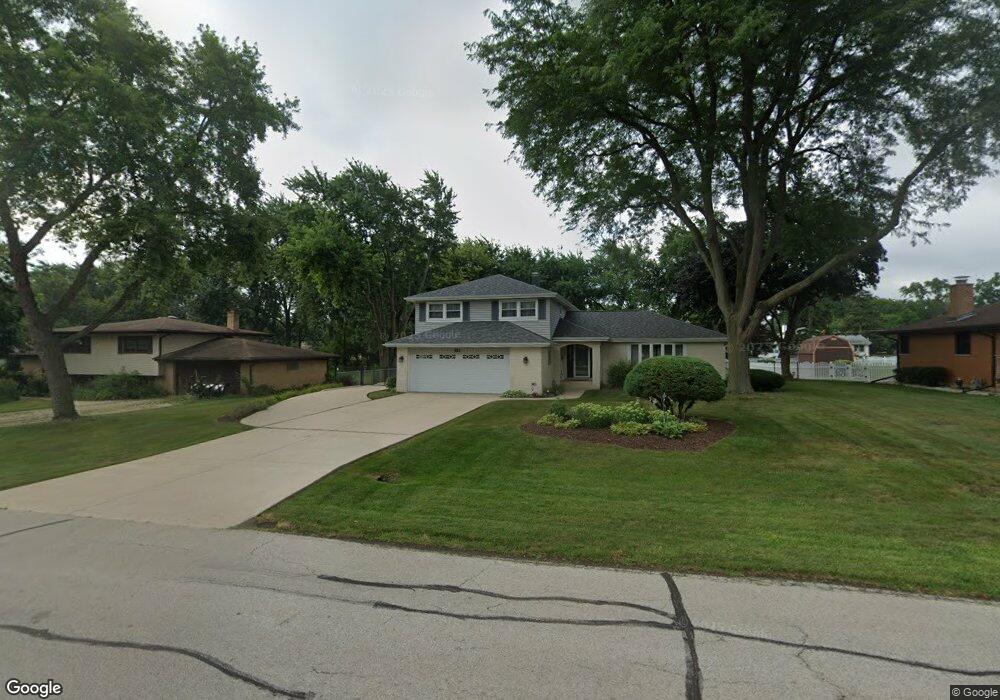
211 E Niagara Ave Schaumburg, IL 60193
South Schaumburg NeighborhoodEstimated Value: $538,000 - $633,000
4
Beds
3
Baths
2,300
Sq Ft
$247/Sq Ft
Est. Value
About This Home
This home is located at 211 E Niagara Ave, Schaumburg, IL 60193 and is currently estimated at $567,713, approximately $246 per square foot. 211 E Niagara Ave is a home located in Cook County with nearby schools including Frederick Nerge Elementary School, Margaret Mead Junior High School, and J B Conant High School.
Ownership History
Date
Name
Owned For
Owner Type
Purchase Details
Closed on
Mar 16, 2017
Sold by
Lemay Pamela L
Bought by
Stack Collette A and Stack William N
Current Estimated Value
Home Financials for this Owner
Home Financials are based on the most recent Mortgage that was taken out on this home.
Original Mortgage
$380,000
Outstanding Balance
$313,554
Interest Rate
4.25%
Mortgage Type
New Conventional
Estimated Equity
$254,159
Purchase Details
Closed on
Apr 26, 2002
Sold by
Lemay Robert J and Lemay Pamela L
Bought by
Lemay Pamela L and Pamela L Lemay Trust
Create a Home Valuation Report for This Property
The Home Valuation Report is an in-depth analysis detailing your home's value as well as a comparison with similar homes in the area
Home Values in the Area
Average Home Value in this Area
Purchase History
| Date | Buyer | Sale Price | Title Company |
|---|---|---|---|
| Stack Collette A | $400,000 | First American Title | |
| Lemay Pamela L | -- | -- |
Source: Public Records
Mortgage History
| Date | Status | Borrower | Loan Amount |
|---|---|---|---|
| Open | Stack Collette A | $380,000 |
Source: Public Records
Tax History
| Year | Tax Paid | Tax Assessment Tax Assessment Total Assessment is a certain percentage of the fair market value that is determined by local assessors to be the total taxable value of land and additions on the property. | Land | Improvement |
|---|---|---|---|---|
| 2025 | $10,913 | $49,000 | $9,000 | $40,000 |
| 2024 | $10,913 | $39,020 | $8,000 | $31,020 |
| 2023 | $10,582 | $39,020 | $8,000 | $31,020 |
| 2022 | $10,582 | $39,020 | $8,000 | $31,020 |
| 2021 | $9,812 | $32,355 | $22,500 | $9,855 |
| 2020 | $9,719 | $32,355 | $22,500 | $9,855 |
| 2019 | $9,731 | $35,950 | $22,500 | $13,450 |
| 2018 | $11,757 | $35,182 | $19,000 | $16,182 |
| 2017 | $10,854 | $36,437 | $19,000 | $17,437 |
| 2016 | $11,116 | $36,437 | $19,000 | $17,437 |
| 2015 | $8,863 | $30,803 | $16,000 | $14,803 |
| 2014 | $8,797 | $30,803 | $16,000 | $14,803 |
| 2013 | $8,547 | $30,803 | $16,000 | $14,803 |
Source: Public Records
Map
Nearby Homes
- 1326 Summit Dr
- 1100 Boston Harbor Unit 7004
- 518 E Niagara Ave
- 411 Drake Cir Unit 401B
- 1064 Hampton Harbor Unit 1064
- 1055 Hampton Harbor Unit 1055
- 134 Lunt Ave
- 620 S Point Dr
- 1500 Illinois St
- 100 Pratt Blvd
- 1630 Myrtle Park St
- 207 Mountain Interval Rd Unit 7230
- 240 Warren Ln Unit 11348
- 211 Steeple Bush Ln Unit 10343
- 232 Warren Ln Unit 11546
- 235 Quincy Ct
- 733 Limerick Ln Unit 7333D
- 717 Killarney Ct Unit 2D
- 1200 Knottingham Ct Unit 2B
- 725 Limerick Ln Unit 2-B
- 213 E Niagara Ave
- 201 E Niagara Ave
- 219 E Niagara Ave
- 206 E Monterey Ave
- 133 E Niagara Ave
- 212 E Monterey Ave
- 200 E Monterey Ave
- 1226 Greenview Ct
- 218 E Monterey Ave
- 216 E Niagara Ave
- 225 E Niagara Ave
- 132 E Monterey Ave
- 130 E Niagara Ave
- 224 E Monterey Ave
- 1295 Laurel Ln
- 1235 Laurel Ln
- 1307 Laurel Ln
- 231 E Niagara Ave
- 1221 Greenview Ct
- 1218 Greenview Ct
Your Personal Tour Guide
Ask me questions while you tour the home.