Estimated Value: $244,000 - $277,000
4
Beds
2
Baths
2,016
Sq Ft
$131/Sq Ft
Est. Value
About This Home
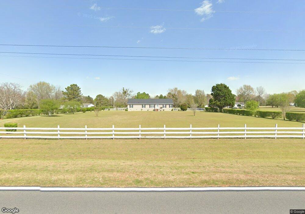
This home is located at 211 Fieldcrest Dr, Byron, GA 31008 and is currently estimated at $263,465, approximately $130 per square foot. 211 Fieldcrest Dr is a home located in Peach County with nearby schools including Kay Road Elementary School, Fort Valley Middle School, and Peach County High School.
Ownership History
Date
Name
Owned For
Owner Type
Purchase Details
Closed on
Mar 27, 2008
Sold by
Manson Rosalind
Bought by
Wright Rose Marie
Current Estimated Value
Purchase Details
Closed on
Feb 9, 2005
Sold by
Southern Oaks Diversifield
Bought by
Lowe Gary
Purchase Details
Closed on
May 9, 1998
Bought by
Manson Rosalind
Purchase Details
Closed on
Sep 29, 1995
Bought by
Manson Steve J
Purchase Details
Closed on
Aug 1, 1995
Bought by
James Emory Inc
Purchase Details
Closed on
May 17, 1993
Bought by
Sharber Melvin and Sharber Mattie
Purchase Details
Closed on
Dec 21, 1990
Bought by
James Emory Inc
Create a Home Valuation Report for This Property
The Home Valuation Report is an in-depth analysis detailing your home's value as well as a comparison with similar homes in the area
Home Values in the Area
Average Home Value in this Area
Purchase History
| Date | Buyer | Sale Price | Title Company |
|---|---|---|---|
| Wright Rose Marie | -- | -- | |
| Lowe Gary | $17,500 | -- | |
| Manson Rosalind | -- | -- | |
| Manson Steve J | $15,000 | -- | |
| James Emory Inc | -- | -- | |
| Sharber Melvin | $15,000 | -- | |
| James Emory Inc | -- | -- |
Source: Public Records
Tax History Compared to Growth
Tax History
| Year | Tax Paid | Tax Assessment Tax Assessment Total Assessment is a certain percentage of the fair market value that is determined by local assessors to be the total taxable value of land and additions on the property. | Land | Improvement |
|---|---|---|---|---|
| 2024 | $1,562 | $68,120 | $11,280 | $56,840 |
| 2023 | $1,554 | $67,200 | $11,280 | $55,920 |
| 2022 | $1,421 | $62,280 | $11,280 | $51,000 |
| 2021 | $1,318 | $52,760 | $11,280 | $41,480 |
| 2020 | $1,288 | $51,800 | $11,280 | $40,520 |
| 2019 | $1,293 | $51,800 | $11,280 | $40,520 |
| 2018 | $1,299 | $51,800 | $11,280 | $40,520 |
| 2017 | $1,304 | $51,800 | $11,280 | $40,520 |
| 2016 | $1,299 | $51,800 | $11,280 | $40,520 |
| 2015 | $1,302 | $51,800 | $11,280 | $40,520 |
| 2014 | $1,304 | $51,800 | $11,280 | $40,520 |
| 2013 | -- | $51,800 | $11,280 | $40,520 |
Source: Public Records
Map
Nearby Homes
- 24C Sterling Dr
- 245 Sterling Dr
- 800 John E Sullivan Rd
- 211 Serenity Ct
- 19C Crown Ct
- 199 Red Tail Cir
- 0 Housers Mill Rd Unit 5515996
- 109 Early Dr
- 109 Red Tail Cir
- 107 Red Tail Cir
- 120 Hawks Place
- 108 Early Dr
- 3355 Housers Mill Rd
- 219 Rowland Cir
- 120 Hawks Ridge Trace
- 115 Early Dr
- 117 Hawks Ridge Trace
- 119 Early Dr
- 111 Early Dr
- 127 Hawks Ridge Trace
- 140 Fieldcrest Dr
- 212 Fieldcrest Dr
- 140 Fieldcrest Dr
- 266 Fieldcrest Dr
- 88 Fieldcrest Dr
- 169 Fieldcrest Dr
- 302 Fieldcrest Dr
- 1204 John E Sullivan Rd
- 263 Fieldcrest Dr
- 1310 John E Sullivan Rd
- 89 Fieldcrest Dr
- 36 Fieldcrest Dr
- 1410 John E Sullivan Rd
- 3763 Housers Mill Rd
- 1202 John E Sullivan Rd
- 1442 John E Sullivan Rd
- 380 Fieldcrest Dr
- 345 Fieldcrest Dr
- 4 and 5 Hwy 247 Connector
- 0 Highway 247 Conn Unit 10364666