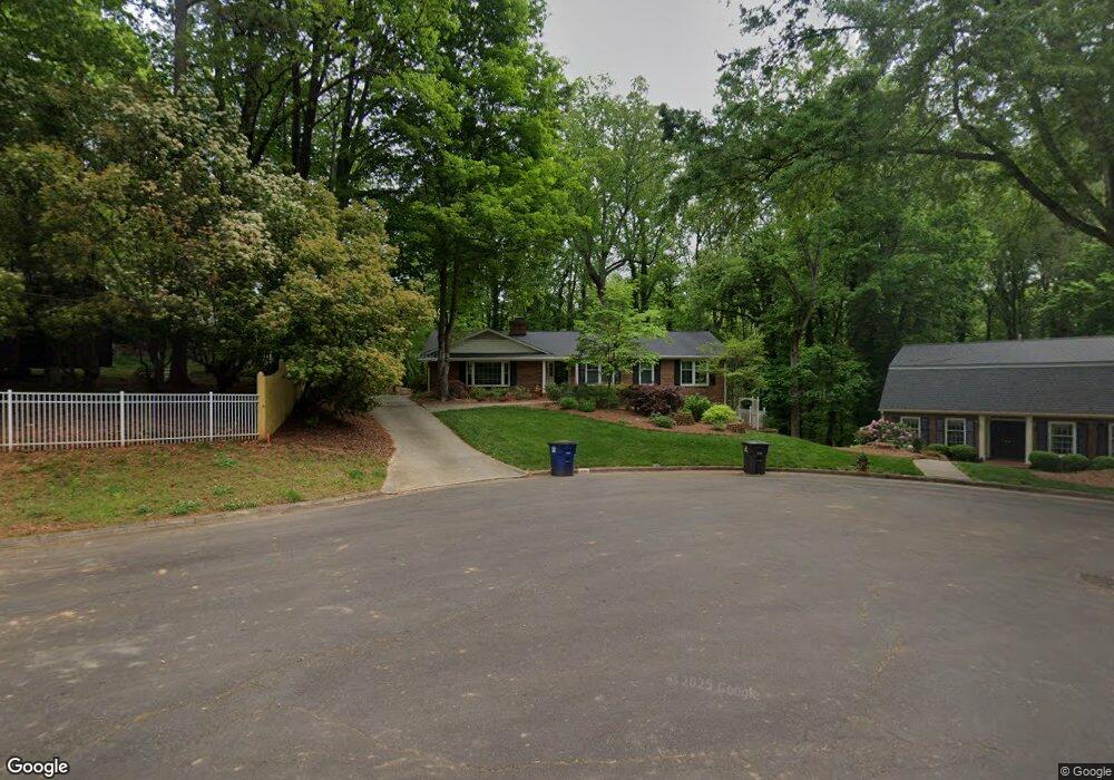
211 Flintshire Rd Winston Salem, NC 27104
Peace Haven NeighborhoodEstimated Value: $459,198 - $508,000
8
Beds
6
Baths
4,236
Sq Ft
$114/Sq Ft
Est. Value
About This Home
This home is located at 211 Flintshire Rd, Winston Salem, NC 27104 and is currently estimated at $484,550, approximately $114 per square foot. 211 Flintshire Rd is a home located in Forsyth County with nearby schools including Sherwood Forest Elementary School, Thomas Jefferson Middle School, and Mount Tabor High School.
Ownership History
Date
Name
Owned For
Owner Type
Purchase Details
Closed on
May 24, 2024
Sold by
Kenny John and Kenny Adele
Bought by
Kenny Alan R and Kenny Rita O
Current Estimated Value
Purchase Details
Closed on
Jun 25, 1998
Sold by
Harris Joan Diane and Harris Joan H
Bought by
Kenny Alan R and Kenny Rita O
Home Financials for this Owner
Home Financials are based on the most recent Mortgage that was taken out on this home.
Original Mortgage
$195,700
Interest Rate
7.21%
Create a Home Valuation Report for This Property
The Home Valuation Report is an in-depth analysis detailing your home's value as well as a comparison with similar homes in the area
Home Values in the Area
Average Home Value in this Area
Purchase History
| Date | Buyer | Sale Price | Title Company |
|---|---|---|---|
| Kenny Alan R | -- | None Listed On Document | |
| Kenny Alan | $435,000 | None Listed On Document | |
| Kenny Alan R | $206,000 | -- |
Source: Public Records
Mortgage History
| Date | Status | Borrower | Loan Amount |
|---|---|---|---|
| Previous Owner | Kenny Alan R | $195,700 |
Source: Public Records
Tax History Compared to Growth
Tax History
| Year | Tax Paid | Tax Assessment Tax Assessment Total Assessment is a certain percentage of the fair market value that is determined by local assessors to be the total taxable value of land and additions on the property. | Land | Improvement |
|---|---|---|---|---|
| 2025 | $4,293 | $480,400 | $91,400 | $389,000 |
| 2024 | $4,097 | $306,000 | $82,200 | $223,800 |
| 2023 | $4,097 | $306,000 | $82,200 | $223,800 |
| 2022 | $4,020 | $306,000 | $82,200 | $223,800 |
| 2021 | $3,948 | $306,000 | $82,200 | $223,800 |
| 2020 | $3,900 | $282,400 | $80,700 | $201,700 |
| 2019 | $3,928 | $282,400 | $80,700 | $201,700 |
| 2018 | $3,733 | $282,600 | $80,700 | $201,900 |
| 2016 | $3,637 | $276,399 | $80,692 | $195,707 |
| 2015 | $3,582 | $276,399 | $80,692 | $195,707 |
| 2014 | $3,486 | $276,399 | $80,692 | $195,707 |
Source: Public Records
Map
Nearby Homes
- 624 Brentwood Ct
- 204 Bradberry Ln
- 4813 Tiffany Ave
- 431 Hearthside Dr
- 310 Coventry Park Ln
- 3980 Seaton Rd
- 200 Coventry Park Ln
- 185 Coventry Park Ln
- 4205 Club Pointe Ct
- 435 Burkes Crossing Dr
- 4855 Tiffany Ave
- 224 Longwood Dr NW
- 228 Longwood Dr NW
- 626 Willowbrook Ln
- 543 Barrett Rd
- 3770 Will Scarlet Rd
- 581 Clyde Dr
- 120 Carrisbrooke Ln
- 5025 Mereworth Ct
- 132 Carrisbrooke Ln
- 205 Flintshire Rd
- 207 Stanaford Rd
- 201 Stanaford Rd
- 213 Stanaford Rd
- 200 Flintshire Rd
- 212 Flintshire Rd
- 206 Flintshire Rd
- 218 Flintshire Rd
- 229 Flintshire Rd
- 226 Stanaford Rd
- 224 Flintshire Rd
- 221 Stanaford Rd
- 600 Valley Brook Ln
- 230 Flintshire Rd
- 235 Flintshire Rd
- 231 Stanaford Rd
- 236 Stanaford Rd
- 389 Flyntvalley Ct
- 610 Valley Brook Ln
- 236 Flintshire Rd