Estimated Value: $160,000 - $207,000
--
Bed
2
Baths
2,040
Sq Ft
$90/Sq Ft
Est. Value
About This Home
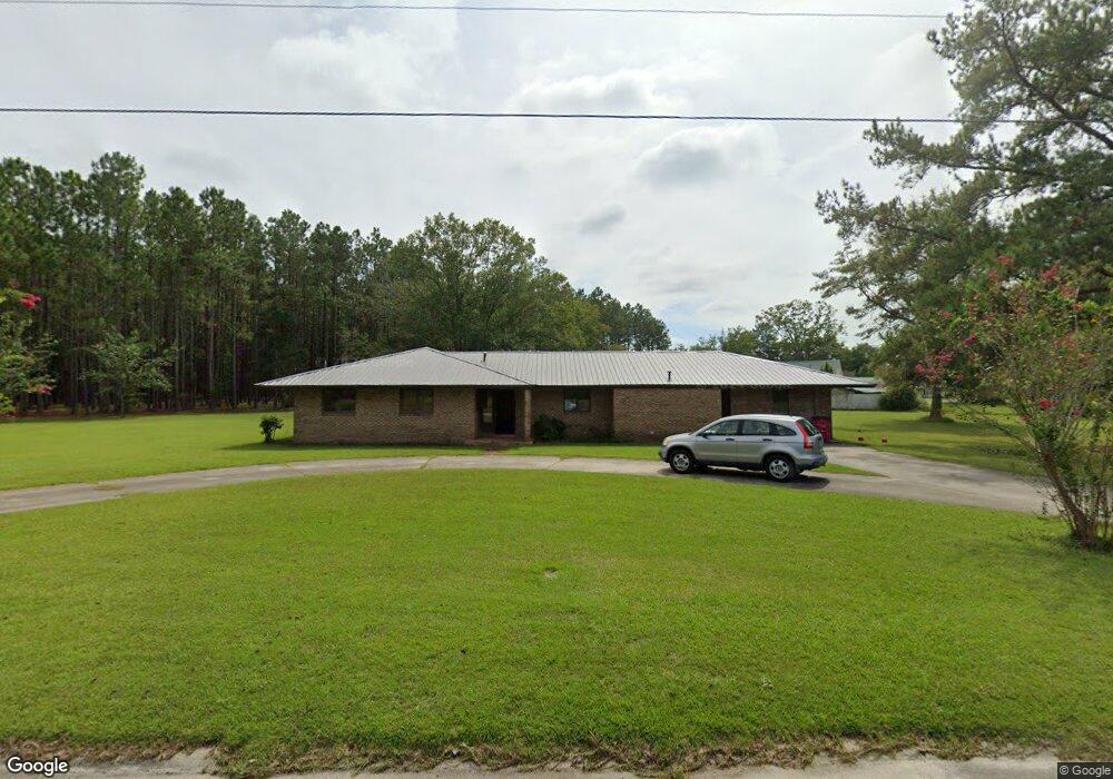
This home is located at 211 Flora Ln, Alma, GA 31510 and is currently estimated at $184,330, approximately $90 per square foot. 211 Flora Ln is a home located in Bacon County with nearby schools including Bacon County Primary School, Bacon County Elementary School, and Bacon County Middle School.
Ownership History
Date
Name
Owned For
Owner Type
Purchase Details
Closed on
Feb 9, 2021
Sold by
Scott Robert Glover
Bought by
Scott Robert Harold
Current Estimated Value
Purchase Details
Closed on
May 5, 2011
Sold by
Secretary Of Housing & Urban Development
Bought by
Scott Robert and Scott Maurice
Purchase Details
Closed on
Jan 18, 2011
Sold by
Wells Fargo Bank Na
Bought by
Secretary Of Hud
Purchase Details
Closed on
Sep 7, 2010
Sold by
Whidby Susan
Bought by
Wells Fargo Bank Na
Purchase Details
Closed on
Jun 4, 2004
Sold by
Walker Henry C
Bought by
Whidby Thomas D
Purchase Details
Closed on
Dec 26, 1986
Sold by
Nordin Kenneth and Nordin Nelle
Bought by
Walker Henry C
Create a Home Valuation Report for This Property
The Home Valuation Report is an in-depth analysis detailing your home's value as well as a comparison with similar homes in the area
Home Values in the Area
Average Home Value in this Area
Purchase History
| Date | Buyer | Sale Price | Title Company |
|---|---|---|---|
| Scott Robert Harold | -- | -- | |
| Scott Clara Nichole | -- | -- | |
| Scott Robert | -- | -- | |
| Secretary Of Hud | -- | -- | |
| Wells Fargo Bank Na | $114,055 | -- | |
| Whidby Thomas D | $118,900 | -- | |
| Walker Henry C | -- | -- |
Source: Public Records
Tax History Compared to Growth
Tax History
| Year | Tax Paid | Tax Assessment Tax Assessment Total Assessment is a certain percentage of the fair market value that is determined by local assessors to be the total taxable value of land and additions on the property. | Land | Improvement |
|---|---|---|---|---|
| 2024 | $2,349 | $64,640 | $4,200 | $60,440 |
| 2023 | $2,251 | $58,400 | $4,200 | $54,200 |
| 2022 | $1,560 | $40,480 | $4,200 | $36,280 |
| 2021 | $1,565 | $40,600 | $5,200 | $35,400 |
| 2020 | $1,521 | $37,728 | $5,216 | $32,512 |
| 2019 | $1,521 | $37,728 | $5,216 | $32,512 |
| 2018 | $1,452 | $36,084 | $5,216 | $30,868 |
| 2017 | $1,453 | $36,084 | $5,216 | $30,868 |
| 2016 | $1,453 | $36,084 | $5,216 | $30,868 |
| 2015 | $1,432 | $35,511 | $5,216 | $30,295 |
| 2014 | $1,605 | $35,511 | $5,216 | $30,295 |
| 2013 | $1,605 | $37,851 | $5,216 | $32,635 |
Source: Public Records
Map
Nearby Homes
- 611 S Bead St
- 403 S Ware St
- 117 Grace Loop Unit 1
- 118 Grace Loop Unit 1
- 122 Grace Loop Unit 1
- 314 W 16th St
- 9TH E 417
- 907 N Pierce St
- 113 Brite Blue Dr
- 401 Lee St
- 0 Oriole Rd Unit 1654653
- 0 Oriole Rd Unit 10543585
- 0 Oriole Rd Unit 25773381
- 0 Oriole Rd Unit 160930
- 166 Grace Loop Unit 1
- 198 Meadow Rd
- 118 Morris Dr
- 224 Meadow Rd
- 1348 U S 1
- 1109 W 4th Street Extension
- 310 Radio Station Rd
- 222 Flora Ln
- 201 Flora Ln
- 202 Flora Ln
- 311 Radio Station Rd
- 204 Johnson St
- 313 Radio Station Rd
- 104 Flora Ln
- 307 Radio Station Rd
- 407 Dykes St
- 315 Radio Station Rd
- 205 Johnson St
- 317 Radio Station Rd
- 305 Radio Station Rd
- 203 Johnson St
- 910 S Wayne St
- 201 Johnson St
- 303 Radio Station Rd
- 904 S Wayne St
- 118 Crosby Rd