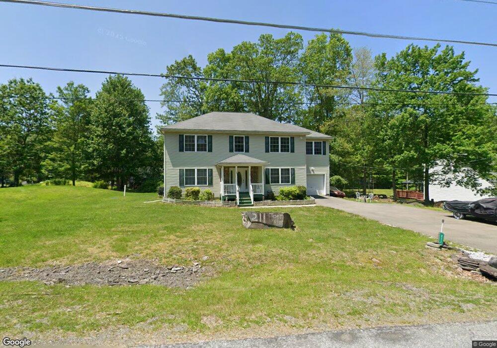
211 Footprint Rd East Stroudsburg, PA 18302
Estimated Value: $363,000 - $429,000
4
Beds
3
Baths
2,424
Sq Ft
$166/Sq Ft
Est. Value
About This Home
This home is located at 211 Footprint Rd, East Stroudsburg, PA 18302 and is currently estimated at $402,101, approximately $165 per square foot. 211 Footprint Rd is a home located in Monroe County with nearby schools including East Stroudsburg Elementary School, J.T. Lambert Intermediate School, and East Stroudsburg Senior High School South.
Ownership History
Date
Name
Owned For
Owner Type
Purchase Details
Closed on
Jan 9, 2009
Sold by
Wengerd David S and Wengerd Emma L
Bought by
Cooks Donald
Current Estimated Value
Home Financials for this Owner
Home Financials are based on the most recent Mortgage that was taken out on this home.
Original Mortgage
$240,624
Outstanding Balance
$154,755
Interest Rate
5.51%
Mortgage Type
FHA
Estimated Equity
$247,346
Purchase Details
Closed on
Sep 23, 2008
Sold by
Wengerd David S and Wengerd Emma L
Bought by
Wengerd David S and Wengerd Emma L
Create a Home Valuation Report for This Property
The Home Valuation Report is an in-depth analysis detailing your home's value as well as a comparison with similar homes in the area
Home Values in the Area
Average Home Value in this Area
Purchase History
| Date | Buyer | Sale Price | Title Company |
|---|---|---|---|
| Cooks Donald | $244,400 | None Available | |
| Wengerd David S | -- | None Available |
Source: Public Records
Mortgage History
| Date | Status | Borrower | Loan Amount |
|---|---|---|---|
| Open | Cooks Donald | $240,624 |
Source: Public Records
Tax History Compared to Growth
Tax History
| Year | Tax Paid | Tax Assessment Tax Assessment Total Assessment is a certain percentage of the fair market value that is determined by local assessors to be the total taxable value of land and additions on the property. | Land | Improvement |
|---|---|---|---|---|
| 2025 | $1,347 | $210,920 | $29,540 | $181,380 |
| 2024 | $1,031 | $210,920 | $29,540 | $181,380 |
| 2023 | $7,316 | $210,920 | $29,540 | $181,380 |
| 2022 | $7,417 | $210,920 | $29,540 | $181,380 |
| 2021 | $7,301 | $210,920 | $29,540 | $181,380 |
| 2020 | $6,975 | $210,920 | $29,540 | $181,380 |
| 2019 | $7,167 | $35,270 | $2,600 | $32,670 |
| 2018 | $7,167 | $35,270 | $2,600 | $32,670 |
| 2017 | $7,167 | $35,270 | $2,600 | $32,670 |
| 2016 | $6,741 | $35,270 | $2,600 | $32,670 |
| 2015 | -- | $35,270 | $2,600 | $32,670 |
| 2014 | -- | $35,270 | $2,600 | $32,670 |
Source: Public Records
Map
Nearby Homes
- 430 Indian Way
- 529 Highland Dr
- Lot 17 Footprint Rd
- 0 Way
- 0 Lace Dr 24 Dr
- 53 Barren Rd
- 0 Lenape Dr Unit Lot 31 & 32 763518
- Lot 31 & 32 Lenape Dr
- 237 Footprint Rd
- Lot18 Lenape Dr
- Lot 36 Lenape Dr
- 84 Lenape Dr
- 28 Lenape Dr
- 630 Wooddale Rd
- 30 Ledgewood Ct
- 0 Green Meadow Dr
- Lot 24 Green Meadow Dr
- 1136 Sierra Trail
- 6 Westridge Ct
- Lot 4 Adams Dr
- 213 Footprint Rd
- 115 Lenape Dr
- 117 Lenape Dr
- 210 Footprint Rd
- 421 Indian Way
- 113 Lenape Dr
- 425 Indian Way
- 425 Indian Way
- 121 Lenape Dr
- 215 Footprint Rd
- 46-47 Indian Way
- Lot 51 Indian Way
- 32-3 Indian Way
- Lot 8&9 Indian Way
- 8-9 Indian Way
- 417 Indian Way
- 0 Indian Way Unit 12-215
- 0 Indian Way Unit 6-2253
- 46,47 Indian Way
- 0 Indian Way Unit PM-44633