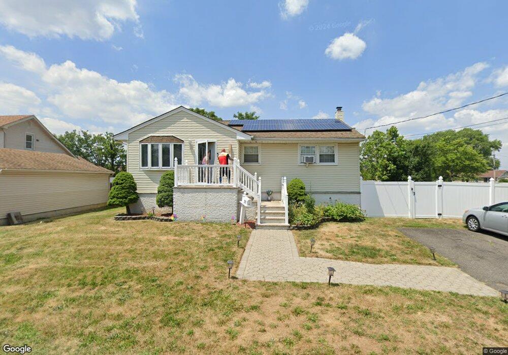
211 Furman Blvd Keyport, NJ 07735
Estimated Value: $419,488 - $492,000
--
Bed
--
Bath
1,124
Sq Ft
$410/Sq Ft
Est. Value
About This Home
This home is located at 211 Furman Blvd, Keyport, NJ 07735 and is currently estimated at $460,372, approximately $409 per square foot. 211 Furman Blvd is a home located in Middlesex County with nearby schools including Old Bridge High School, Icob Academy, and St. Joseph Elementary School.
Ownership History
Date
Name
Owned For
Owner Type
Purchase Details
Closed on
Jun 9, 2018
Sold by
Marrero Laura N and Rhodey Laura Norma
Bought by
Marrero Laura N
Current Estimated Value
Home Financials for this Owner
Home Financials are based on the most recent Mortgage that was taken out on this home.
Original Mortgage
$165,000
Interest Rate
4.5%
Mortgage Type
New Conventional
Purchase Details
Closed on
Jan 15, 1992
Bought by
Rhodey Laura and Marrero Lorenzo
Create a Home Valuation Report for This Property
The Home Valuation Report is an in-depth analysis detailing your home's value as well as a comparison with similar homes in the area
Home Values in the Area
Average Home Value in this Area
Purchase History
| Date | Buyer | Sale Price | Title Company |
|---|---|---|---|
| Marrero Laura N | $70,000 | First American Title Ins Co | |
| Rhodey Laura | $110,000 | -- |
Source: Public Records
Mortgage History
| Date | Status | Borrower | Loan Amount |
|---|---|---|---|
| Previous Owner | Marrero Laura N | $165,000 |
Source: Public Records
Tax History Compared to Growth
Tax History
| Year | Tax Paid | Tax Assessment Tax Assessment Total Assessment is a certain percentage of the fair market value that is determined by local assessors to be the total taxable value of land and additions on the property. | Land | Improvement |
|---|---|---|---|---|
| 2025 | $6,657 | $116,200 | $49,500 | $66,700 |
| 2024 | $6,384 | $116,200 | $49,500 | $66,700 |
| 2023 | $6,384 | $116,200 | $49,500 | $66,700 |
| 2022 | $6,212 | $116,200 | $49,500 | $66,700 |
| 2021 | $4,554 | $116,200 | $49,500 | $66,700 |
| 2020 | $6,024 | $116,200 | $49,500 | $66,700 |
| 2019 | $5,927 | $116,200 | $49,500 | $66,700 |
| 2018 | $5,861 | $116,200 | $49,500 | $66,700 |
| 2017 | $5,679 | $116,200 | $49,500 | $66,700 |
| 2016 | $5,566 | $116,200 | $49,500 | $66,700 |
| 2015 | $5,468 | $116,200 | $49,500 | $66,700 |
| 2014 | $5,402 | $116,200 | $49,500 | $66,700 |
Source: Public Records
Map
Nearby Homes
- 42 Boulevard E
- 363 Ocean Blvd
- 103 Furman Blvd
- 65 Boulevard E
- 125 Raritan Blvd
- 136 Hilltop Blvd
- 106 Boulevard W
- 107 Boulevard W
- 38 Lcpl Phillip E Frank Way Unit 38
- 112 Lcpl Phillip E Frank Way
- 108 W Concourse
- 599 Keyport Ave
- 281 Prospect Ave
- 839 Brookside Ave
- 235 Garfield Ave
- 250 Brookside Ave
- 745 Cliffwood Ave
- 22 Stemler Dr
- 786 Cliffwood Ave
- 615 Greenwood Ave
- 206 Furman Blvd
- 302 Furman Blvd
- 10 Seaglade Cir
- 303 Furman Blvd
- 214 Furman Blvd
- 215 Furman Blvd
- 306 Furman Blvd
- 298 Furman Blvd
- 307 Furman Blvd
- 284 Furman Blvd
- 202 Furman Blvd
- 182 Furman Blvd
- 184 Furman Blvd
- 310 Furman Blvd
- 296 Furman Blvd
- 47 Boulevard E
- 49 Boulevard E
- 320 Furman Blvd
- 247 Raritan Blvd
- 250 Raritan Blvd