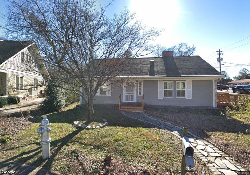
211 Jarvis St Canton, GA 30114
Estimated Value: $253,000 - $392,000
4
Beds
2
Baths
1,666
Sq Ft
$191/Sq Ft
Est. Value
About This Home
This home is located at 211 Jarvis St, Canton, GA 30114 and is currently estimated at $318,461, approximately $191 per square foot. 211 Jarvis St is a home located in Cherokee County with nearby schools including Hasty Elementary School Fine Arts Academy, Teasley Middle School, and Cherokee High School.
Ownership History
Date
Name
Owned For
Owner Type
Purchase Details
Closed on
Jan 5, 2022
Sold by
Smith Mary Elizabeth
Bought by
Cox Kimberly
Current Estimated Value
Home Financials for this Owner
Home Financials are based on the most recent Mortgage that was taken out on this home.
Original Mortgage
$200,000
Outstanding Balance
$183,569
Interest Rate
3.11%
Mortgage Type
Cash
Estimated Equity
$134,892
Purchase Details
Closed on
Jul 15, 2019
Sold by
Smith Mary Elizabeth
Bought by
Smith Robert E and Smith Mary Elizabeth
Purchase Details
Closed on
Mar 13, 2017
Sold by
Sosebee Frances Davis
Bought by
Sosebee Mary Elizabeth
Purchase Details
Closed on
Aug 6, 2010
Sold by
Johnson Alma E
Bought by
Sosebee Frances D
Create a Home Valuation Report for This Property
The Home Valuation Report is an in-depth analysis detailing your home's value as well as a comparison with similar homes in the area
Home Values in the Area
Average Home Value in this Area
Purchase History
| Date | Buyer | Sale Price | Title Company |
|---|---|---|---|
| Cox Kimberly | $250,000 | -- | |
| Cox Kimberly | $250,000 | -- | |
| Smith Robert E | -- | -- | |
| Sosebee Mary Elizabeth | $80,000 | -- | |
| Sosebee George Norman | -- | -- | |
| Sosebee Frances D | -- | -- | |
| Sosebee Frances D | $80,000 | -- |
Source: Public Records
Mortgage History
| Date | Status | Borrower | Loan Amount |
|---|---|---|---|
| Open | Cox Kimberly | $200,000 |
Source: Public Records
Tax History Compared to Growth
Tax History
| Year | Tax Paid | Tax Assessment Tax Assessment Total Assessment is a certain percentage of the fair market value that is determined by local assessors to be the total taxable value of land and additions on the property. | Land | Improvement |
|---|---|---|---|---|
| 2025 | $2,802 | $107,804 | $23,040 | $84,764 |
| 2024 | $2,778 | $106,804 | $21,600 | $85,204 |
| 2023 | $2,617 | $100,000 | $21,208 | $78,792 |
| 2022 | $157 | $62,084 | $15,360 | $46,724 |
| 2021 | $164 | $52,684 | $13,440 | $39,244 |
| 2020 | $165 | $51,604 | $13,440 | $38,164 |
| 2019 | $163 | $45,920 | $13,440 | $32,480 |
| 2018 | $165 | $40,200 | $11,520 | $28,680 |
| 2017 | $802 | $87,400 | $8,640 | $26,320 |
| 2016 | $802 | $77,900 | $8,640 | $22,520 |
| 2015 | $769 | $74,000 | $8,640 | $20,960 |
| 2014 | $151 | $60,800 | $7,200 | $17,120 |
Source: Public Records
Map
Nearby Homes
- 235 W Marietta St
- 176 Railroad St
- 180 Railroad St
- 172 Railroad St
- 200 Lakeside Place
- 701 Longview Dr
- 120 Jeanette St
- 120 E Killian St
- 0 Lake St Unit 10599928
- 0 Lake St Unit 7637074
- 241 E Killian St
- 231 Breeze Hill Ln
- 251 E Killian St
- 621 Elmwood St
- Lot2&3 Georgia 140
- 0 Reed St Unit 7646438
- 619 Elmwood St
- 727 Lower Scott Mill Rd
- 2635 Georgia 140
- 100 Daisy Cir
- 231 Jarvis St
- 121 Coker St
- 251 Jarvis St
- 111 Coker St
- 220 Jarvis St
- 271 Jarvis St
- 161 Dr John T Pettit St
- 250 Jarvis St
- 190 Jarvis St
- 171 Dr John T Pettit St
- 270 Jarvis St
- 181 Dr John T Pettit St
- 141 Dr John T Pettit St
- 171 Dr John Petit
- 171 John T Pettit St
- 291 Jarvis St
- 151 Dr John T Pettit St
- 180 Jarvis St
- 171 Dr John Pettit St
- 341 Archer St