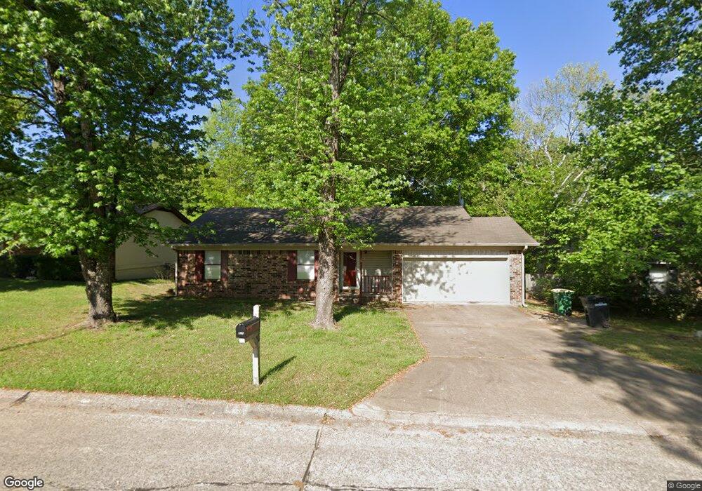
211 Katye Ln Sherwood, AR 72120
Estimated Value: $180,000 - $198,803
--
Bed
2
Baths
1,336
Sq Ft
$140/Sq Ft
Est. Value
About This Home
This home is located at 211 Katye Ln, Sherwood, AR 72120 and is currently estimated at $187,201, approximately $140 per square foot. 211 Katye Ln is a home located in Pulaski County with nearby schools including Sylvan Hills Elementary School, Sylvan Hills Middle School, and Sylvan Hills High School.
Ownership History
Date
Name
Owned For
Owner Type
Purchase Details
Closed on
Dec 26, 2007
Sold by
Cartus Financial Corp
Bought by
Hart Darrin C
Current Estimated Value
Home Financials for this Owner
Home Financials are based on the most recent Mortgage that was taken out on this home.
Original Mortgage
$127,687
Outstanding Balance
$80,528
Interest Rate
6.23%
Mortgage Type
VA
Estimated Equity
$106,673
Purchase Details
Closed on
Dec 18, 2007
Sold by
Brooks Darryl A and Brooks Angela M
Bought by
Cartus Financial Corp
Home Financials for this Owner
Home Financials are based on the most recent Mortgage that was taken out on this home.
Original Mortgage
$127,687
Outstanding Balance
$80,528
Interest Rate
6.23%
Mortgage Type
VA
Estimated Equity
$106,673
Purchase Details
Closed on
Nov 13, 2003
Sold by
Darrington Christy Ann and Darrington Robert B
Bought by
Brooks Darryl A
Home Financials for this Owner
Home Financials are based on the most recent Mortgage that was taken out on this home.
Original Mortgage
$113,025
Interest Rate
5.93%
Mortgage Type
VA
Create a Home Valuation Report for This Property
The Home Valuation Report is an in-depth analysis detailing your home's value as well as a comparison with similar homes in the area
Home Values in the Area
Average Home Value in this Area
Purchase History
| Date | Buyer | Sale Price | Title Company |
|---|---|---|---|
| Hart Darrin C | $125,000 | None Available | |
| Cartus Financial Corp | $125,000 | None Available | |
| Brooks Darryl A | $110,000 | American Abstract & Title Co |
Source: Public Records
Mortgage History
| Date | Status | Borrower | Loan Amount |
|---|---|---|---|
| Open | Hart Darrin C | $127,687 | |
| Previous Owner | Brooks Darryl A | $113,025 |
Source: Public Records
Tax History Compared to Growth
Tax History
| Year | Tax Paid | Tax Assessment Tax Assessment Total Assessment is a certain percentage of the fair market value that is determined by local assessors to be the total taxable value of land and additions on the property. | Land | Improvement |
|---|---|---|---|---|
| 2025 | $1,514 | $32,142 | $6,200 | $25,942 |
| 2024 | $1,387 | $32,142 | $6,200 | $25,942 |
| 2023 | $1,387 | $32,142 | $6,200 | $25,942 |
| 2022 | $1,488 | $32,142 | $6,200 | $25,942 |
| 2021 | $1,381 | $24,210 | $4,800 | $19,410 |
| 2020 | $1,000 | $24,210 | $4,800 | $19,410 |
| 2019 | $1,000 | $24,210 | $4,800 | $19,410 |
| 2018 | $1,025 | $24,210 | $4,800 | $19,410 |
| 2017 | $1,015 | $24,210 | $4,800 | $19,410 |
| 2016 | $1,245 | $23,900 | $5,600 | $18,300 |
| 2015 | $1,214 | $23,900 | $5,600 | $18,300 |
| 2014 | $1,214 | $23,900 | $5,600 | $18,300 |
Source: Public Records
Map
Nearby Homes
- 00 Highway 107
- 104 Mayfair Cove
- 00 E Kiehl Ave
- 8222 Mark Ave
- 8109 Oak Ridge Rd
- 2410 Crown Ct
- 208 E Kiehl Ave Unit out parcel
- 135 W Lee Ave
- 3073 Woodruff Creek Dr
- 8100 Coleridge Dr
- 4690 Hollyridge Cove
- 7909 Coleridge Dr
- 59 Wesley Dr
- 7901 Coleridge Dr
- 125 Almond Cove
- 2100 Covington Dr
- 222 Gragson Ave
- 9125 Woodbine St
- 7605 Toltec Dr
- 7625 Highway 107