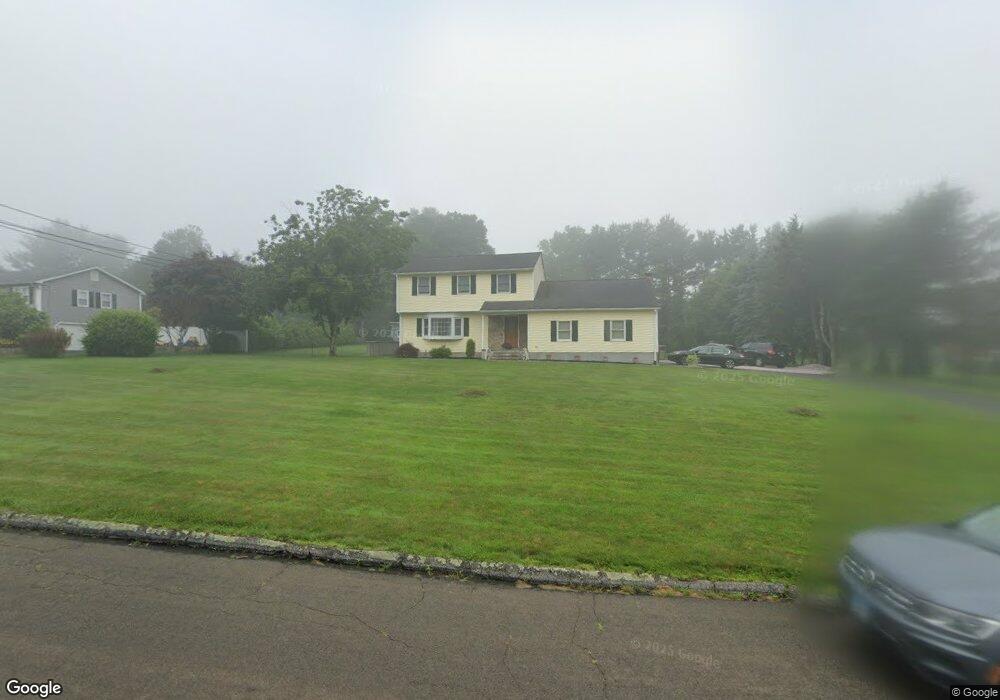
211 Lenore Dr Shelton, CT 06484
Estimated Value: $537,753 - $631,000
3
Beds
1
Bath
1,884
Sq Ft
$311/Sq Ft
Est. Value
About This Home
This home is located at 211 Lenore Dr, Shelton, CT 06484 and is currently estimated at $586,438, approximately $311 per square foot. 211 Lenore Dr is a home located in Fairfield County with nearby schools including Elizabeth Shelton Elementary School, Perry Hill School, and Shelton Intermediate School.
Ownership History
Date
Name
Owned For
Owner Type
Purchase Details
Closed on
Dec 20, 2017
Sold by
Dreyer Theresa
Bought by
Dreyer George
Current Estimated Value
Purchase Details
Closed on
Dec 5, 1995
Sold by
Czesnowski Richard and Czesnowski Patricia
Bought by
Dreyer George and Dreyer Theresa
Create a Home Valuation Report for This Property
The Home Valuation Report is an in-depth analysis detailing your home's value as well as a comparison with similar homes in the area
Home Values in the Area
Average Home Value in this Area
Purchase History
| Date | Buyer | Sale Price | Title Company |
|---|---|---|---|
| Dreyer George | -- | -- | |
| Dreyer George | -- | -- | |
| Dreyer George | $178,000 | -- | |
| Dreyer George | $178,000 | -- |
Source: Public Records
Mortgage History
| Date | Status | Borrower | Loan Amount |
|---|---|---|---|
| Previous Owner | Dreyer George | $274,000 | |
| Previous Owner | Dreyer George | $50,000 | |
| Previous Owner | Dreyer George | $25,250 |
Source: Public Records
Tax History
| Year | Tax Paid | Tax Assessment Tax Assessment Total Assessment is a certain percentage of the fair market value that is determined by local assessors to be the total taxable value of land and additions on the property. | Land | Improvement |
|---|---|---|---|---|
| 2025 | $5,140 | $273,140 | $98,000 | $175,140 |
| 2024 | $5,239 | $273,140 | $98,000 | $175,140 |
| 2023 | $4,772 | $273,140 | $98,000 | $175,140 |
| 2022 | $4,772 | $273,140 | $98,000 | $175,140 |
| 2021 | $4,464 | $202,650 | $68,600 | $134,050 |
| 2020 | $4,543 | $202,650 | $68,600 | $134,050 |
| 2019 | $4,543 | $202,650 | $68,600 | $134,050 |
| 2017 | $4,501 | $202,650 | $68,600 | $134,050 |
| 2015 | $4,520 | $202,580 | $66,500 | $136,080 |
| 2014 | $4,520 | $202,580 | $66,500 | $136,080 |
Source: Public Records
Map
Nearby Homes
- 6 Chaucer Dr
- 128 Barn Hill Rd
- 41 Longfellow Rd
- 941 Constitution Blvd N
- 32 Valley View Rd
- 30 E Village Rd
- 55 Old Dairy Ln
- 7 Canterbury Ln
- 67 Hillside Ln
- 3 Roosevelt Dr
- 36 Spinning Wheel Rd
- 810 Roosevelt Dr
- 396 Walnut Tree Hill Rd
- 56 Lazy Brook Rd
- 154 S Benham Rd
- 198 Meadow St
- 40 Walnut St
- 455 Barn Hill Rd
- 12 Great Meadow Rd
- Lot A Abbey Ln
Your Personal Tour Guide
Ask me questions while you tour the home.